
Previsioni:

Previsione a breve terminePioggia abbondante (Totale 24mm), più pesante durante giovedì notte. Warm (Max 29°C mercoledì mattina, Min 27°C mercoledì pomeriggio). Vento sarà generalmente leggero. | ||||||||||||||||||||||||
Mer 15 | Giovedì 16 | Venerdì 17 | 18 | |||||||||||||||||||||
10 AM | 1 PM | 4 PM | 7 PM | 10 PM | 1 AM | 4 AM | 7 AM | 10 AM | 1 PM | 4 PM | 7 PM | 10 PM | 1 AM | 4 AM | 7 AM | 10 AM | 1 PM | 4 PM | 7 PM | 10 PM | 1 AM | 4 AM | 7 AM | |
Mappa dell'altezza del moto ondoso |  |  |  | 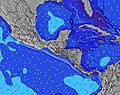 |  |  | 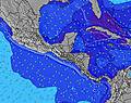 |  |  | |||||||||||||||
Onda Altezza (m) Direzione Periodo (s) | NE 9 | NE 9 | NE 10 | NE 10 | NE 10 | NE 10 | NE 10 | NE 10 | NE 10 | NE 10 | NE 10 | NE 11 | NE 11 | NE 10 | NE 10 | NE 10 | NE 10 | NE 10 | NE 10 | NE 10 | NE 10 | NE 10 | NE 10 | NE 10 |
Grafico delle onde | ||||||||||||||||||||||||
427 | 446 | 573 | 730 | 730 | 730 | 788 | 788 | 773 | 833 | 977 | 1080 | 1154 | 1048 | 989 | 898 | 880 | 898 | 989 | 959 | 884 | 738 | 709 | 597 | |
Vento (km/h) | ||||||||||||||||||||||||
Stato del vento onshore cross-onshore cross-shore cross-offshore offshore piatto | cross-on | on | on | on | cross-on | cross-on | cross-on | cross-on | cross-on | on | on | on | cross-on | cross-on | cross-on | cross-on | cross-on | cross-on | on | on | on | cross-on | cross-on | cross-on |
Alta Marea | 2:36PM0.19m | 1:17AM0.47m | 3:34PM0.24m | 2:12AM0.43m | 4:27PM0.30m | 3:08AM0.38m | ||||||||||||||||||
Basso Marea | 8:38AM0.01m | 5:15PM0.18m | 9:20AM0.03m | 7:56PM0.21m | 9:59AM0.05m | 9:49PM0.21m | ||||||||||||||||||
6:05 | — | — | — | — | — | 6:07 | — | — | — | — | — | — | — | 6:07 | — | — | — | — | — | — | — | 6:07 | — | |
— | — | 6:44 | — | — | — | — | — | — | — | 6:44 | — | — | — | — | — | — | — | 6:44 | — | — | — | — | 6:43 | |
mm | — | — | — | — | 1 | 1 | 1 | 1 | 2 | — | — | — | — | — | 3 | 3 | 2 | 1 | 1 | — | — | 2 | 3 | 3 |
Temp. °C | 29 | 29 | 29 | 27 | 27 | 27 | 27 | 27 | 28 | 29 | 28 | 27 | 27 | 27 | 27 | 27 | 28 | 29 | 28 | 27 | 27 | 27 | 27 | 27 |
Gelo °C | 32 | 32 | 33 | 31 | 31 | 31 | 30 | 30 | 30 | 31 | 30 | 30 | 30 | 30 | 30 | 30 | 30 | 31 | 30 | 30 | 30 | 31 | 31 | 31 |
Onda 1 Altezza (m) Direzione Periodo (s) | NE 9 | NE 9 | NE 10 | NE 10 | NE 10 | NE 10 | NNE 10 | NNE 10 | NNE 10 | NNE 10 | NE 10 | NE 11 | NE 11 | NE 10 | NE 10 | NNE 10 | NNE 10 | NNE 10 | NE 10 | NE 10 | NE 10 | NE 10 | NE 10 | NE 10 |
427 | 446 | 573 | 730 | 730 | 730 | 402 | 402 | 446 | 446 | 977 | 1080 | 1154 | 1048 | 989 | 491 | 491 | 502 | 341 | 959 | 884 | 738 | 709 | 597 | |
Onda 2 Altezza (m) Direzione Periodo (s) | — | — | — | — | — | — | — | — | — | — | — | — | — | — | — | — | — | — | — | — | — | — | — | — |
— | — | — | — | — | — | — | — | — | — | — | — | — | — | — | — | — | — | — | — | — | — | — | — | |
Onda 3 Altezza (m) Direzione Periodo (s) | — | — | — | — | — | — | — | — | — | — | — | — | — | — | — | — | — | — | — | — | — | — | — | — |
— | — | — | — | — | — | — | — | — | — | — | — | — | — | — | — | — | — | — | — | — | — | — | — | |
onde vento Altezza (m) Direzione Periodo (s) | — | — | — | — | — | — | NE 10 | NE 10 | NE 10 | NE 10 | — | — | — | — | — | NE 10 | NE 10 | NE 10 | NE 10 | — | — | — | — | — |
— | — | — | — | — | — | 788 | 788 | 773 | 833 | — | — | — | — | — | 898 | 880 | 898 | 989 | — | — | — | — | — | |
Il più vicino Offshore or Glassy | ||||||||||||||||||||||||
Distanza (km) | 61 | 61 | 61 | 61 | 61 | 61 | 62 | 61 | 61 | 61 | 61 | 61 | 61 | 61 | 61 | 61 | 61 | 62 | 61 | 61 | 61 | 61 | 61 | 61 |
Migliori previsioni per le condizioni d'onda in Colón Province | ||||||||||||||||||||||||
Migliori previsioni per le condizioni d'onda in Panama | ||||||||||||||||||||||||
Trova Onde Globale | ||||||||||||||||||||||||
- Map Icons:
 Break
Break Live Wave Height (m)
 Live Wind Speed (km/h)
 Surf Rating (10 Max)
 Ocean Swells (m)
- Wind Speed (km/h)
Widget Free Surf-Forecast.com per il tuo sito
La relazione di surf / widget meteo è disponibile qui sotto per incorporare su siti esterni a titolo gratuito e fornisce una sintesi delle nostre Maria Chiquita previsione surf. Basta prendere il frammento di codice html da noi fornito e copiarlo nel proprio sito. È possibile scegliere la lingua preferita e unità metriche / imperiali per il feed delle previsioni surf per soddisfare le esigenze degli utenti del vostro sito .... Clicca qui per ottenere il codice.
 Nearest