
Previsioni:

Previsione a breve termineper lo più asciutto. Warm (Max 21°C Lunedì mattina, Min 18°C Domenica mattina). Venti decrescenti (venti freschi da SE Lunedì pomeriggio, venti deboli da E per martedì notte). | ||||||||||||||||||||||||
Domenica 2 | Lunedì 3 | Martedì 4 | ||||||||||||||||||||||
2 AM | 5 AM | 8 AM | 11 AM | 2 PM | 5 PM | 8 PM | 11 PM | 2 AM | 5 AM | 8 AM | 11 AM | 2 PM | 5 PM | 8 PM | 11 PM | 2 AM | 5 AM | 8 AM | 11 AM | 2 PM | 5 PM | 8 PM | 11 PM | |
Mappa dell'altezza del moto ondoso |  | 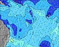 | 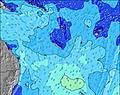 | 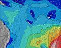 | 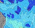 | 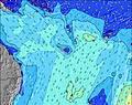 | 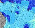 | 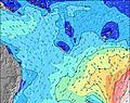 | 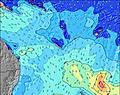 | |||||||||||||||
Onda Altezza (m) Direzione Periodo (s) | SSW 13 | S 12 | SSW 12 | S 12 | S 12 | S 11 | S 11 | S 12 | S 12 | S 13 | S 13 | S 12 | S 12 | SSE 12 | SSE 11 | SSE 10 | S 10 | SE 10 | SE 10 | SE 10 | SSW 18 | SSW 18 | SSW 17 | SSW 17 |
Grafico delle onde | ||||||||||||||||||||||||
1815 | 2386 | 1835 | 2171 | 2300 | 2039 | 1898 | 1947 | 2119 | 2235 | 2185 | 1866 | 1602 | 1946 | 1747 | 1544 | 962 | 845 | 880 | 848 | 794 | 751 | 734 | 717 | |
Vento (km/h) | ||||||||||||||||||||||||
Stato del vento onshore cross-onshore cross-shore cross-offshore offshore piatto | cross | cross | cross | cross | cross | cross | cross | cross | cross-off | cross-off | cross-off | cross-off | cross | cross | cross-off | cross-off | cross-off | cross-off | cross-off | cross | cross | cross | cross-off | cross-off |
Alta Marea | 10:04AM1.09m | 10:35PM1.33m | 10:46AM1.08m | 11:06PM1.29m | 11:31AM1.06m | |||||||||||||||||||
Basso Marea | 4:24AM0.31m | 4:07PM0.18m | 4:58AM0.28m | 4:43PM0.26m | 5:34AM0.26m | 5:24PM0.35m | ||||||||||||||||||
— | 6:28 | — | — | — | — | — | — | — | 6:28 | — | — | — | — | — | — | — | 6:26 | — | — | — | — | — | — | |
— | — | — | — | — | 5:36 | — | — | — | — | — | — | — | 5:36 | — | — | — | — | — | — | — | 5:37 | — | — | |
mm | — | — | — | — | — | — | — | — | — | — | — | — | — | — | — | — | — | — | — | — | — | — | — | — |
Temp. °C | 19 | 18 | 18 | 19 | 20 | 19 | 19 | 19 | 18 | 18 | 18 | 21 | 20 | 20 | 19 | 19 | 19 | 19 | 19 | 20 | 20 | 20 | 19 | 18 |
Gelo °C | 12 | 11 | 12 | 12 | 13 | 12 | 12 | 13 | 14 | 15 | 14 | 18 | 14 | 14 | 14 | 14 | 14 | 14 | 15 | 16 | 14 | 14 | 16 | 15 |
Onda 1 Altezza (m) Direzione Periodo (s) | SE 11 | SSW 12 | SSW 12 | S 12 | S 12 | S 11 | S 11 | S 12 | S 12 | S 13 | S 13 | S 12 | S 12 | S 12 | S 12 | S 11 | S 10 | S 10 | S 10 | SSE 10 | SSW 18 | SSW 18 | SSW 17 | SSW 17 |
18 | 1786 | 1835 | 2171 | 2300 | 2039 | 1898 | 1947 | 2119 | 2235 | 2185 | 1866 | 1602 | 1444 | 1258 | 1075 | 962 | 789 | 418 | 241 | 794 | 751 | 734 | 717 | |
Onda 2 Altezza (m) Direzione Periodo (s) | — | SE 11 | SE 11 | SE 11 | SE 11 | SE 11 | S 15 | SE 11 | SSW 20 | SW 20 | SE 12 | SSW 18 | SW 23 | SSW 22 | SSW 21 | SSW 21 | SSW 21 | SSW 20 | SE 10 | S 10 | S 10 | SE 10 | SE 10 | SE 9 |
— | 19 | 20 | 20 | 20 | 20 | 286 | 5 | 37 | 15 | 47 | 31 | 133 | 183 | 393 | 562 | 666 | 798 | 260 | 260 | 218 | 220 | 181 | 125 | |
Onda 3 Altezza (m) Direzione Periodo (s) | — | S 22 | S 21 | SE 16 | SW 21 | SW 21 | SW 20 | SSW 20 | SSW 20 | S 24 | SE 15 | SSW 23 | SSW 18 | SSW 18 | SSE 14 | SE 14 | SE 14 | — | SSW 19 | SSW 19 | — | S 10 | S 10 | S 9 |
— | 9 | 9 | 10 | 18 | 17 | 15 | 37 | 37 | 11 | 59 | 52 | 31 | 31 | 20 | 8 | 32 | — | 758 | 848 | — | 151 | 120 | 110 | |
onde vento Altezza (m) Direzione Periodo (s) | SSW 13 | S 12 | SE 11 | SE 11 | SE 11 | — | SE 11 | — | — | — | — | — | — | SSE 12 | SSE 11 | SSE 10 | SE 9 | SE 10 | SE 10 | SE 10 | SE 10 | SE 10 | SE 10 | SE 9 |
1815 | 2386 | 119 | 121 | 77 | — | 79 | — | — | — | — | — | — | 1946 | 1747 | 1544 | 632 | 845 | 880 | 817 | 225 | 673 | 554 | 488 | |
Il più vicino Offshore or Glassy | ||||||||||||||||||||||||
Distanza (km) | 1263 | 1263 | 1260 | 1268 | 1319 | 1389 | 1389 | 1368 | 1368 | 1368 | 31 | 31 | 31 | 1368 | 1368 | 1368 | 1368 | 69 | 69 | 69 | 31 | 69 | 800 | 800 |
Migliori previsioni per le condizioni d'onda in New Caledonia | ||||||||||||||||||||||||
Migliori previsioni per le condizioni d'onda in New Caledonia | ||||||||||||||||||||||||
Trova Onde Globale | ||||||||||||||||||||||||
- Map Icons:
 Break
Break Live Wave Height (m)
 Live Wind Speed (km/h)
 Surf Rating (10 Max)
 Ocean Swells (m)
- Wind Speed (km/h)
Widget Free Surf-Forecast.com per il tuo sito
La relazione di surf / widget meteo è disponibile qui sotto per incorporare su siti esterni a titolo gratuito e fornisce una sintesi delle nostre Maria Reef left previsione surf. Basta prendere il frammento di codice html da noi fornito e copiarlo nel proprio sito. È possibile scegliere la lingua preferita e unità metriche / imperiali per il feed delle previsioni surf per soddisfare le esigenze degli utenti del vostro sito .... Clicca qui per ottenere il codice.
 Nearest