
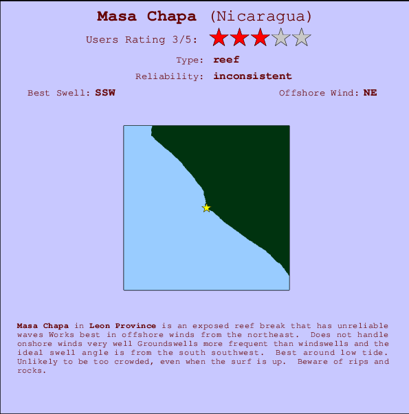
Masa Chapa Surf Guide
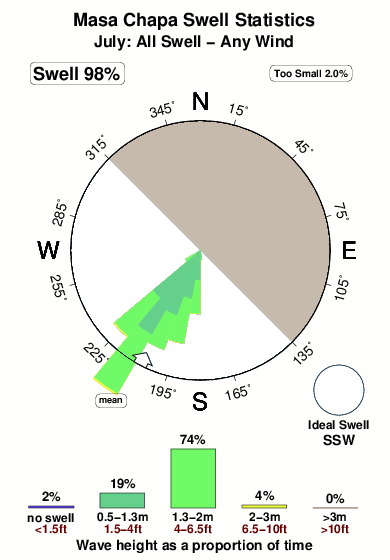
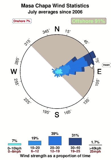
Masa Chapa in Leon Province is an exposed reef break that only works once in a while Offshore winds are from the northeast. Easily blown out by an onshore breeze Groundswells more frequent than windswells and the ideal swell direction is from the south southwest. A right hand reef break. Best around low tide. Unlikely to be too crowded, even when the surf is up. Hazards include rips and rocks.
Masa Chapa Spot Info
| Type: | Rating: | Reliability: | Todays Sea Temp*: |
|---|---|---|---|
| inconsistent | 29.4°C*ocean temperature recorded from satellite |
Surfing Masa Chapa:
The best conditions reported for surf at Masa Chapa occur when a South-southwest swell combines with an offshore wind direction from the Northeast.

Previsioni Energia d'onda (Potenza): 12hrs


Masa Chapa Surf:
Tuesday, 7 July 2026, 14:25 Local time| Martedì 07 | Mer | |||
| 3PM | 6PM | 9PM | 0AM | |
| Wave (m) | ||||
| Periodo (s) | 18 | 18 | 18 | 17 |
| Vento (km/h) | ||||
| Stato del vento | cross- off |
off | cross- off |
off |
- /breaks/Masa-Chapa/forecasts/latest
Masa Chapa Surf Guide
Masa Chapa in Leon Province is an exposed reef break that only works once in a while Offshore winds are from the northeast. Easily blown out by an onshore breeze Groundswells more frequent than windswells and the ideal swell direction is from the south southwest. A right hand reef break. Best around low tide. Unlikely to be too crowded, even when the surf is up. Hazards include rips and rocks.
Masa Chapa Spot Info
Type: Rating: Reliability: Todays Sea Temp*:  Reef
Reef 3
3inconsistent 29.4°C*ocean temperature recorded from satelliteSurfing Masa Chapa:
The best conditions reported for surf at Masa Chapa occur when a South-southwest swell combines with an offshore wind direction from the Northeast.
Previsioni Energia d'onda (Potenza): 12hrs
Utilizzare la scheda di navigazione in alto per visualizzare Masa Chapa temperatura del mare, Masa Chapa fotografie, Masa Chapa dettagliate previsioni onde, il vento e le previsioni meteo, Masa Chapa webcam, vento corrente da Leon Province stazioni meteo e Masa Chapa previsioni marea. Il link Nicaragua mappe maree apre l'immagine grande, che mostra Nicaragua e dei mari circostanti. Queste mappe possono essere animate per mostrare le diverse componenti del moto ondoso, energia delle onde, periodo d'onda, altezza delle onde, insieme con le previsioni del vento e meteo, meteo corrente e osservazioni sullo stato del mare dal Nicaragua onda-boe, le navi passanti e stazioni meteo costiere. Ciascuna delle pagine di previsioni per questo surf break rappresenta uno strumento di wavefinder globale e regionale per individuare le migliori condizioni di surf nella zona intorno Masa Chapa.
Masa Chapa Surf:
Tuesday, 7 July 2026, 14:25 Local timeMartedì 07 Mer 3PM 6PM 9PM 0AM Wave (m) Periodo (s) 18 18 18 17 Vento (km/h) Stato del vento cross-
offoff cross-
offoff - /breaks/Masa-Chapa/forecasts/latest
- /breaks/Masa-Chapa/forecasts/latest/six_day
Masa Chapa Surf Guide
Masa Chapa in Leon Province is an exposed reef break that only works once in a while Offshore winds are from the northeast. Easily blown out by an onshore breeze Groundswells more frequent than windswells and the ideal swell direction is from the south southwest. A right hand reef break. Best around low tide. Unlikely to be too crowded, even when the surf is up. Hazards include rips and rocks.
Masa Chapa Spot Info
Type: Rating: Reliability: Todays Sea Temp*: Reef3inconsistent 29.4°C*ocean temperature recorded from satelliteSurfing Masa Chapa:
The best conditions reported for surf at Masa Chapa occur when a South-southwest swell combines with an offshore wind direction from the Northeast.
Previsioni Energia d'onda (Potenza): 12hrs
Utilizzare la scheda di navigazione in alto per visualizzare Masa Chapa temperatura del mare, Masa Chapa fotografie, Masa Chapa dettagliate previsioni onde, il vento e le previsioni meteo, Masa Chapa webcam, vento corrente da Leon Province stazioni meteo e Masa Chapa previsioni marea. Il link Nicaragua mappe maree apre l'immagine grande, che mostra Nicaragua e dei mari circostanti. Queste mappe possono essere animate per mostrare le diverse componenti del moto ondoso, energia delle onde, periodo d'onda, altezza delle onde, insieme con le previsioni del vento e meteo, meteo corrente e osservazioni sullo stato del mare dal Nicaragua onda-boe, le navi passanti e stazioni meteo costiere. Ciascuna delle pagine di previsioni per questo surf break rappresenta uno strumento di wavefinder globale e regionale per individuare le migliori condizioni di surf nella zona intorno Masa Chapa.
Masa Chapa Surf:
Tuesday, 7 July 2026, 14:25 Local timeMartedì 07 Mer 3PM 6PM 9PM 0AM Wave (m) Periodo (s) 18 18 18 17 Vento (km/h) Stato del vento cross-
offoff cross-
offoff - /breaks/Masa-Chapa/forecasts/latest
Masa Chapa Surf Guide
Masa Chapa in Leon Province is an exposed reef break that only works once in a while Offshore winds are from the northeast. Easily blown out by an onshore breeze Groundswells more frequent than windswells and the ideal swell direction is from the south southwest. A right hand reef break. Best around low tide. Unlikely to be too crowded, even when the surf is up. Hazards include rips and rocks.
Masa Chapa Spot Info
Type: Rating: Reliability: Todays Sea Temp*: Reef3inconsistent 29.4°C*ocean temperature recorded from satelliteSurfing Masa Chapa:
The best conditions reported for surf at Masa Chapa occur when a South-southwest swell combines with an offshore wind direction from the Northeast.
Previsioni Energia d'onda (Potenza): 12hrs
Utilizzare la scheda di navigazione in alto per visualizzare Masa Chapa temperatura del mare, Masa Chapa fotografie, Masa Chapa dettagliate previsioni onde, il vento e le previsioni meteo, Masa Chapa webcam, vento corrente da Leon Province stazioni meteo e Masa Chapa previsioni marea. Il link Nicaragua mappe maree apre l'immagine grande, che mostra Nicaragua e dei mari circostanti. Queste mappe possono essere animate per mostrare le diverse componenti del moto ondoso, energia delle onde, periodo d'onda, altezza delle onde, insieme con le previsioni del vento e meteo, meteo corrente e osservazioni sullo stato del mare dal Nicaragua onda-boe, le navi passanti e stazioni meteo costiere. Ciascuna delle pagine di previsioni per questo surf break rappresenta uno strumento di wavefinder globale e regionale per individuare le migliori condizioni di surf nella zona intorno Masa Chapa.
Masa Chapa Surf:
Tuesday, 7 July 2026, 14:25 Local timeMartedì 07 Mer 3PM 6PM 9PM 0AM Wave (m) Periodo (s) 18 18 18 17 Vento (km/h) Stato del vento cross-
offoff cross-
offoff Tide Times:
Per Masachapa, %{dist} %{km} da %{location}.
PROSSIMA È ALLE (ora locale) rimanente alta marea bassa marea Masa Chapa Tide Times and Tide Chart
Live Weather:
At Bluefields Airport, 37 km from Masa Chapa.
light winds from the ENE
(km/h)
Moderate rainAir temperature
28°COverall Masa Chapa Surf Consistency and Wind Distribution in Luglio
foto dall' album
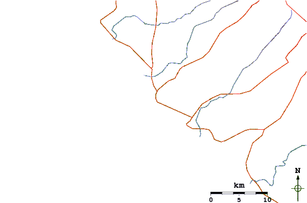
Contorni: Strade e fiumi: seleziona un surf break dal menu 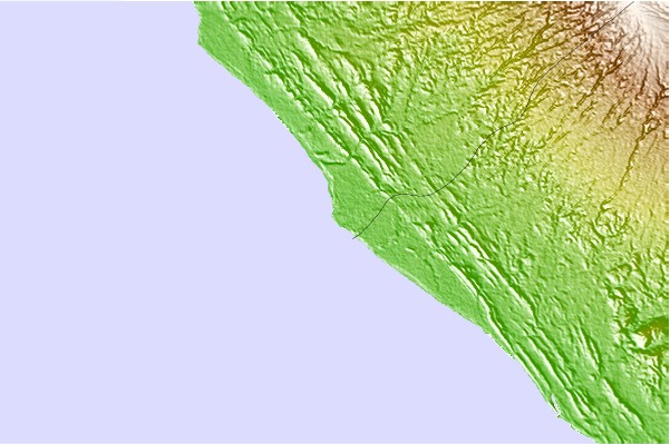
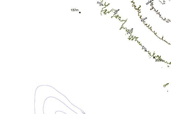
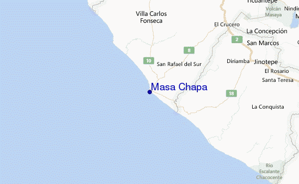
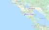
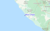
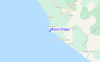
Utilizzare questa mappa sollievo per navigare Leon Province surf breaks e stazioni di marea che si trovano nella zona diMasa Chapa
Altri surf breaks più vicini al Masa Chapa:
(clicca sul nome del luogo per maggiori informazioni)- Closest località surf1 mi
- Second closest località surf1 mi
- Third closest località surf2 mi
- Fourth closest località surf6 mi
- Fifth closest località surf9 mi
Onda boe più vicina a Masa Chapa:
- Closest Onda boa485 mi
- Second closest Onda boa568 mi
- Third closest Onda boa865 mi
- Fourth closest Onda boa981 mi
- Fifth closest Onda boa983 mi
Stazioni di marea più vicina alla Masa Chapa:
- Closest marea stazioneMasachapa1 mi
- Second closest marea stazioneSan Juan del Sur57 mi
- Third closest marea stazioneCorinto66 mi
- Fourth closest marea stazioneEl Realejo68 mi
- Fifth closest marea stazioneLa Union, El Salvador139 mi
Airports
- The nearest passenger airport to Masa Chapa is Managua International Airport (MGA) in Nicaragua, which is 56 km (35 miles) away (directly).
- The second closest airport to Masa Chapa is Daniel Oduber Quiros International (Liberia) Airport (LIR) in Costa Rica, 169 km (105 miles) away.
- /breaks/Masa-Chapa/forecasts/latest

 Nearest