
Previsioni:

Previsione a breve terminepioggia leggera (Totale 6mm), per lo più che cade Sabato notte. Warm (Max 28°C Domenica mattina, Min 18°C Domenica mattina). Venti decrescenti (venti freschi da SW Sabato notte, calma per lunedì mattina). | ||||||||||||||||||||||||
Sabato 18 | Domenica 19 | Lunedì 20 | ||||||||||||||||||||||
2 AM | 5 AM | 8 AM | 11 AM | 2 PM | 5 PM | 8 PM | 11 PM | 2 AM | 5 AM | 8 AM | 11 AM | 2 PM | 5 PM | 8 PM | 11 PM | 2 AM | 5 AM | 8 AM | 11 AM | 2 PM | 5 PM | 8 PM | 11 PM | |
Mappa dell'altezza del moto ondoso | 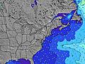 | 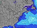 |  | 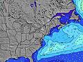 | 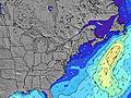 |  | 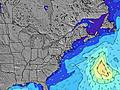 | 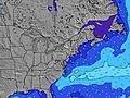 |  | |||||||||||||||
Onda Altezza (m) Direzione Periodo (s) | SE 14 | SSW 5 | SSW 5 | SSW 3 | SSW 4 | SSW 4 | S 5 | SSW 5 | SSW 6 | SE 13 | SE 13 | SE 13 | SE 13 | SE 13 | SE 12 | SE 12 | SE 12 | SE 12 | S 8 | S 8 | S 8 | S 8 | S 8 | S 7 |
Grafico delle onde | ||||||||||||||||||||||||
8 | 9 | 10 | 7 | 19 | 26 | 76 | 94 | 119 | 7 | 7 | 7 | 7 | 6 | 6 | 6 | 6 | 6 | 78 | 98 | 76 | 74 | 72 | 70 | |
Vento (km/h) | ||||||||||||||||||||||||
Stato del vento onshore cross-onshore cross-shore cross-offshore offshore piatto | cross-on | cross-on | on | on | on | on | on | cross-on | cross-on | cross-on | cross-off | cross-off | cross-off | cross-off | cross-off | cross-off | off | off | off | glassy | on | on | cross-on | cross-on |
Alta Marea | 11:18PM1.06m | 11:47AM1.04m | 00:07AM0.97m | 12:38PM1.00m | 00:56AM0.87m | 1:29PM0.95m | ||||||||||||||||||
Basso Marea | 5:38AM-0.07m | 6:06PM0.01m | 6:23AM-0.01m | 7:03PM0.08m | 7:08AM0.06m | 8:05PM0.15m | ||||||||||||||||||
— | 5:26 | — | — | — | — | — | — | — | 5:28 | — | — | — | — | — | — | — | 5:28 | — | — | — | — | — | — | |
— | — | — | — | — | — | 8:15 | — | — | — | — | — | — | — | 8:15 | — | — | — | — | — | — | — | 8:14 | — | |
mm | — | — | — | — | — | 2 | — | 4 | — | — | — | — | — | — | — | — | — | — | — | — | — | — | — | — |
Temp. °C | 22 | 22 | 22 | 24 | 24 | 20 | 21 | 22 | 22 | 22 | 23 | 24 | 26 | 28 | 24 | 21 | 20 | 18 | 19 | 23 | 23 | 23 | 21 | 21 |
Gelo °C | 20 | 21 | 21 | 23 | 22 | 18 | 19 | 19 | 21 | 22 | 22 | 22 | 23 | 25 | 21 | 20 | 17 | 15 | 17 | 21 | 19 | 19 | 20 | 21 |
Onda 1 Altezza (m) Direzione Periodo (s) | SSW 5 | SE 8 | SE 8 | SE 8 | SE 8 | SE 8 | SE 13 | SE 13 | SE 13 | SSW 6 | SSW 7 | SSW 7 | SSW 7 | SSW 7 | S 7 | SSW 8 | SSW 8 | SSW 8 | S 8 | S 8 | S 8 | S 8 | S 8 | S 7 |
11 | 3 | 3 | 3 | 3 | 3 | 7 | 7 | 7 | 113 | 139 | 156 | 136 | 136 | 112 | 94 | 94 | 77 | 78 | 98 | 76 | 74 | 72 | 70 | |
Onda 2 Altezza (m) Direzione Periodo (s) | SE 8 | SE 14 | SE 14 | SE 14 | SE 13 | SE 13 | — | SE 13 | SE 8 | SE 13 | SE 13 | SE 13 | SE 13 | SE 13 | SE 12 | SE 12 | SE 12 | SE 12 | SE 12 | SE 12 | SE 12 | SE 12 | SE 12 | S 12 |
3 | 8 | 7 | 7 | 7 | 7 | — | 7 | 3 | 7 | 7 | 7 | 7 | 6 | 6 | 6 | 6 | 6 | 6 | 6 | 6 | 6 | 6 | 3 | |
Onda 3 Altezza (m) Direzione Periodo (s) | SE 14 | — | — | — | — | — | — | — | — | SE 8 | — | — | — | — | — | — | — | — | — | — | — | — | SE 12 | SE 8 |
8 | — | — | — | — | — | — | — | — | 3 | — | — | — | — | — | — | — | — | — | — | — | — | 6 | 3 | |
onde vento Altezza (m) Direzione Periodo (s) | — | SSW 5 | SSW 5 | SSW 3 | SSW 4 | SSW 4 | S 5 | SSW 5 | SSW 6 | — | WNW 2 | NW 2 | — | — | — | NW 2 | N 2 | NNE 3 | NNE 3 | NNE 3 | — | — | — | — |
— | 9 | 10 | 7 | 19 | 26 | 76 | 94 | 119 | — | 1 | 1 | — | — | — | 1 | 1 | 1 | 1 | 1 | — | — | — | — | |
Il più vicino Offshore or Glassy | ||||||||||||||||||||||||
Distanza (km) | 618 | 618 | 1066 | 1066 | 2617 | 366 | 236 | 241 | 355 | 5 | 5 | 1 | 0 | 0 | 15 | 0 | 0 | 0 | 0 | 0 | 18 | 18 | 618 | 618 |
Migliori previsioni per le condizioni d'onda in Rhode Island | ||||||||||||||||||||||||
Migliori previsioni per le condizioni d'onda in United States | ||||||||||||||||||||||||
Trova Onde Globale | ||||||||||||||||||||||||
- Map Icons:
 Break
Break Live Wave Height (m)
 Live Wind Speed (km/h)
 Surf Rating (10 Max)
 Ocean Swells (m)
- Wind Speed (km/h)
Widget Free Surf-Forecast.com per il tuo sito
La relazione di surf / widget meteo è disponibile qui sotto per incorporare su siti esterni a titolo gratuito e fornisce una sintesi delle nostre Matunuck-Trestles previsione surf. Basta prendere il frammento di codice html da noi fornito e copiarlo nel proprio sito. È possibile scegliere la lingua preferita e unità metriche / imperiali per il feed delle previsioni surf per soddisfare le esigenze degli utenti del vostro sito .... Clicca qui per ottenere il codice.
 Nearest