
Previsioni:

Previsione a breve terminePioggia abbondante (Totale 28mm), più pesante durante mercoledì mattina. Warm (Max 30°C Lunedì pomeriggio, Min 25°C Lunedì notte). Vento sarà generalmente leggero. | ||||||||||||||||||||||||
Lunedì 27 | Martedì 28 | Mercoledì 29 | ||||||||||||||||||||||
2 AM | 5 AM | 8 AM | 11 AM | 2 PM | 5 PM | 8 PM | 11 PM | 2 AM | 5 AM | 8 AM | 11 AM | 2 PM | 5 PM | 8 PM | 11 PM | 2 AM | 5 AM | 8 AM | 11 AM | 2 PM | 5 PM | 8 PM | 11 PM | |
Mappa dell'altezza del moto ondoso | 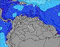 | 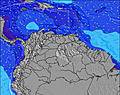 |  | 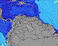 | 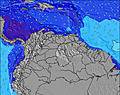 |  | 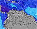 | 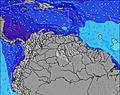 | 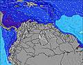 | |||||||||||||||
Onda Altezza (m) Direzione Periodo (s) | ENE 8 | ENE 8 | ENE 8 | NE 8 | NE 8 | NE 8 | ENE 8 | ENE 8 | ENE 5 | ENE 5 | ENE 6 | ENE 7 | ENE 7 | ENE 8 | ENE 8 | ENE 7 | ENE 7 | ENE 7 | ENE 8 | ENE 8 | ENE 8 | ENE 8 | ENE 8 | ENE 8 |
Grafico delle onde | ||||||||||||||||||||||||
78 | 78 | 80 | 64 | 67 | 67 | 45 | 45 | 49 | 74 | 117 | 166 | 164 | 169 | 196 | 220 | 208 | 214 | 226 | 240 | 246 | 295 | 370 | 439 | |
Vento (km/h) | ||||||||||||||||||||||||
Stato del vento onshore cross-onshore cross-shore cross-offshore offshore piatto | cross-on | cross | cross | cross-on | cross-on | cross-on | cross-on | cross-on | cross | cross | cross | cross | cross | cross | cross | cross | cross | cross | cross | cross | cross | cross | cross | cross |
Alta Marea | 3:15PM0.57m | 2:11AM0.77m | 3:42PM0.60m | 2:50AM0.80m | 4:09PM0.63m | |||||||||||||||||||
Basso Marea | 8:36AM0.10m | 8:00PM0.36m | 9:11AM0.09m | 8:39PM0.35m | 9:43AM0.09m | 9:18PM0.33m | ||||||||||||||||||
— | 5:52 | — | — | — | — | — | — | — | 5:52 | — | — | — | — | — | — | — | 5:52 | — | — | — | — | — | — | |
— | — | — | — | — | 6:29 | — | — | — | — | — | — | — | 6:29 | — | — | — | — | — | — | — | 6:29 | — | — | |
mm | — | — | — | — | — | 2 | 1 | — | 1 | — | 1 | 1 | — | — | — | 1 | 2 | 1 | 2 | 5 | 3 | 3 | 2 | 1 |
Temp. °C | 26 | 26 | 27 | 29 | 30 | 28 | 26 | 26 | 25 | 26 | 27 | 29 | 29 | 28 | 26 | 26 | 26 | 26 | 27 | 28 | 28 | 27 | 26 | 26 |
Gelo °C | 29 | 30 | 30 | 32 | 32 | 30 | 29 | 29 | 28 | 29 | 29 | 31 | 30 | 30 | 29 | 29 | 29 | 29 | 29 | 31 | 30 | 29 | 28 | 28 |
Onda 1 Altezza (m) Direzione Periodo (s) | ENE 8 | ENE 8 | ENE 8 | NE 8 | NE 8 | NE 8 | ENE 8 | ENE 8 | ENE 8 | ENE 8 | ESE 8 | ESE 8 | ESE 8 | ESE 8 | — | — | — | — | — | — | — | — | — | — |
78 | 78 | 80 | 64 | 67 | 67 | 45 | 45 | 26 | 27 | 13 | 13 | 12 | 11 | — | — | — | — | — | — | — | — | — | — | |
Onda 2 Altezza (m) Direzione Periodo (s) | ESE 9 | ESE 9 | ESE 9 | ESE 9 | ESE 9 | ESE 9 | ESE 9 | ESE 8 | — | — | — | — | — | — | — | — | — | — | — | — | — | — | — | — |
15 | 30 | 31 | 30 | 30 | 25 | 25 | 14 | — | — | — | — | — | — | — | — | — | — | — | — | — | — | — | — | |
Onda 3 Altezza (m) Direzione Periodo (s) | ESE 8 | ESE 9 | — | — | — | — | — | — | — | — | — | — | — | — | — | — | — | — | — | — | — | — | — | — |
7 | 15 | — | — | — | — | — | — | — | — | — | — | — | — | — | — | — | — | — | — | — | — | — | — | |
onde vento Altezza (m) Direzione Periodo (s) | ESE 9 | — | — | — | — | — | ENE 3 | ENE 4 | ENE 5 | ENE 5 | ENE 6 | ENE 7 | ENE 7 | ENE 8 | ENE 8 | ENE 7 | ENE 7 | ENE 7 | ENE 8 | ENE 8 | ENE 8 | ENE 8 | ENE 8 | ENE 8 |
44 | — | — | — | — | — | 4 | 20 | 49 | 74 | 117 | 166 | 164 | 169 | 196 | 220 | 208 | 214 | 226 | 240 | 246 | 295 | 370 | 439 | |
Il più vicino Offshore or Glassy | ||||||||||||||||||||||||
Distanza (km) | 302 | 18 | 302 | 49 | 302 | 614 | 551 | 302 | 551 | 18 | 551 | 49 | 1866 | 1039 | 687 | 551 | 18 | 18 | 551 | 551 | 640 | 640 | 551 | 232 |
Migliori previsioni per le condizioni d'onda in Tobago | ||||||||||||||||||||||||
Migliori previsioni per le condizioni d'onda in Trinidad and Tobago | ||||||||||||||||||||||||
Trova Onde Globale | ||||||||||||||||||||||||
- Map Icons:
 Break
Break Live Wave Height (m)
 Live Wind Speed (km/h)
 Surf Rating (10 Max)
 Ocean Swells (m)
- Wind Speed (km/h)
Widget Free Surf-Forecast.com per il tuo sito
La relazione di surf / widget meteo è disponibile qui sotto per incorporare su siti esterni a titolo gratuito e fornisce una sintesi delle nostre Matelot previsione surf. Basta prendere il frammento di codice html da noi fornito e copiarlo nel proprio sito. È possibile scegliere la lingua preferita e unità metriche / imperiali per il feed delle previsioni surf per soddisfare le esigenze degli utenti del vostro sito .... Clicca qui per ottenere il codice.
 Nearest