
Previsioni:

Previsione a breve termineper lo più asciutto. Very mild (Max 15°C martedì pomeriggio, Min 8°C Sabato notte). Vento sarà generalmente leggero. | ||||||||||||||||||
1 | Domenica 2 | Lunedì 3 | ||||||||||||||||
6 PM | 9 PM | 12 AM | 3 AM | 6 AM | 9 AM | 12 PM | 3 PM | 6 PM | 9 PM | 12 AM | 3 AM | 6 AM | 9 AM | 12 PM | 3 PM | 6 PM | 9 PM | |
Mappa dell'altezza del moto ondoso |  | 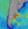 | 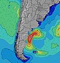 | 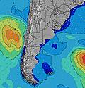 | 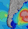 | 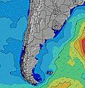 | 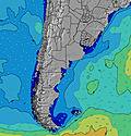 | |||||||||||
Onda Altezza (m) Direzione Periodo (s) | E 10 | E 10 | E 10 | E 10 | E 10 | E 10 | E 10 | S 12 | S 12 | S 11 | SSE 11 | SSE 11 | SSE 10 | SSE 11 | SSE 11 | SSE 11 | SSE 11 | SSE 11 |
Grafico delle onde | ||||||||||||||||||
121 | 125 | 94 | 96 | 96 | 70 | 67 | 76 | 221 | 244 | 350 | 353 | 365 | 372 | 404 | 352 | 346 | 300 | |
Vento (km/h) | ||||||||||||||||||
Stato del vento onshore cross-onshore cross-shore cross-offshore offshore piatto | cross | cross | cross | cross-off | cross-off | cross-off | cross-off | cross | cross-off | cross-off | cross-off | cross-off | cross-off | cross | cross-on | cross | cross-on | on |
Alta Marea | 9:11PM1.31m | 9:51AM0.97m | 9:52PM1.29m | 10:25AM1.02m | ||||||||||||||
Basso Marea | 3:31PM0.47m | 4:39AM0.21m | 4:16PM0.43m | 5:15AM0.25m | 5:01PM0.39m | |||||||||||||
— | — | — | — | 7:50 | — | — | — | — | — | — | — | 7:50 | — | — | — | — | — | |
6:01 | — | — | — | — | — | — | — | 6:02 | — | — | — | — | — | — | — | 6:04 | — | |
mm | — | — | — | — | — | — | — | — | — | — | — | — | — | — | — | — | — | — |
Temp. °C | 10 | 9 | 9 | 8 | 8 | 8 | 9 | 11 | 10 | 10 | 10 | 10 | 10 | 11 | 13 | 14 | 13 | 12 |
Gelo °C | 5 | 5 | 7 | 5 | 5 | 4 | 5 | 8 | 5 | 5 | 8 | 8 | 8 | 9 | 12 | 13 | 12 | 11 |
Onda 1 Altezza (m) Direzione Periodo (s) | E 10 | E 10 | E 10 | E 10 | E 10 | E 10 | E 10 | E 10 | S 12 | S 11 | SSE 11 | SSE 11 | SSE 10 | SSE 11 | SSE 11 | SSE 11 | SSE 11 | SSE 11 |
121 | 125 | 94 | 96 | 96 | 70 | 67 | 46 | 221 | 244 | 350 | 353 | 365 | 372 | 404 | 352 | 346 | 300 | |
Onda 2 Altezza (m) Direzione Periodo (s) | S 11 | S 11 | SSW 6 | SSW 6 | S 6 | S 7 | S 7 | S 7 | E 9 | E 9 | ENE 4 | ENE 4 | E 9 | E 9 | ENE 9 | ENE 9 | ENE 9 | ENE 9 |
2 | 2 | 26 | 30 | 30 | 33 | 34 | 24 | 45 | 44 | 10 | 8 | 41 | 40 | 26 | 26 | 25 | 25 | |
Onda 3 Altezza (m) Direzione Periodo (s) | — | S 16 | S 16 | S 15 | SSE 14 | SSE 13 | SSE 13 | S 12 | SSW 7 | — | E 9 | E 9 | NE 4 | S 10 | S 10 | S 10 | S 10 | S 10 |
— | 5 | 5 | 18 | 20 | 35 | 57 | 76 | 31 | — | 27 | 26 | 10 | 2 | 2 | 2 | 2 | 2 | |
onde vento Altezza (m) Direzione Periodo (s) | SSW 6 | SSW 6 | — | — | — | — | NE 2 | NE 3 | NE 3 | NE 4 | NE 4 | — | — | — | — | — | — | — |
34 | 36 | — | — | — | — | 1 | 1 | 2 | 6 | 17 | — | — | — | — | — | — | — | |
Il più vicino Offshore or Glassy | ||||||||||||||||||
Distanza (km) | 34 | 34 | 13 | 0 | 0 | 0 | 31 | 31 | 31 | 81 | 0 | 0 | 0 | 30 | 31 | 31 | 13 | 14 |
Migliori previsioni per le condizioni d'onda in Provincia de Buenos Aires | ||||||||||||||||||
Migliori previsioni per le condizioni d'onda in Argentina | ||||||||||||||||||
Trova Onde Globale | ||||||||||||||||||
- Map Icons:
 Break
Break Live Wave Height (m)
 Live Wind Speed (km/h)
 Surf Rating (10 Max)
 Ocean Swells (m)
- Wind Speed (km/h)
Widget Free Surf-Forecast.com per il tuo sito
La relazione di surf / widget meteo è disponibile qui sotto per incorporare su siti esterni a titolo gratuito e fornisce una sintesi delle nostre Miramar previsione surf. Basta prendere il frammento di codice html da noi fornito e copiarlo nel proprio sito. È possibile scegliere la lingua preferita e unità metriche / imperiali per il feed delle previsioni surf per soddisfare le esigenze degli utenti del vostro sito .... Clicca qui per ottenere il codice.
 Nearest