
Previsioni:

Previsione a breve terminePioggia moderata (Totale 17mm), più pesante Domenica mattina. Warm (Max 25°C Lunedì mattina, Min 21°C Lunedì notte). Venti decrescenti (raffiche di vento da SSW Lunedì mattina, calma per martedì mattina). | |||||||||||||||||||||||
Domenica 2 | Lunedì 3 | Martedì 4 | |||||||||||||||||||||
5 AM | 8 AM | 11 AM | 2 PM | 5 PM | 8 PM | 11 PM | 2 AM | 5 AM | 8 AM | 11 AM | 2 PM | 5 PM | 8 PM | 11 PM | 2 AM | 5 AM | 8 AM | 11 AM | 2 PM | 5 PM | 8 PM | 11 PM | |
Mappa dell'altezza del moto ondoso |  | 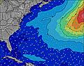 | 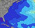 | 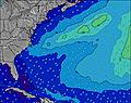 | 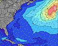 | 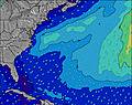 | 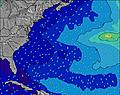 | 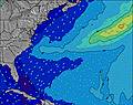 | 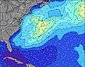 | ||||||||||||||
Onda Altezza (m) Direzione Periodo (s) | S 7 | S 7 | S 7 | S 7 | SSW 7 | SSE 4 | SSE 6 | S 5 | S 6 | S 7 | S 8 | S 8 | S 9 | SSW 8 | SSW 8 | S 8 | S 8 | S 8 | S 8 | S 8 | S 8 | S 7 | S 7 |
Grafico delle onde | |||||||||||||||||||||||
40 | 39 | 25 | 59 | 17 | 25 | 66 | 57 | 143 | 364 | 806 | 1046 | 993 | 831 | 864 | 546 | 432 | 331 | 247 | 198 | 163 | 130 | 126 | |
Vento (km/h) | |||||||||||||||||||||||
Stato del vento onshore cross-onshore cross-shore cross-offshore offshore piatto | cross-on | cross-on | cross-on | cross-on | cross-on | on | cross-on | cross-on | cross-on | cross-on | cross-on | cross | cross | cross | cross-off | cross-off | cross-off | cross-off | glassy | cross | cross | cross | cross-on |
Alta Marea | 10:47AM0.84m | 10:53PM0.80m | 11:24AM0.86m | 11:36PM0.76m | 12:08PM0.87m | ||||||||||||||||||
Basso Marea | 4:17AM0.02m | 4:38PM0.11m | 4:55AM0.03m | 5:27PM0.13m | 5:36AM0.05m | 6:22PM0.15m | |||||||||||||||||
5:43 | — | — | — | — | — | — | — | 5:43 | — | — | — | — | — | — | — | 5:45 | — | — | — | — | — | — | |
— | — | — | — | — | 8:02 | — | — | — | — | — | — | — | 8:00 | — | — | — | — | — | — | — | 8:00 | — | |
mm | — | — | — | — | — | — | — | 1 | 5 | 2 | 1 | 3 | 1 | 2 | 2 | — | — | — | — | — | — | — | — |
Temp. °C | 22 | 23 | 23 | 24 | 24 | 24 | 24 | 24 | 24 | 24 | 25 | 23 | 24 | 23 | 22 | 21 | 21 | 21 | 23 | 24 | 25 | 25 | 24 |
Gelo °C | 22 | 23 | 23 | 24 | 25 | 25 | 25 | 23 | 23 | 21 | 21 | 20 | 22 | 21 | 21 | 20 | 20 | 19 | 23 | 22 | 23 | 22 | 21 |
Onda 1 Altezza (m) Direzione Periodo (s) | S 7 | S 7 | S 7 | SE 7 | SSW 7 | S 7 | SE 9 | SE 9 | — | — | — | — | — | — | S 8 | S 8 | S 8 | S 8 | S 8 | S 8 | S 8 | S 7 | S 7 |
40 | 39 | 25 | 16 | 15 | 14 | 3 | 3 | — | — | — | — | — | — | 675 | 546 | 432 | 331 | 247 | 198 | 163 | 130 | 126 | |
Onda 2 Altezza (m) Direzione Periodo (s) | SE 7 | SE 7 | SE 7 | S 9 | SE 7 | SE 9 | SE 9 | — | — | — | — | — | — | — | — | — | — | — | — | SE 7 | — | — | E 12 |
7 | 17 | 16 | 6 | 16 | 3 | 3 | — | — | — | — | — | — | — | — | — | — | — | — | 37 | — | — | 3 | |
Onda 3 Altezza (m) Direzione Periodo (s) | ESE 8 | SE 9 | S 9 | SE 9 | S 8 | — | — | — | — | — | — | — | — | — | — | — | — | — | — | — | — | — | E 9 |
7 | 3 | 6 | 3 | 1 | — | — | — | — | — | — | — | — | — | — | — | — | — | — | — | — | — | 1 | |
onde vento Altezza (m) Direzione Periodo (s) | S 4 | S 4 | S 4 | S 7 | S 4 | SSE 4 | SSE 6 | S 5 | S 6 | S 7 | S 8 | S 8 | S 9 | SSW 8 | SSW 8 | — | N 3 | NNE 3 | — | — | — | — | — |
13 | 13 | 13 | 59 | 17 | 25 | 66 | 57 | 143 | 364 | 806 | 1046 | 993 | 831 | 864 | — | 2 | 1 | — | — | — | — | — | |
Il più vicino Offshore or Glassy | |||||||||||||||||||||||
Distanza (km) | 658 | 791 | 1660 | 1660 | 1660 | 1520 | 1202 | 1202 | 1521 | 1050 | 192 | 192 | 192 | 93 | 24 | 0 | 0 | 0 | 0 | 0 | 2 | 2 | 0 |
Migliori previsioni per le condizioni d'onda in Long Island New York | |||||||||||||||||||||||
Migliori previsioni per le condizioni d'onda in United States | |||||||||||||||||||||||
Trova Onde Globale | |||||||||||||||||||||||
- Map Icons:
 Break
Break Live Wave Height (m)
 Live Wind Speed (km/h)
 Surf Rating (10 Max)
 Ocean Swells (m)
- Wind Speed (km/h)
Widget Free Surf-Forecast.com per il tuo sito
La relazione di surf / widget meteo è disponibile qui sotto per incorporare su siti esterni a titolo gratuito e fornisce una sintesi delle nostre Montauk Point - Turtles previsione surf. Basta prendere il frammento di codice html da noi fornito e copiarlo nel proprio sito. È possibile scegliere la lingua preferita e unità metriche / imperiali per il feed delle previsioni surf per soddisfare le esigenze degli utenti del vostro sito .... Clicca qui per ottenere il codice.
 Nearest