
Previsioni:

Previsione a breve termineQualche pioggerella, più pesante durante lunedì mattina. Warm (Max 23°C Sabato pomeriggio, Min 16°C Sabato mattina). Vento sarà generalmente leggero. | ||||||||||||||||||||||||
Sabato 18 | Domenica 19 | Lunedì 20 | ||||||||||||||||||||||
2 AM | 5 AM | 8 AM | 11 AM | 2 PM | 5 PM | 8 PM | 11 PM | 2 AM | 5 AM | 8 AM | 11 AM | 2 PM | 5 PM | 8 PM | 11 PM | 2 AM | 5 AM | 8 AM | 11 AM | 2 PM | 5 PM | 8 PM | 11 PM | |
Mappa dell'altezza del moto ondoso |  |  |  |  | 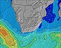 |  |  | 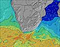 |  | |||||||||||||||
Onda Altezza (m) Direzione Periodo (s) | ESE 10 | S 13 | S 12 | S 11 | S 11 | ESE 10 | S 13 | S 13 | S 12 | S 12 | SSE 14 | SSE 12 | SSE 12 | SSE 12 | SSE 11 | SSE 12 | SSE 12 | SE 12 | SE 13 | SE 12 | SE 12 | SE 12 | SE 12 | SE 12 |
Grafico delle onde | ||||||||||||||||||||||||
154 | 168 | 180 | 198 | 149 | 125 | 128 | 324 | 356 | 322 | 790 | 666 | 669 | 635 | 663 | 749 | 807 | 918 | 1028 | 971 | 929 | 827 | 813 | 736 | |
Vento (km/h) | ||||||||||||||||||||||||
Stato del vento onshore cross-onshore cross-shore cross-offshore offshore piatto | glassy | off | glassy | on | on | cross-on | glassy | cross-off | cross-off | cross-off | cross-off | glassy | on | on | glassy | off | off | cross-off | cross-off | cross | cross-on | on | cross | cross-off |
Alta Marea | 6:08AM1.78m | 6:37PM1.85m | 6:43AM1.67m | 7:14PM1.73m | 7:19AM1.54m | 7:52PM1.59m | ||||||||||||||||||
Basso Marea | 00:05AM0.20m | 12:16PM0.10m | 00:43AM0.30m | 12:52PM0.21m | 1:20AM0.42m | 1:28PM0.35m | ||||||||||||||||||
— | 6:43 | — | — | — | — | — | — | — | 6:43 | — | — | — | — | — | — | — | 6:43 | — | — | — | — | — | — | |
— | — | — | — | — | 5:14 | — | — | — | — | — | — | — | 5:14 | — | — | — | — | — | — | — | 5:15 | — | — | |
mm | — | — | — | — | — | — | — | — | — | — | — | — | — | — | — | — | — | — | — | 1 | — | — | — | — |
Temp. °C | 17 | 16 | 16 | 21 | 23 | 21 | 20 | 18 | 17 | 17 | 17 | 20 | 21 | 20 | 19 | 18 | 17 | 17 | 18 | 20 | 20 | 20 | 19 | 18 |
Gelo °C | 17 | 15 | 15 | 20 | 21 | 21 | 21 | 18 | 16 | 16 | 16 | 20 | 20 | 20 | 20 | 19 | 17 | 17 | 17 | 18 | 19 | 20 | 19 | 17 |
Onda 1 Altezza (m) Direzione Periodo (s) | ESE 10 | ESE 10 | ESE 10 | S 11 | ESE 10 | ESE 10 | E 10 | S 13 | S 12 | S 12 | SSE 14 | SSE 12 | SSE 12 | SSE 12 | SSE 11 | SSE 12 | SSE 12 | SE 12 | SE 13 | SE 12 | SE 12 | SE 12 | SE 12 | SE 12 |
154 | 157 | 125 | 198 | 125 | 125 | 88 | 324 | 356 | 322 | 790 | 666 | 669 | 635 | 663 | 749 | 807 | 918 | 1028 | 971 | 929 | 827 | 813 | 736 | |
Onda 2 Altezza (m) Direzione Periodo (s) | S 14 | S 13 | S 12 | ESE 10 | S 11 | S 10 | S 10 | E 9 | E 9 | SSE 15 | E 10 | E 10 | E 10 | E 10 | E 10 | E 10 | E 10 | E 10 | ESE 10 | E 9 | E 9 | E 10 | E 10 | SSW 11 |
101 | 168 | 180 | 128 | 149 | 98 | 90 | 87 | 87 | 272 | 88 | 65 | 70 | 71 | 70 | 71 | 49 | 48 | 31 | 41 | 27 | 17 | 16 | 22 | |
Onda 3 Altezza (m) Direzione Periodo (s) | — | — | S 16 | S 15 | SSE 15 | S 14 | S 13 | E 10 | SSE 15 | E 10 | S 12 | E 10 | S 15 | S 11 | E 10 | NE 6 | NE 6 | NE 6 | SSW 12 | SW 12 | S 16 | S 10 | S 15 | S 14 |
— | — | 5 | 40 | 72 | 103 | 128 | 116 | 89 | 88 | 26 | 96 | 4 | 38 | 94 | 1 | 1 | 1 | 15 | 6 | 19 | 8 | 17 | 15 | |
onde vento Altezza (m) Direzione Periodo (s) | — | — | — | — | — | — | — | — | — | — | — | — | — | — | — | — | — | — | — | — | — | — | NE 5 | — |
— | — | — | — | — | — | — | — | — | — | — | — | — | — | — | — | — | — | — | — | — | — | 4 | — | |
Il più vicino Offshore or Glassy | ||||||||||||||||||||||||
Distanza (km) | 0 | 0 | 0 | 14 | 123 | 63 | 0 | 0 | 0 | 0 | 0 | 0 | 123 | 123 | 0 | 0 | 0 | 0 | 0 | 63 | 37 | 123 | 14 | 0 |
Migliori previsioni per le condizioni d'onda in KwaZulu-Natal North Coast | ||||||||||||||||||||||||
Migliori previsioni per le condizioni d'onda in South Africa | ||||||||||||||||||||||||
Trova Onde Globale | ||||||||||||||||||||||||
- Map Icons:
 Break
Break Live Wave Height (m)
 Live Wind Speed (km/h)
 Surf Rating (10 Max)
 Ocean Swells (m)
- Wind Speed (km/h)
Widget Free Surf-Forecast.com per il tuo sito
La relazione di surf / widget meteo è disponibile qui sotto per incorporare su siti esterni a titolo gratuito e fornisce una sintesi delle nostre Mtunzini previsione surf. Basta prendere il frammento di codice html da noi fornito e copiarlo nel proprio sito. È possibile scegliere la lingua preferita e unità metriche / imperiali per il feed delle previsioni surf per soddisfare le esigenze degli utenti del vostro sito .... Clicca qui per ottenere il codice.
 Nearest