
Previsioni:

Previsione a breve terminePioggia abbondante (Totale 36mm), più pesante durante mercoledì mattina. Warm (Max 21°C Lunedì pomeriggio, Min 13°C Domenica mattina). Venti in aumento (venti deboli da S martedì mattina, bufere nelle prossimità da O per mercoledì mattina). | ||||||||||||||||||||||||
Lunedì 3 | Martedì 4 | Mercoledì 5 | ||||||||||||||||||||||
1 AM | 4 AM | 7 AM | 10 AM | 1 PM | 4 PM | 7 PM | 10 PM | 1 AM | 4 AM | 7 AM | 10 AM | 1 PM | 4 PM | 7 PM | 10 PM | 1 AM | 4 AM | 7 AM | 10 AM | 1 PM | 4 PM | 7 PM | 10 PM | |
Mappa dell'altezza del moto ondoso |  | 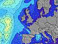 |  |  |  |  |  |  |  | |||||||||||||||
Onda Altezza (m) Direzione Periodo (s) | NW 8 | NW 8 | NW 7 | NW 7 | NW 7 | NW 7 | NW 9 | NW 9 | NW 9 | NW 9 | NW 9 | NW 9 | W 11 | NNW 9 | NNW 9 | NW 10 | WSW 5 | W 7 | WNW 7 | WNW 7 | WNW 8 | WNW 8 | WNW 8 | WNW 8 |
Grafico delle onde | ||||||||||||||||||||||||
20 | 20 | 8 | 8 | 7 | 7 | 3 | 3 | 3 | 3 | 3 | 3 | 3 | 8 | 8 | 14 | 78 | 202 | 317 | 276 | 437 | 592 | 705 | 635 | |
Vento (km/h) | ||||||||||||||||||||||||
Stato del vento onshore cross-onshore cross-shore cross-offshore offshore piatto | cross-off | cross-off | cross-off | cross-off | cross-off | off | cross-off | cross-off | cross-off | off | off | cross-off | cross-off | cross | cross-on | cross-on | cross-on | cross-on | cross-on | cross-on | cross-on | cross-on | on | on |
Alta Marea | 9:25AM2.98m | 9:38PM3.38m | 10:04AM2.91m | 10:18PM3.21m | 10:49AM2.80m | |||||||||||||||||||
Basso Marea | 3:15AM0.38m | 3:13PM0.48m | 3:50AM0.46m | 3:52PM0.63m | 4:31AM0.58m | 4:39PM0.80m | ||||||||||||||||||
— | 5:47 | — | — | — | — | — | — | — | 5:48 | — | — | — | — | — | — | — | 5:50 | — | — | — | — | — | — | |
— | — | — | — | — | — | 9:30 | — | — | — | — | — | — | — | 9:29 | — | — | — | — | — | — | — | 9:27 | — | |
mm | — | 1 | — | — | — | — | — | 1 | 2 | 5 | 3 | — | — | 1 | 1 | — | — | 1 | 1 | 9 | 8 | 1 | 2 | 1 |
Temp. °C | 14 | 14 | 13 | 14 | 17 | 21 | 19 | 15 | 15 | 15 | 16 | 17 | 18 | 18 | 16 | 15 | 14 | 14 | 13 | 14 | 14 | 14 | 14 | 14 |
Gelo °C | 12 | 12 | 10 | 10 | 14 | 18 | 17 | 12 | 12 | 13 | 15 | 16 | 17 | 17 | 14 | 11 | 8 | 7 | 3 | 4 | 7 | 7 | 8 | 8 |
Onda 1 Altezza (m) Direzione Periodo (s) | NW 8 | NW 8 | NW 7 | NW 7 | NW 7 | NW 7 | NW 7 | NW 6 | NW 6 | NW 9 | NW 9 | NW 9 | NW 9 | NNW 9 | NNW 9 | NW 10 | NW 10 | — | — | — | — | — | — | — |
20 | 20 | 8 | 8 | 7 | 7 | 2 | 2 | 2 | 3 | 3 | 3 | 3 | 8 | 8 | 14 | 16 | — | — | — | — | — | — | — | |
Onda 2 Altezza (m) Direzione Periodo (s) | W 10 | W 10 | W 10 | W 10 | NW 9 | NW 9 | NW 9 | NW 9 | NW 9 | NW 6 | NW 6 | W 9 | NW 7 | NW 7 | NW 7 | — | — | — | — | — | — | — | — | — |
2 | 7 | 2 | 2 | 3 | 3 | 3 | 3 | 3 | 2 | 2 | 2 | 2 | 2 | 2 | — | — | — | — | — | — | — | — | — | |
Onda 3 Altezza (m) Direzione Periodo (s) | — | — | NW 9 | NW 9 | W 9 | W 9 | W 9 | W 9 | W 9 | W 9 | W 9 | NW 6 | W 11 | W 11 | W 11 | — | — | — | — | — | — | — | — | — |
— | — | 3 | 3 | 2 | 2 | 2 | 2 | 2 | 2 | 2 | 1 | 2 | 2 | 2 | — | — | — | — | — | — | — | — | — | |
onde vento Altezza (m) Direzione Periodo (s) | — | — | — | ENE 2 | E 3 | — | — | — | ESE 2 | SE 3 | SE 3 | SSE 2 | — | — | — | WSW 4 | WSW 5 | W 7 | WNW 7 | WNW 7 | WNW 8 | WNW 8 | WNW 8 | WNW 8 |
— | — | — | 1 | 2 | — | — | — | 1 | 1 | 2 | 1 | — | — | — | 13 | 78 | 202 | 317 | 276 | 437 | 592 | 705 | 635 | |
Il più vicino Offshore or Glassy | ||||||||||||||||||||||||
Distanza (km) | 9 | 9 | 19 | 46 | 47 | 34 | 34 | 45 | 34 | 34 | 34 | 39 | 34 | 39 | 79 | 88 | 397 | 401 | 292 | 413 | 455 | 498 | 499 | 727 |
Migliori previsioni per le condizioni d'onda in Sligo | ||||||||||||||||||||||||
Migliori previsioni per le condizioni d'onda in Ireland | ||||||||||||||||||||||||
Trova Onde Globale | ||||||||||||||||||||||||
- Map Icons:
 Break
Break Live Wave Height (m)
 Live Wind Speed (km/h)
 Surf Rating (10 Max)
 Ocean Swells (m)
- Wind Speed (km/h)
Widget Free Surf-Forecast.com per il tuo sito
La relazione di surf / widget meteo è disponibile qui sotto per incorporare su siti esterni a titolo gratuito e fornisce una sintesi delle nostre Mullaghmore previsione surf. Basta prendere il frammento di codice html da noi fornito e copiarlo nel proprio sito. È possibile scegliere la lingua preferita e unità metriche / imperiali per il feed delle previsioni surf per soddisfare le esigenze degli utenti del vostro sito .... Clicca qui per ottenere il codice.
 Nearest