
Previsioni:

Previsione a breve terminePioggia moderata (Totale 10mm), più pesante Lunedì notte. Warm (Max 32°C Lunedì mattina, Min 27°C Lunedì notte). Venti in aumento (venti deboli da NE Lunedì mattina, raffiche di vento da NE per mercoledì notte). | ||||||||||||||||||||||||
Lunedì 3 | Martedì 4 | Mercoledì 5 | ||||||||||||||||||||||
12 AM | 3 AM | 6 AM | 9 AM | 12 PM | 3 PM | 6 PM | 9 PM | 12 AM | 3 AM | 6 AM | 9 AM | 12 PM | 3 PM | 6 PM | 9 PM | 12 AM | 3 AM | 6 AM | 9 AM | 12 PM | 3 PM | 6 PM | 9 PM | |
Mappa dell'altezza del moto ondoso |  |  |  |  | 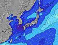 |  |  | 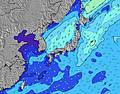 |  | |||||||||||||||
Onda Altezza (m) Direzione Periodo (s) | ESE 16 | ESE 15 | ESE 16 | E 16 | ESE 16 | ESE 16 | ESE 16 | ESE 16 | E 16 | E 17 | E 17 | E 17 | ESE 17 | E 17 | ESE 17 | ESE 17 | E 17 | E 17 | E 18 | E 17 | E 17 | E 18 | E 18 | ESE 17 |
Grafico delle onde | ||||||||||||||||||||||||
749 | 764 | 1012 | 1131 | 1400 | 1512 | 1752 | 1938 | 2381 | 3125 | 3393 | 3974 | 2750 | 4817 | 3879 | 4082 | 6692 | 8245 | 10388 | 12852 | 15221 | 17997 | 20110 | 22374 | |
Vento (km/h) | ||||||||||||||||||||||||
Stato del vento onshore cross-onshore cross-shore cross-offshore offshore piatto | cross | cross-off | cross-off | off | off | off | off | off | off | off | off | off | off | off | off | off | off | off | off | off | off | off | off | off |
Alta Marea | 9:03PM2.05m | 9:07AM1.95m | 9:32PM2.00m | 9:52AM1.82m | 10:03PM1.95m | 10:46AM1.67m | ||||||||||||||||||
Basso Marea | 3:08AM0.67m | 3:16PM0.60m | 3:48AM0.66m | 3:49PM0.78m | 4:34AM0.68m | 4:24PM0.97m | ||||||||||||||||||
— | 5:31 | — | — | — | — | — | — | — | 5:31 | — | — | — | — | — | — | — | 5:33 | — | — | — | — | — | — | |
— | — | — | — | — | — | 7:09 | — | — | — | — | — | — | — | 7:08 | — | — | — | — | — | — | — | 7:07 | — | |
mm | — | — | — | — | — | — | — | 1 | 1 | 2 | 2 | 1 | — | 1 | 1 | 1 | — | — | — | — | — | — | — | — |
Temp. °C | 29 | 28 | 28 | 32 | 32 | 32 | 30 | 28 | 27 | 27 | 27 | 29 | 30 | 30 | 29 | 27 | 27 | 27 | 27 | 29 | 29 | 30 | 28 | 28 |
Gelo °C | 33 | 31 | 32 | 35 | 33 | 33 | 33 | 31 | 31 | 30 | 30 | 31 | 31 | 32 | 31 | 30 | 29 | 29 | 28 | 29 | 29 | 30 | 28 | 28 |
Onda 1 Altezza (m) Direzione Periodo (s) | ESE 16 | ESE 15 | ESE 16 | E 16 | ESE 16 | ESE 16 | ESE 16 | ESE 16 | E 16 | E 17 | E 17 | E 17 | ESE 17 | E 17 | ESE 17 | ESE 17 | E 17 | E 17 | E 18 | E 17 | E 17 | E 18 | E 18 | ESE 17 |
749 | 764 | 1012 | 1131 | 1400 | 1512 | 1752 | 1938 | 2381 | 3125 | 3393 | 3974 | 2750 | 4817 | 3879 | 4082 | 6692 | 8245 | 10388 | 12852 | 15221 | 17997 | 20110 | 22374 | |
Onda 2 Altezza (m) Direzione Periodo (s) | ESE 10 | SSW 8 | SSE 10 | SE 9 | S 7 | S 7 | S 7 | S 7 | SSE 8 | — | — | — | — | — | — | — | — | — | — | — | — | — | — | — |
30 | 6 | 9 | 3 | 4 | 1 | 4 | 4 | 6 | — | — | — | — | — | — | — | — | — | — | — | — | — | — | — | |
Onda 3 Altezza (m) Direzione Periodo (s) | SE 10 | SSW 8 | SSW 7 | S 7 | S 7 | S 7 | — | — | — | — | — | — | — | — | — | — | — | — | — | — | — | — | — | — |
15 | 6 | 5 | 4 | 4 | 4 | — | — | — | — | — | — | — | — | — | — | — | — | — | — | — | — | — | — | |
onde vento Altezza (m) Direzione Periodo (s) | — | — | — | — | NE 4 | NE 4 | ENE 4 | NE 4 | ENE 6 | ENE 6 | ENE 7 | ENE 7 | E 7 | ENE 8 | E 8 | E 9 | ENE 9 | — | — | — | — | — | — | — |
— | — | — | — | 13 | 29 | 26 | 20 | 63 | 121 | 178 | 261 | 245 | 395 | 333 | 442 | 662 | — | — | — | — | — | — | — | |
Il più vicino Offshore or Glassy | ||||||||||||||||||||||||
Distanza (km) | 12 | 0 | 0 | 0 | 0 | 0 | 0 | 0 | 0 | 0 | 0 | 0 | 0 | 0 | 0 | 0 | 0 | 0 | 0 | 335 | 406 | 167 | 167 | 335 |
Migliori previsioni per le condizioni d'onda in Kyu Shu | ||||||||||||||||||||||||
Migliori previsioni per le condizioni d'onda in Japan | ||||||||||||||||||||||||
Trova Onde Globale | ||||||||||||||||||||||||
- Map Icons:
 Break
Break Live Wave Height (m)
 Live Wind Speed (km/h)
 Surf Rating (10 Max)
 Ocean Swells (m)
- Wind Speed (km/h)
Widget Free Surf-Forecast.com per il tuo sito
La relazione di surf / widget meteo è disponibile qui sotto per incorporare su siti esterni a titolo gratuito e fornisce una sintesi delle nostre Nagata previsione surf. Basta prendere il frammento di codice html da noi fornito e copiarlo nel proprio sito. È possibile scegliere la lingua preferita e unità metriche / imperiali per il feed delle previsioni surf per soddisfare le esigenze degli utenti del vostro sito .... Clicca qui per ottenere il codice.
 Nearest