
Previsioni:

Previsione a breve termineQualche pioggerella, più pesante durante giovedì pomeriggio. Warm (Max 20°C Lunedì notte, Min 18°C Domenica mattina). Vento sarà generalmente leggero. | |||||||||||||||||||
Dom 2 | Lunedì 3 | Martedì 4 | |||||||||||||||||
5 PM | 8 PM | 11 PM | 2 AM | 5 AM | 8 AM | 11 AM | 2 PM | 5 PM | 8 PM | 11 PM | 2 AM | 5 AM | 8 AM | 11 AM | 2 PM | 5 PM | 8 PM | 11 PM | |
Mappa dell'altezza del moto ondoso |  |  | 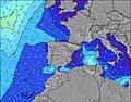 |  |  | 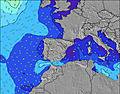 |  | ||||||||||||
Onda Altezza (m) Direzione Periodo (s) | W 10 | W 9 | W 9 | W 9 | W 9 | W 8 | W 8 | W 8 | W 8 | WSW 7 | W 8 | W 9 | W 9 | W 9 | W 9 | W 8 | W 8 | W 8 | W 8 |
Grafico delle onde | |||||||||||||||||||
88 | 85 | 81 | 103 | 123 | 141 | 172 | 173 | 142 | 89 | 138 | 153 | 158 | 154 | 146 | 113 | 111 | 107 | 82 | |
Vento (km/h) | |||||||||||||||||||
Stato del vento onshore cross-onshore cross-shore cross-offshore offshore piatto | on | cross-on | cross-on | cross | cross | cross | cross-on | cross-on | cross-on | cross-on | cross-on | cross-on | cross-on | cross-on | cross-on | cross-on | on | cross | off |
Alta Marea | 7:27PM3.17m | 7:49AM2.90m | 8:03PM3.07m | 8:28AM2.83m | 8:44PM2.93m | ||||||||||||||
Basso Marea | 1:41AM0.32m | 1:49PM0.44m | 2:17AM0.40m | 2:29PM0.55m | |||||||||||||||
— | — | — | — | 7:28 | — | — | — | — | — | — | — | 7:30 | — | — | — | — | — | — | |
— | 9:57 | — | — | — | — | — | — | — | 9:55 | — | — | — | — | — | — | — | 9:54 | — | |
mm | — | — | — | — | — | — | — | — | — | — | — | — | — | — | — | 1 | — | — | — |
Temp. °C | 19 | 19 | 19 | 18 | 18 | 18 | 19 | 19 | 19 | 20 | 20 | 20 | 19 | 19 | 19 | 20 | 20 | 20 | 19 |
Gelo °C | 19 | 19 | 18 | 17 | 16 | 16 | 16 | 16 | 18 | 20 | 20 | 20 | 19 | 18 | 18 | 20 | 21 | 21 | 20 |
Onda 1 Altezza (m) Direzione Periodo (s) | W 10 | W 9 | W 9 | W 9 | W 9 | W 8 | W 8 | W 8 | W 8 | WSW 7 | W 8 | W 9 | W 9 | W 9 | W 9 | W 8 | W 8 | W 8 | W 8 |
88 | 85 | 81 | 103 | 123 | 141 | 172 | 173 | 142 | 89 | 138 | 153 | 158 | 154 | 146 | 113 | 111 | 107 | 82 | |
Onda 2 Altezza (m) Direzione Periodo (s) | NNE 6 | NNE 5 | NNW 7 | NNW 8 | NNW 8 | NNW 8 | NNW 8 | WNW 10 | WNW 10 | W 9 | N 10 | NNW 10 | NNW 9 | NNW 9 | NW 11 | NW 11 | NW 11 | NNW 10 | NNW 10 |
10 | 6 | 11 | 11 | 11 | 6 | 6 | 32 | 32 | 60 | 7 | 18 | 17 | 16 | 20 | 30 | 57 | 73 | 72 | |
Onda 3 Altezza (m) Direzione Periodo (s) | NNW 7 | NNW 7 | NNE 5 | NNE 5 | NNE 5 | NNE 6 | NNE 6 | NNW 8 | NNW 8 | NNW 8 | N 8 | S 14 | NW 11 | NNW 11 | NNW 9 | NNW 9 | NNW 9 | SSW 13 | SW 13 |
9 | 9 | 5 | 2 | 2 | 4 | 3 | 6 | 6 | 6 | 4 | 4 | 5 | 13 | 16 | 16 | 15 | 17 | 7 | |
onde vento Altezza (m) Direzione Periodo (s) | — | — | SSW 2 | — | SSE 3 | SSE 3 | SSE 4 | S 4 | S 5 | S 5 | S 4 | S 4 | S 4 | — | — | SSE 3 | — | — | — |
— | — | 1 | — | 2 | 6 | 19 | 28 | 36 | 15 | 10 | 6 | 2 | — | — | 2 | — | — | — | |
Il più vicino Offshore or Glassy | |||||||||||||||||||
Distanza (km) | 39 | 39 | 5 | 26 | 26 | 26 | 39 | 39 | 39 | 39 | 26 | 26 | 26 | 26 | 30 | 39 | 39 | 50 | 0 |
Migliori previsioni per le condizioni d'onda in Galicia | |||||||||||||||||||
Migliori previsioni per le condizioni d'onda in Spain (Europe) | |||||||||||||||||||
Trova Onde Globale | |||||||||||||||||||
- Map Icons:
 Break
Break Live Wave Height (m)
 Live Wind Speed (km/h)
 Surf Rating (10 Max)
 Ocean Swells (m)
- Wind Speed (km/h)
Widget Free Surf-Forecast.com per il tuo sito
La relazione di surf / widget meteo è disponibile qui sotto per incorporare su siti esterni a titolo gratuito e fornisce una sintesi delle nostre Nemina previsione surf. Basta prendere il frammento di codice html da noi fornito e copiarlo nel proprio sito. È possibile scegliere la lingua preferita e unità metriche / imperiali per il feed delle previsioni surf per soddisfare le esigenze degli utenti del vostro sito .... Clicca qui per ottenere il codice.
 Nearest