
Previsioni:

Previsione a breve termineper lo più asciutto. Warm (Max 21°C Venerdì pomeriggio, Min 11°C giovedì notte). Venti in aumento (venti deboli da NNE giovedì mattina, venti freschi da NNW per venerdì pomeriggio). | ||||||||||||||||||||||||
Mercoledì 15 | Giovedì 16 | Venerdì 17 | 18 | |||||||||||||||||||||
8 AM | 11 AM | 2 PM | 5 PM | 8 PM | 11 PM | 2 AM | 5 AM | 8 AM | 11 AM | 2 PM | 5 PM | 8 PM | 11 PM | 2 AM | 5 AM | 8 AM | 11 AM | 2 PM | 5 PM | 8 PM | 11 PM | 2 AM | 5 AM | |
Mappa dell'altezza del moto ondoso |  |  |  | 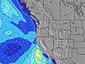 |  |  |  | 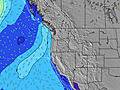 |  | |||||||||||||||
Onda Altezza (m) Direzione Periodo (s) | SW 18 | SW 18 | SW 18 | WNW 9 | WNW 20 | WNW 20 | W 19 | W 19 | W 19 | W 19 | W 19 | W 18 | W 18 | W 17 | W 17 | W 17 | W 17 | W 17 | WNW 16 | W 16 | W 16 | W 16 | W 16 | W 16 |
Grafico delle onde | ||||||||||||||||||||||||
152 | 152 | 152 | 118 | 140 | 127 | 192 | 186 | 186 | 186 | 182 | 246 | 230 | 220 | 290 | 293 | 297 | 373 | 363 | 334 | 330 | 330 | 254 | 326 | |
Vento (km/h) | ||||||||||||||||||||||||
Stato del vento onshore cross-onshore cross-shore cross-offshore offshore piatto | cross-on | on | on | on | on | cross-on | cross-on | cross | cross | on | on | on | on | cross-on | cross-on | cross-on | cross-on | on | on | on | cross-on | cross-on | cross-on | cross-on |
Alta Marea | 2:00PM1.78m | 1:04AM2.30m | 2:41PM1.83m | 1:56AM2.14m | 3:22PM1.88m | 2:50AM1.93m | ||||||||||||||||||
Basso Marea | 7:26AM-0.58m | 7:16PM0.66m | 8:10AM-0.49m | 8:12PM0.59m | 8:52AM-0.34m | 9:09PM0.52m | ||||||||||||||||||
5:52 | — | — | — | — | — | — | 5:54 | — | — | — | — | — | — | — | 5:54 | — | — | — | — | — | — | — | 5:56 | |
— | — | — | — | 8:52 | — | — | — | — | — | — | — | 8:52 | — | — | — | — | — | — | — | 8:52 | — | — | 8:51 | |
mm | — | — | — | — | — | — | — | — | — | — | — | — | — | — | — | — | — | — | — | — | — | — | — | — |
Temp. °C | 15 | 18 | 19 | 18 | 16 | 13 | 12 | 12 | 14 | 17 | 17 | 17 | 16 | 13 | 12 | 11 | 14 | 19 | 21 | 20 | 18 | 14 | 13 | 12 |
Gelo °C | 12 | 13 | 15 | 15 | 13 | 11 | 11 | 11 | 13 | 15 | 14 | 14 | 13 | 11 | 10 | 8 | 11 | 14 | 16 | 15 | 13 | 11 | 11 | 9 |
Onda 1 Altezza (m) Direzione Periodo (s) | WNW 10 | WNW 10 | WNW 10 | WNW 9 | WNW 9 | WNW 9 | WNW 9 | WNW 9 | WNW 9 | WNW 9 | W 19 | W 18 | NW 8 | NW 8 | NW 8 | NW 8 | NW 8 | W 17 | WNW 16 | W 16 | W 16 | NW 7 | NW 7 | NW 7 |
131 | 131 | 125 | 118 | 113 | 86 | 94 | 92 | 90 | 68 | 182 | 246 | 84 | 82 | 82 | 84 | 69 | 373 | 363 | 334 | 330 | 84 | 77 | 61 | |
Onda 2 Altezza (m) Direzione Periodo (s) | SW 18 | SW 18 | SW 18 | SW 18 | WSW 17 | NW 5 | W 19 | W 19 | W 19 | SW 16 | SW 16 | SW 16 | W 18 | W 17 | W 17 | W 17 | W 17 | SW 19 | SW 19 | SW 19 | SW 19 | W 16 | W 16 | W 16 |
152 | 152 | 152 | 108 | 116 | 11 | 192 | 186 | 186 | 125 | 124 | 124 | 230 | 220 | 290 | 293 | 297 | 179 | 181 | 130 | 129 | 330 | 254 | 326 | |
Onda 3 Altezza (m) Direzione Periodo (s) | SW 12 | SW 12 | W 13 | W 13 | WNW 20 | WNW 20 | SW 16 | SW 16 | SW 16 | W 19 | SW 11 | SW 12 | SW 16 | SW 16 | SW 16 | SW 15 | SW 15 | SW 15 | SW 14 | SW 14 | NW 12 | WNW 11 | WNW 11 | WNW 11 |
37 | 38 | 83 | 51 | 140 | 127 | 127 | 125 | 125 | 186 | 20 | 21 | 124 | 122 | 121 | 116 | 110 | 54 | 54 | 54 | 36 | 74 | 98 | 66 | |
onde vento Altezza (m) Direzione Periodo (s) | NW 5 | NNW 5 | NW 5 | NW 5 | NW 5 | NW 5 | — | — | — | — | WNW 9 | WNW 8 | NW 8 | NW 7 | NW 8 | — | — | NW 8 | NW 5 | NW 6 | NW 6 | NW 6 | — | — |
5 | 14 | 22 | 24 | 14 | 28 | — | — | — | — | 96 | 84 | 160 | 137 | 142 | — | — | 79 | 58 | 86 | 99 | 186 | — | — | |
Il più vicino Offshore or Glassy | ||||||||||||||||||||||||
Distanza (km) | 20 | 547 | 650 | 649 | 87 | 20 | 20 | 20 | 20 | 490 | 490 | 490 | 331 | 66 | 20 | 20 | 20 | 83 | 491 | 650 | 87 | 20 | 20 | 20 |
Migliori previsioni per le condizioni d'onda in South Oregon | ||||||||||||||||||||||||
Migliori previsioni per le condizioni d'onda in United States | ||||||||||||||||||||||||
Trova Onde Globale | ||||||||||||||||||||||||
- Map Icons:
 Break
Break Live Wave Height (m)
 Live Wind Speed (km/h)
 Surf Rating (10 Max)
 Ocean Swells (m)
- Wind Speed (km/h)
Widget Free Surf-Forecast.com per il tuo sito
La relazione di surf / widget meteo è disponibile qui sotto per incorporare su siti esterni a titolo gratuito e fornisce una sintesi delle nostre Nesika Beach previsione surf. Basta prendere il frammento di codice html da noi fornito e copiarlo nel proprio sito. È possibile scegliere la lingua preferita e unità metriche / imperiali per il feed delle previsioni surf per soddisfare le esigenze degli utenti del vostro sito .... Clicca qui per ottenere il codice.
 Nearest