
Previsioni:

Previsione a breve termineper lo più asciutto. Warm (Max 28°C martedì pomeriggio, Min 27°C martedì mattina). Principalmente venti freschi. | ||||||||||||||||||||||||
Martedì 21 | Mercoledì 22 | Giovedì 23 | ||||||||||||||||||||||
12 AM | 3 AM | 6 AM | 9 AM | 12 PM | 3 PM | 6 PM | 9 PM | 12 AM | 3 AM | 6 AM | 9 AM | 12 PM | 3 PM | 6 PM | 9 PM | 12 AM | 3 AM | 6 AM | 9 AM | 12 PM | 3 PM | 6 PM | 9 PM | |
Mappa dell'altezza del moto ondoso |  |  |  |  | 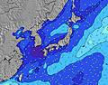 |  |  | 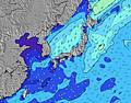 |  | |||||||||||||||
Onda Altezza (m) Direzione Periodo (s) | E 12 | SW 8 | WSW 8 | SW 8 | WSW 8 | SE 11 | SE 11 | ESE 11 | ESE 11 | ESE 11 | ESE 11 | ESE 11 | ESE 11 | SE 11 | SE 11 | SSE 11 | SSE 11 | SSE 10 | SSE 10 | SE 10 | SE 10 | SE 10 | SE 10 | E 9 |
Grafico delle onde | ||||||||||||||||||||||||
397 | 9 | 34 | 11 | 7 | 33 | 31 | 12 | 11 | 11 | 11 | 11 | 11 | 5 | 5 | 11 | 15 | 15 | 15 | 15 | 16 | 16 | 16 | 85 | |
Vento (km/h) | ||||||||||||||||||||||||
Stato del vento onshore cross-onshore cross-shore cross-offshore offshore piatto | cross-off | cross-off | cross-off | cross-off | cross-off | cross-off | cross-off | cross-off | cross-off | cross-off | cross-off | cross-off | cross-off | cross-off | cross-off | cross-off | cross-off | cross-off | cross-off | cross-off | cross-off | cross-off | cross-off | cross-off |
Alta Marea | 9:08PM1.46m | 9:15AM1.30m | 9:38PM1.44m | 10:32AM1.19m | 10:11PM1.42m | 12:30PM1.13m | ||||||||||||||||||
Basso Marea | 3:22AM0.68m | 3:12PM0.68m | 4:20AM0.63m | 3:49PM0.86m | 5:32AM0.58m | 4:36PM1.02m | ||||||||||||||||||
— | 4:45 | — | — | — | — | — | — | — | 4:45 | — | — | — | — | — | — | — | 4:46 | — | — | — | — | — | — | |
— | — | — | — | — | — | 6:52 | — | — | — | — | — | — | — | 6:52 | — | — | — | — | — | — | — | 6:51 | — | |
mm | — | — | — | — | — | — | — | — | — | — | — | — | — | — | — | — | — | — | — | — | — | — | — | — |
Temp. °C | 27 | 27 | 27 | 27 | 27 | 28 | 28 | 28 | 27 | 27 | 27 | 27 | 27 | 28 | 28 | 28 | 27 | 27 | 27 | 27 | 28 | 28 | 28 | 28 |
Gelo °C | 29 | 29 | 28 | 29 | 29 | 30 | 30 | 30 | 29 | 29 | 30 | 29 | 28 | 30 | 30 | 30 | 29 | 29 | 30 | 31 | 32 | 30 | 30 | 30 |
Onda 1 Altezza (m) Direzione Periodo (s) | E 12 | ENE 11 | ENE 11 | ENE 11 | ENE 11 | ENE 10 | ENE 10 | ENE 10 | ENE 10 | ENE 10 | ENE 10 | ENE 10 | ENE 10 | E 10 | ENE 10 | ENE 10 | ENE 10 | ENE 10 | ENE 10 | ENE 10 | ENE 10 | ENE 10 | ENE 9 | E 9 |
397 | 370 | 415 | 343 | 337 | 276 | 270 | 222 | 218 | 214 | 214 | 176 | 180 | 208 | 167 | 167 | 163 | 131 | 128 | 128 | 125 | 96 | 92 | 85 | |
Onda 2 Altezza (m) Direzione Periodo (s) | WSW 8 | SW 8 | SSE 8 | SW 8 | WSW 8 | SE 11 | SE 11 | WSW 8 | ESE 11 | ESE 11 | ESE 11 | ESE 11 | ESE 11 | SE 11 | SW 8 | SSE 11 | SSE 11 | SSE 10 | SSE 10 | SE 10 | SE 10 | SE 10 | SE 10 | SE 10 |
6 | 9 | 6 | 11 | 7 | 33 | 31 | 6 | 11 | 11 | 11 | 11 | 11 | 5 | 2 | 11 | 11 | 10 | 10 | 15 | 16 | 16 | 16 | 15 | |
Onda 3 Altezza (m) Direzione Periodo (s) | SSE 8 | SSE 8 | ESE 11 | S 8 | SSE 8 | S 7 | SSE 8 | ESE 11 | SSE 8 | SSE 8 | SE 8 | SE 8 | SE 7 | — | SE 11 | E 20 | SE 20 | SE 20 | SE 20 | SE 19 | SE 19 | S 8 | SSW 8 | SE 18 |
6 | 7 | 12 | 5 | 6 | 1 | 6 | 12 | 6 | 6 | 2 | 2 | 2 | — | 5 | 8 | 15 | 15 | 15 | 15 | 15 | 5 | 6 | 50 | |
onde vento Altezza (m) Direzione Periodo (s) | WSW 3 | WSW 3 | WSW 8 | WSW 3 | WSW 4 | SW 4 | SW 4 | SW 4 | SW 4 | SW 4 | SW 5 | WSW 5 | WSW 5 | WSW 5 | WSW 5 | SW 5 | WSW 5 | WSW 5 | SW 5 | SW 5 | SW 5 | SW 5 | SW 5 | SW 5 |
3 | 3 | 34 | 4 | 5 | 15 | 26 | 22 | 28 | 29 | 32 | 42 | 45 | 45 | 45 | 51 | 58 | 58 | 67 | 57 | 41 | 27 | 25 | 22 | |
Il più vicino Offshore or Glassy | ||||||||||||||||||||||||
Distanza (km) | 44 | 44 | 44 | 44 | 104 | 480 | 480 | 44 | 44 | 44 | 44 | 44 | 44 | 151 | 44 | 44 | 44 | 44 | 44 | 44 | 99 | 44 | 44 | 3 |
Migliori previsioni per le condizioni d'onda in Izu Islands | ||||||||||||||||||||||||
Migliori previsioni per le condizioni d'onda in Japan | ||||||||||||||||||||||||
Trova Onde Globale | ||||||||||||||||||||||||
- Map Icons:
 Break
Break Live Wave Height (m)
 Live Wind Speed (km/h)
 Surf Rating (10 Max)
 Ocean Swells (m)
- Wind Speed (km/h)
Widget Free Surf-Forecast.com per il tuo sito
La relazione di surf / widget meteo è disponibile qui sotto per incorporare su siti esterni a titolo gratuito e fornisce una sintesi delle nostre Niijima - Awaii previsione surf. Basta prendere il frammento di codice html da noi fornito e copiarlo nel proprio sito. È possibile scegliere la lingua preferita e unità metriche / imperiali per il feed delle previsioni surf per soddisfare le esigenze degli utenti del vostro sito .... Clicca qui per ottenere il codice.
 Nearest