
Previsioni:

Previsione a breve terminepioggia leggera (Totale 5mm), per lo più che cade martedì notte. Warm (Max 28°C mercoledì pomeriggio, Min 21°C martedì notte). Venti decrescenti (venti freschi da SW martedì notte, calma per giovedì notte). | |||||||||||||||||||
Mar 21 | Mercoledì 22 | Giovedì 23 | |||||||||||||||||
5 PM | 8 PM | 11 PM | 2 AM | 5 AM | 8 AM | 11 AM | 2 PM | 5 PM | 8 PM | 11 PM | 2 AM | 5 AM | 8 AM | 11 AM | 2 PM | 5 PM | 8 PM | 11 PM | |
Mappa dell'altezza del moto ondoso |  |  | 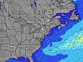 | 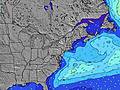 |  | 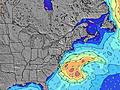 | 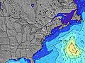 | ||||||||||||
Onda Altezza (m) Direzione Periodo (s) | S 6 | S 6 | S 7 | S 7 | S 7 | S 8 | S 8 | S 8 | S 9 | S 9 | S 9 | SSE 8 | SSE 8 | SSE 8 | SSE 8 | SSE 8 | SSE 7 | SSE 7 | SE 8 |
Grafico delle onde | |||||||||||||||||||
188 | 182 | 184 | 239 | 236 | 329 | 339 | 264 | 290 | 251 | 225 | 184 | 171 | 133 | 105 | 102 | 73 | 71 | 40 | |
Vento (km/h) | |||||||||||||||||||
Stato del vento onshore cross-onshore cross-shore cross-offshore offshore piatto | cross | cross-off | cross-off | cross-off | cross-off | cross-off | cross-off | off | off | glassy | cross-off | cross-off | cross-off | cross | cross | cross-on | on | on | cross-on |
Alta Marea | 2:02AM1.17m | 2:45PM1.36m | 2:54AM1.11m | 3:36PM1.35m | |||||||||||||||
Basso Marea | 8:12PM0.45m | 8:09AM0.36m | 9:08PM0.49m | 8:58AM0.40m | 10:04PM0.50m | ||||||||||||||
— | — | — | — | 5:43 | — | — | — | — | — | — | — | 5:45 | — | — | — | — | — | — | |
— | 8:20 | — | — | — | — | — | — | — | 8:19 | — | — | — | — | — | — | — | 8:19 | — | |
mm | 4 | 5 | — | — | — | — | — | — | — | — | — | — | — | — | — | — | — | — | — |
Temp. °C | 28 | 23 | 22 | 23 | 21 | 22 | 27 | 28 | 28 | 28 | 24 | 22 | 21 | 21 | 21 | 23 | 23 | 22 | 22 |
Gelo °C | 29 | 23 | 21 | 23 | 19 | 20 | 27 | 28 | 27 | 29 | 20 | 18 | 18 | 18 | 18 | 21 | 20 | 20 | 21 |
Onda 1 Altezza (m) Direzione Periodo (s) | E 12 | SE 11 | — | — | S 7 | — | S 8 | S 8 | S 9 | S 9 | S 9 | SSE 8 | SSE 8 | SSE 8 | SSE 8 | SSE 8 | SSE 7 | SSE 7 | S 7 |
3 | 5 | — | — | 178 | — | 339 | 264 | 290 | 251 | 225 | 184 | 171 | 133 | 105 | 102 | 73 | 71 | 40 | |
Onda 2 Altezza (m) Direzione Periodo (s) | — | — | — | — | — | — | — | — | — | — | — | — | NW 3 | — | — | NE 4 | SE 8 | SE 8 | SE 8 |
— | — | — | — | — | — | — | — | — | — | — | — | 3 | — | — | 5 | 3 | 11 | 39 | |
Onda 3 Altezza (m) Direzione Periodo (s) | — | — | — | — | — | — | — | — | — | — | — | — | — | — | — | — | SE 8 | SE 8 | ENE 4 |
— | — | — | — | — | — | — | — | — | — | — | — | — | — | — | — | 11 | 11 | 3 | |
onde vento Altezza (m) Direzione Periodo (s) | S 6 | S 6 | S 7 | S 7 | S 7 | S 8 | — | — | — | WNW 3 | NW 3 | NNW 3 | NNW 3 | NNE 3 | NE 3 | NE 4 | E 4 | ENE 4 | — |
188 | 182 | 184 | 239 | 236 | 329 | — | — | — | 1 | 5 | 6 | 2 | 3 | 5 | 3 | 6 | 4 | — | |
Il più vicino Offshore or Glassy | |||||||||||||||||||
Distanza (km) | 1202 | 4 | 132 | 236 | 409 | 189 | 4 | 0 | 0 | 0 | 27 | 40 | 46 | 43 | 37 | 46 | 223 | 200 | 223 |
Migliori previsioni per le condizioni d'onda in New Jersey | |||||||||||||||||||
Migliori previsioni per le condizioni d'onda in United States | |||||||||||||||||||
Trova Onde Globale | |||||||||||||||||||
- Map Icons:
 Break
Break Live Wave Height (m)
 Live Wind Speed (km/h)
 Surf Rating (10 Max)
 Ocean Swells (m)
- Wind Speed (km/h)
Widget Free Surf-Forecast.com per il tuo sito
La relazione di surf / widget meteo è disponibile qui sotto per incorporare su siti esterni a titolo gratuito e fornisce una sintesi delle nostre Ocean Lane Deal previsione surf. Basta prendere il frammento di codice html da noi fornito e copiarlo nel proprio sito. È possibile scegliere la lingua preferita e unità metriche / imperiali per il feed delle previsioni surf per soddisfare le esigenze degli utenti del vostro sito .... Clicca qui per ottenere il codice.
 Nearest