
Previsioni:

Previsione a breve termineper lo più asciutto. Warm (Max 22°C mercoledì pomeriggio, Min 19°C mercoledì notte). Principalmente raffiche di vento. | ||||||||||||||||||||||||
Mer 15 | Giovedì 16 | Venerdì 17 | 18 | |||||||||||||||||||||
4 PM | 7 PM | 10 PM | 1 AM | 4 AM | 7 AM | 10 AM | 1 PM | 4 PM | 7 PM | 10 PM | 1 AM | 4 AM | 7 AM | 10 AM | 1 PM | 4 PM | 7 PM | 10 PM | 1 AM | 4 AM | 7 AM | 10 AM | 1 PM | |
Mappa dell'altezza del moto ondoso | 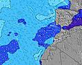 | 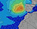 | 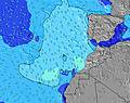 | 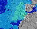 | 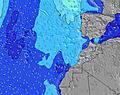 | 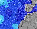 | 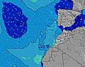 | 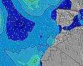 | 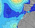 | |||||||||||||||
Onda Altezza (m) Direzione Periodo (s) | N 6 | N 6 | N 6 | N 6 | N 7 | N 7 | N 6 | N 6 | N 6 | N 6 | N 7 | N 7 | N 7 | N 7 | N 7 | N 7 | N 7 | N 7 | N 7 | N 7 | N 7 | N 7 | N 7 | N 7 |
Grafico delle onde | ||||||||||||||||||||||||
119 | 120 | 170 | 240 | 198 | 220 | 157 | 157 | 175 | 212 | 254 | 226 | 254 | 254 | 225 | 199 | 220 | 229 | 229 | 181 | 179 | 150 | 149 | 128 | |
Vento (km/h) | ||||||||||||||||||||||||
Stato del vento onshore cross-onshore cross-shore cross-offshore offshore piatto | cross-on | cross-on | cross-on | cross-on | cross | cross | cross-on | cross-on | cross-on | cross-on | cross-on | cross | cross | cross-on | cross-on | cross-on | cross-on | cross-on | cross-on | cross-on | cross-on | cross-on | cross-on | cross-on |
Alta Marea | 1:54PM2.22m | 2:24AM1.95m | 2:38PM2.24m | 3:08AM1.91m | 3:22PM2.20m | 3:51AM1.84m | ||||||||||||||||||
Basso Marea | 8:13PM-0.02m | 8:17AM0.12m | 8:57PM0.00m | 8:58AM0.16m | 9:39PM0.08m | 9:39AM0.23m | ||||||||||||||||||
— | — | — | — | — | 7:24 | — | — | — | — | — | — | — | 7:26 | — | — | — | — | — | — | — | 7:26 | — | — | |
— | 8:52 | — | — | — | — | — | — | — | 8:52 | — | — | — | — | — | — | — | 8:52 | — | — | — | — | — | 8:52 | |
mm | — | — | — | — | — | — | — | — | — | — | — | — | — | — | — | — | — | — | — | — | — | — | — | — |
Temp. °C | 22 | 21 | 20 | 20 | 20 | 19 | 20 | 21 | 21 | 21 | 21 | 20 | 20 | 19 | 20 | 20 | 21 | 21 | 20 | 20 | 19 | 19 | 19 | 20 |
Gelo °C | 19 | 18 | 16 | 15 | 15 | 15 | 17 | 18 | 18 | 17 | 16 | 15 | 15 | 15 | 17 | 16 | 18 | 17 | 16 | 18 | 16 | 16 | 17 | 18 |
Onda 1 Altezza (m) Direzione Periodo (s) | WNW 10 | WNW 10 | WNW 10 | W 14 | WNW 9 | WNW 9 | WNW 9 | WNW 9 | NW 9 | NW 9 | NW 9 | NW 9 | NW 8 | NW 8 | WNW 8 | WNW 8 | WNW 8 | WNW 8 | NW 8 | NW 8 | WNW 8 | WNW 8 | WNW 8 | WNW 8 |
10 | 10 | 10 | 4 | 8 | 8 | 8 | 8 | 20 | 20 | 19 | 19 | 18 | 11 | 7 | 7 | 6 | 7 | 3 | 3 | 6 | 6 | 6 | 6 | |
Onda 2 Altezza (m) Direzione Periodo (s) | W 15 | W 15 | — | — | — | W 14 | W 14 | — | W 21 | W 21 | W 12 | W 12 | W 12 | W 19 | W 19 | W 19 | W 19 | W 19 | W 18 | W 18 | W 18 | W 18 | W 18 | W 17 |
4 | 4 | — | — | — | 4 | 4 | — | 9 | 9 | 3 | 3 | 3 | 7 | 7 | 7 | 7 | 7 | 6 | 6 | 6 | 6 | 6 | 6 | |
Onda 3 Altezza (m) Direzione Periodo (s) | — | — | — | — | — | — | — | — | — | — | W 21 | W 21 | W 20 | W 12 | W 11 | W 11 | W 11 | W 11 | W 11 | W 11 | W 10 | W 10 | W 10 | W 10 |
— | — | — | — | — | — | — | — | — | — | 9 | 9 | 7 | 3 | 2 | 2 | 2 | 2 | 2 | 2 | 2 | 2 | 2 | 2 | |
onde vento Altezza (m) Direzione Periodo (s) | N 6 | N 6 | N 6 | N 6 | N 7 | N 7 | N 6 | N 6 | N 6 | N 6 | N 7 | N 7 | N 7 | N 7 | N 7 | N 7 | N 7 | N 7 | N 7 | N 7 | N 7 | N 7 | N 7 | N 7 |
119 | 120 | 170 | 240 | 198 | 220 | 157 | 157 | 175 | 212 | 254 | 226 | 254 | 254 | 225 | 199 | 220 | 229 | 229 | 181 | 179 | 150 | 149 | 128 | |
Il più vicino Offshore or Glassy | ||||||||||||||||||||||||
Distanza (km) | 484 | 484 | 604 | 484 | 484 | 484 | 484 | 484 | 505 | 970 | 945 | 444 | 484 | 484 | 505 | 444 | 444 | 444 | 444 | 484 | 484 | 444 | 444 | 444 |
Migliori previsioni per le condizioni d'onda in Western-Sahara - Coast | ||||||||||||||||||||||||
Migliori previsioni per le condizioni d'onda in Western Sahara | ||||||||||||||||||||||||
Trova Onde Globale | ||||||||||||||||||||||||
- Map Icons:
 Break
Break Live Wave Height (m)
 Live Wind Speed (km/h)
 Surf Rating (10 Max)
 Ocean Swells (m)
- Wind Speed (km/h)
Widget Free Surf-Forecast.com per il tuo sito
La relazione di surf / widget meteo è disponibile qui sotto per incorporare su siti esterni a titolo gratuito e fornisce una sintesi delle nostre Oumlabouir previsione surf. Basta prendere il frammento di codice html da noi fornito e copiarlo nel proprio sito. È possibile scegliere la lingua preferita e unità metriche / imperiali per il feed delle previsioni surf per soddisfare le esigenze degli utenti del vostro sito .... Clicca qui per ottenere il codice.
 Nearest