
Previsioni:

Previsione a breve termineQualche pioggerella, più pesante durante giovedì mattina. Very mild (Max 17°C Venerdì pomeriggio, Min 12°C mercoledì mattina). Vento sarà generalmente leggero. | ||||||||||||||||||||||||
Mercoledì 15 | Giovedì 16 | Venerdì 17 | ||||||||||||||||||||||
2 AM | 5 AM | 8 AM | 11 AM | 2 PM | 5 PM | 8 PM | 11 PM | 2 AM | 5 AM | 8 AM | 11 AM | 2 PM | 5 PM | 8 PM | 11 PM | 2 AM | 5 AM | 8 AM | 11 AM | 2 PM | 5 PM | 8 PM | 11 PM | |
Mappa dell'altezza del moto ondoso |  |  |  |  | 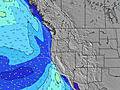 |  |  | 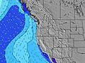 |  | |||||||||||||||
Onda Altezza (m) Direzione Periodo (s) | WNW 9 | WNW 10 | WNW 10 | SW 18 | SW 18 | SW 18 | W 19 | WNW 19 | WNW 19 | NW 9 | WNW 19 | WNW 19 | WNW 18 | WNW 18 | WNW 18 | WNW 17 | WNW 17 | WNW 17 | WNW 17 | WNW 17 | WNW 16 | WNW 16 | WNW 16 | WNW 16 |
Grafico delle onde | ||||||||||||||||||||||||
108 | 183 | 131 | 152 | 152 | 176 | 190 | 210 | 203 | 199 | 203 | 201 | 263 | 249 | 318 | 307 | 390 | 423 | 516 | 486 | 463 | 371 | 366 | 366 | |
Vento (km/h) | ||||||||||||||||||||||||
Stato del vento onshore cross-onshore cross-shore cross-offshore offshore piatto | cross-off | cross-off | cross-off | cross-on | cross-on | cross-on | cross | cross | cross | glassy | cross-on | cross-on | cross-on | cross-on | glassy | glassy | glassy | glassy | off | cross-on | cross-on | cross-on | cross | cross |
Alta Marea | 00:58AM2.76m | 2:46PM2.05m | 1:50AM2.65m | 3:27PM2.12m | 2:42AM2.47m | 4:08PM2.18m | ||||||||||||||||||
Basso Marea | 8:22AM-0.58m | 8:12PM0.66m | 9:06AM-0.49m | 9:08PM0.59m | 9:48AM-0.34m | 10:05PM0.52m | ||||||||||||||||||
— | 5:41 | — | — | — | — | — | — | — | 5:43 | — | — | — | — | — | — | — | 5:43 | — | — | — | — | — | — | |
— | — | — | — | — | — | 9:00 | — | — | — | — | — | — | — | 8:59 | — | — | — | — | — | — | — | 8:59 | — | |
mm | — | — | — | — | — | — | — | — | — | — | 1 | — | — | — | — | — | — | — | — | — | — | — | — | — |
Temp. °C | 12 | 12 | 12 | 16 | 16 | 16 | 14 | 13 | 13 | 13 | 14 | 15 | 16 | 16 | 15 | 14 | 13 | 12 | 14 | 16 | 17 | 16 | 15 | 13 |
Gelo °C | 12 | 12 | 11 | 14 | 14 | 14 | 12 | 12 | 13 | 13 | 14 | 14 | 13 | 14 | 14 | 14 | 13 | 11 | 13 | 14 | 15 | 14 | 13 | 11 |
Onda 1 Altezza (m) Direzione Periodo (s) | WNW 9 | WNW 10 | WNW 10 | WNW 10 | WNW 9 | SW 18 | WNW 9 | WNW 9 | WNW 9 | NW 9 | WNW 8 | WNW 9 | WNW 8 | WNW 7 | WNW 7 | WNW 7 | WNW 7 | WNW 7 | WNW 8 | NW 8 | NW 8 | WNW 16 | WNW 16 | WNW 16 |
108 | 183 | 131 | 128 | 118 | 152 | 110 | 84 | 82 | 170 | 126 | 154 | 120 | 134 | 111 | 114 | 114 | 114 | 120 | 133 | 129 | 371 | 366 | 366 | |
Onda 2 Altezza (m) Direzione Periodo (s) | NW 5 | SSW 12 | NW 6 | NW 6 | SW 18 | WNW 20 | W 19 | WNW 19 | WNW 19 | WNW 19 | WNW 19 | WNW 19 | WNW 18 | WNW 18 | WNW 18 | WNW 17 | WNW 17 | WNW 17 | WNW 17 | WNW 17 | WNW 16 | WNW 12 | WNW 11 | WNW 11 |
12 | 60 | 19 | 15 | 152 | 131 | 190 | 210 | 203 | 199 | 203 | 201 | 263 | 249 | 318 | 307 | 390 | 423 | 516 | 486 | 463 | 121 | 163 | 190 | |
Onda 3 Altezza (m) Direzione Periodo (s) | W 13 | WNW 13 | W 13 | SW 18 | WNW 20 | SW 12 | SW 18 | SW 17 | SW 17 | SW 16 | SW 16 | SW 16 | SW 16 | SW 16 | SW 16 | SW 16 | SW 16 | SW 16 | SW 16 | SW 15 | NW 12 | SW 19 | SW 15 | SW 14 |
87 | 60 | 89 | 152 | 132 | 37 | 150 | 106 | 97 | 93 | 127 | 125 | 125 | 125 | 124 | 124 | 124 | 122 | 121 | 113 | 69 | 179 | 75 | 74 | |
onde vento Altezza (m) Direzione Periodo (s) | — | — | — | — | NW 6 | WNW 9 | NW 4 | NW 5 | NW 5 | — | — | — | — | — | — | — | — | — | — | — | — | NW 8 | NW 7 | NW 7 |
— | — | — | — | 15 | 176 | 18 | 26 | 25 | — | — | — | — | — | — | — | — | — | — | — | — | 160 | 137 | 169 | |
Il più vicino Offshore or Glassy | ||||||||||||||||||||||||
Distanza (km) | 27 | 27 | 27 | 356 | 931 | 930 | 194 | 63 | 63 | 27 | 27 | 191 | 191 | 191 | 153 | 27 | 27 | 27 | 27 | 153 | 191 | 458 | 194 | 51 |
Migliori previsioni per le condizioni d'onda in North Oregon | ||||||||||||||||||||||||
Migliori previsioni per le condizioni d'onda in United States | ||||||||||||||||||||||||
Trova Onde Globale | ||||||||||||||||||||||||
- Map Icons:
 Break
Break Live Wave Height (m)
 Live Wind Speed (km/h)
 Surf Rating (10 Max)
 Ocean Swells (m)
- Wind Speed (km/h)
Widget Free Surf-Forecast.com per il tuo sito
La relazione di surf / widget meteo è disponibile qui sotto per incorporare su siti esterni a titolo gratuito e fornisce una sintesi delle nostre Pacific City/Cape Kiwanda previsione surf. Basta prendere il frammento di codice html da noi fornito e copiarlo nel proprio sito. È possibile scegliere la lingua preferita e unità metriche / imperiali per il feed delle previsioni surf per soddisfare le esigenze degli utenti del vostro sito .... Clicca qui per ottenere il codice.
 Nearest