
Previsioni:

Previsione a breve terminePioggia abbondante (Totale 49mm), più pesante durante giovedì mattina. Warm (Max 26°C mercoledì pomeriggio, Min 25°C giovedì mattina). Principalmente venti freschi. | ||||||||||||||||||||||||
Mer 15 | Giovedì 16 | Venerdì 17 | 18 | |||||||||||||||||||||
2 PM | 5 PM | 8 PM | 11 PM | 2 AM | 5 AM | 8 AM | 11 AM | 2 PM | 5 PM | 8 PM | 11 PM | 2 AM | 5 AM | 8 AM | 11 AM | 2 PM | 5 PM | 8 PM | 11 PM | 2 AM | 5 AM | 8 AM | 11 AM | |
Mappa dell'altezza del moto ondoso | 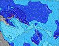 | 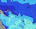 | 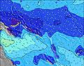 | 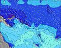 | 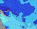 | 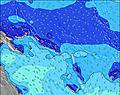 | 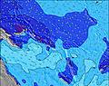 | 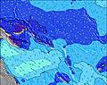 | 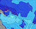 |  | ||||||||||||||
Onda Altezza (m) Direzione Periodo (s) | SSE 7 | SSE 7 | S 7 | S 7 | SSE 7 | SSE 8 | SSE 8 | SSE 8 | SSE 8 | SSE 8 | SSE 8 | SSE 8 | SSE 8 | SSE 7 | SSE 7 | S 7 | S 6 | SSE 6 | S 6 | S 6 | S 6 | S 6 | S 6 | S 7 |
Grafico delle onde | ||||||||||||||||||||||||
191 | 232 | 255 | 240 | 261 | 316 | 359 | 504 | 605 | 488 | 361 | 336 | 331 | 286 | 247 | 200 | 188 | 160 | 151 | 126 | 108 | 120 | 98 | 135 | |
Vento (km/h) | ||||||||||||||||||||||||
Stato del vento onshore cross-onshore cross-shore cross-offshore offshore piatto | cross-on | cross-on | cross-on | cross-on | cross-on | cross-on | cross-on | cross-on | cross-on | cross-on | cross-on | cross-on | cross-on | cross-on | cross-on | on | cross-on | cross-on | cross-on | cross-on | cross-on | cross-on | cross-on | cross-on |
Alta Marea | 2:19AM0.88m | 3:02AM0.86m | 3:37AM0.82m | |||||||||||||||||||||
Basso Marea | 1:32PM0.03m | 1:47PM0.08m | 1:49PM0.15m | |||||||||||||||||||||
— | — | — | — | — | 6:48 | — | — | — | — | — | — | — | 6:48 | — | — | — | — | — | — | — | 6:48 | — | — | |
— | 6:29 | — | — | — | — | — | — | — | 6:29 | — | — | — | — | — | — | — | 6:29 | — | — | — | — | — | 6:30 | |
mm | 1 | 1 | 1 | — | 2 | 5 | 9 | 8 | 2 | 2 | 1 | 1 | 1 | 3 | 3 | 1 | 1 | 2 | 1 | 1 | — | 1 | 1 | 1 |
Temp. °C | 26 | 26 | 26 | 26 | 26 | 26 | 25 | 25 | 25 | 25 | 26 | 26 | 26 | 25 | 26 | 26 | 26 | 26 | 26 | 26 | 26 | 26 | 26 | 26 |
Gelo °C | 26 | 26 | 26 | 26 | 26 | 26 | 25 | 24 | 25 | 24 | 26 | 26 | 27 | 24 | 25 | 25 | 25 | 26 | 26 | 26 | 26 | 26 | 26 | 26 |
Onda 1 Altezza (m) Direzione Periodo (s) | S 9 | S 10 | S 9 | — | SSE 9 | SE 9 | — | — | S 21 | S 21 | S 20 | S 20 | S 19 | S 10 | S 18 | S 18 | S 10 | SW 9 | SSW 9 | SSW 8 | SSW 8 | SSW 9 | SW 9 | S 13 |
6 | 7 | 6 | — | 16 | 21 | — | — | 9 | 9 | 8 | 7 | 7 | 2 | 6 | 6 | 7 | 3 | 7 | 14 | 13 | 8 | 20 | 3 | |
Onda 2 Altezza (m) Direzione Periodo (s) | S 9 | SSE 9 | — | — | — | — | — | S 22 | — | S 14 | S 13 | — | S 10 | S 19 | S 10 | S 10 | SW 9 | S 9 | S 16 | S 16 | S 15 | S 14 | S 14 | S 13 |
6 | 8 | — | — | — | — | — | 9 | — | 4 | 4 | — | 2 | 7 | 2 | 2 | 3 | 2 | 5 | 5 | 4 | 4 | 4 | 3 | |
Onda 3 Altezza (m) Direzione Periodo (s) | — | — | — | — | — | — | — | — | — | — | — | — | — | S 13 | S 13 | SE 12 | S 17 | S 16 | S 16 | S 16 | SE 12 | S 11 | S 11 | SE 11 |
— | — | — | — | — | — | — | — | — | — | — | — | — | 3 | 3 | 6 | 6 | 5 | 5 | 5 | 6 | 3 | 3 | 5 | |
onde vento Altezza (m) Direzione Periodo (s) | SSE 7 | SSE 7 | S 7 | S 7 | SSE 7 | SSE 8 | SSE 8 | SSE 8 | SSE 8 | SSE 8 | SSE 8 | SSE 8 | SSE 8 | SSE 7 | SSE 7 | S 7 | S 6 | SSE 6 | S 6 | S 6 | S 6 | S 6 | S 6 | S 7 |
191 | 232 | 255 | 240 | 261 | 316 | 359 | 504 | 605 | 488 | 361 | 336 | 331 | 286 | 247 | 200 | 188 | 160 | 151 | 126 | 108 | 120 | 98 | 135 | |
Il più vicino Offshore or Glassy | ||||||||||||||||||||||||
Distanza (km) | 57 | 57 | 57 | 57 | 48 | 57 | 810 | 810 | 1767 | 1767 | 1767 | 1767 | 57 | 1767 | 1767 | 1767 | 1767 | 1767 | 810 | 1767 | 1767 | 1767 | 1645 | 1767 |
Migliori previsioni per le condizioni d'onda in New Georgia | ||||||||||||||||||||||||
Migliori previsioni per le condizioni d'onda in Solomon Islands | ||||||||||||||||||||||||
Trova Onde Globale | ||||||||||||||||||||||||
- Map Icons:
 Break
Break Live Wave Height (m)
 Live Wind Speed (km/h)
 Surf Rating (10 Max)
 Ocean Swells (m)
- Wind Speed (km/h)
Widget Free Surf-Forecast.com per il tuo sito
La relazione di surf / widget meteo è disponibile qui sotto per incorporare su siti esterni a titolo gratuito e fornisce una sintesi delle nostre Pailongge previsione surf. Basta prendere il frammento di codice html da noi fornito e copiarlo nel proprio sito. È possibile scegliere la lingua preferita e unità metriche / imperiali per il feed delle previsioni surf per soddisfare le esigenze degli utenti del vostro sito .... Clicca qui per ottenere il codice.
 Nearest