
Previsioni:

Previsione a breve termineper lo più asciutto. Warm (Max 31°C Venerdì mattina, Min 28°C giovedì notte). Principalmente venti freschi. | ||||||||||||||||||||||||
Gio 16 | Venerdì 17 | Sabato 18 | Dom 19 | |||||||||||||||||||||
11 AM | 2 PM | 5 PM | 8 PM | 11 PM | 2 AM | 5 AM | 8 AM | 11 AM | 2 PM | 5 PM | 8 PM | 11 PM | 2 AM | 5 AM | 8 AM | 11 AM | 2 PM | 5 PM | 8 PM | 11 PM | 2 AM | 5 AM | 8 AM | |
Mappa dell'altezza del moto ondoso | 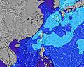 | 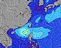 | 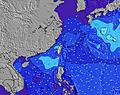 | 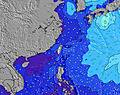 | 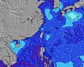 | 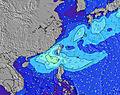 | 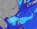 | 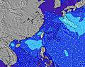 | 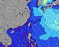 | |||||||||||||||
Onda Altezza (m) Direzione Periodo (s) | E 10 | E 10 | E 10 | ESE 10 | E 10 | E 10 | E 10 | E 9 | E 9 | E 10 | E 10 | E 10 | E 10 | E 10 | E 10 | E 10 | E 10 | E 10 | E 10 | ESE 10 | E 10 | E 10 | E 10 | E 10 |
Grafico delle onde | ||||||||||||||||||||||||
18 | 17 | 17 | 19 | 17 | 16 | 16 | 16 | 16 | 16 | 16 | 17 | 17 | 17 | 17 | 17 | 17 | 17 | 17 | 18 | 16 | 16 | 7 | 7 | |
Vento (km/h) | ||||||||||||||||||||||||
Stato del vento onshore cross-onshore cross-shore cross-offshore offshore piatto | cross-off | cross-off | cross-off | off | off | cross-off | cross-off | cross-off | cross-off | cross-off | cross-off | cross-off | cross-off | cross-off | cross-off | cross-off | cross-off | cross-off | cross-off | cross-off | cross-off | cross-off | cross-off | cross-off |
Alta Marea | 00:40AM2.46m | 12:26PM2.18m | 1:23AM2.39m | 1:19PM2.13m | 2:05AM2.28m | |||||||||||||||||||
Basso Marea | 6:01PM-0.04m | 6:46AM0.70m | 6:50PM0.08m | 7:32AM0.65m | 7:37PM0.26m | |||||||||||||||||||
— | — | — | — | — | — | 5:13 | — | — | — | — | — | — | — | 5:13 | — | — | — | — | — | — | — | 5:13 | — | |
— | — | 6:45 | — | — | — | — | — | — | — | 6:45 | — | — | — | — | — | — | — | 6:45 | — | — | — | — | 6:45 | |
mm | — | — | — | — | — | — | — | — | — | — | — | — | — | — | — | — | — | — | — | — | — | — | — | — |
Temp. °C | 30 | 30 | 30 | 29 | 28 | 28 | 28 | 29 | 31 | 30 | 30 | 29 | 28 | 28 | 28 | 29 | 31 | 30 | 30 | 29 | 28 | 28 | 28 | 28 |
Gelo °C | 30 | 30 | 31 | 32 | 31 | 31 | 30 | 31 | 32 | 31 | 31 | 30 | 29 | 28 | 27 | 29 | 33 | 32 | 33 | 32 | 30 | 29 | 30 | 30 |
Onda 1 Altezza (m) Direzione Periodo (s) | E 10 | E 10 | E 10 | ESE 10 | E 10 | E 10 | E 10 | E 9 | E 9 | E 10 | E 10 | E 10 | E 10 | E 10 | E 10 | E 10 | E 10 | E 10 | WSW 6 | WSW 6 | E 10 | E 10 | E 10 | E 10 |
18 | 17 | 17 | 19 | 17 | 16 | 16 | 16 | 16 | 16 | 16 | 17 | 17 | 17 | 17 | 17 | 17 | 17 | 103 | 82 | 16 | 16 | 7 | 7 | |
Onda 2 Altezza (m) Direzione Periodo (s) | ESE 5 | SE 5 | SE 6 | E 10 | SE 5 | SE 5 | SE 5 | S 7 | S 7 | SSE 7 | SSE 7 | SSE 6 | E 10 | SSE 6 | SSE 6 | SSE 6 | SSE 6 | SE 5 | E 10 | ESE 10 | SE 5 | E 10 | NE 10 | NE 10 |
2 | 1 | 1 | 17 | 1 | 1 | 1 | 1 | 1 | 5 | 5 | 4 | 17 | 3 | 3 | 3 | 4 | 1 | 17 | 18 | 1 | 2 | 4 | 4 | |
Onda 3 Altezza (m) Direzione Periodo (s) | WNW 4 | SE 6 | SE 6 | SE 6 | SE 6 | SE 7 | — | SSE 7 | SSE 7 | SSE 7 | SSE 7 | SSE 7 | SSE 6 | SE 6 | SSE 6 | SE 6 | SE 6 | SSE 6 | SE 5 | SW 8 | E 10 | NE 9 | NE 10 | SE 6 |
2 | 6 | 5 | 5 | 5 | 7 | — | 4 | 4 | 5 | 5 | 4 | 4 | 1 | 3 | 1 | 1 | 3 | 1 | 3 | 2 | 3 | 4 | 1 | |
onde vento Altezza (m) Direzione Periodo (s) | WSW 6 | WSW 6 | WSW 6 | WSW 6 | WSW 6 | WSW 6 | WSW 6 | WSW 7 | WSW 6 | WSW 7 | WSW 7 | WSW 7 | WSW 6 | WSW 7 | WSW 7 | WSW 7 | WSW 6 | WSW 6 | SSE 6 | — | WSW 6 | WSW 6 | WSW 6 | WSW 6 |
145 | 255 | 245 | 140 | 131 | 136 | 181 | 198 | 186 | 423 | 352 | 273 | 265 | 346 | 356 | 326 | 220 | 160 | 3 | — | 90 | 211 | 213 | 136 | |
Il più vicino Offshore or Glassy | ||||||||||||||||||||||||
Distanza (km) | 50 | 50 | 50 | 50 | 55 | 1201 | 1195 | 369 | 369 | 1004 | 55 | 55 | 965 | 1059 | 1175 | 55 | 55 | 55 | 50 | 50 | 701 | 701 | 55 | 50 |
Migliori previsioni per le condizioni d'onda in North Taiwan | ||||||||||||||||||||||||
Migliori previsioni per le condizioni d'onda in Taiwan | ||||||||||||||||||||||||
Trova Onde Globale | ||||||||||||||||||||||||
- Map Icons:
 Break
Break Live Wave Height (m)
 Live Wind Speed (km/h)
 Surf Rating (10 Max)
 Ocean Swells (m)
- Wind Speed (km/h)
Widget Free Surf-Forecast.com per il tuo sito
La relazione di surf / widget meteo è disponibile qui sotto per incorporare su siti esterni a titolo gratuito e fornisce una sintesi delle nostre Paishawan Beach previsione surf. Basta prendere il frammento di codice html da noi fornito e copiarlo nel proprio sito. È possibile scegliere la lingua preferita e unità metriche / imperiali per il feed delle previsioni surf per soddisfare le esigenze degli utenti del vostro sito .... Clicca qui per ottenere il codice.
 Nearest