
Previsioni:

Previsione a breve terminepioggia leggera (Totale 4mm), per lo più che cade giovedì pomeriggio. Warm (Max 21°C giovedì pomeriggio, Min 18°C Sabato pomeriggio). Venti decrescenti (raffiche di vento da O giovedì pomeriggio, calma per sabato mattina). | |||||||||||||||||
Giovedì 16 | Venerdì 17 | ||||||||||||||||
9 PM | 12 AM | 3 AM | 6 AM | 9 AM | 12 PM | 3 PM | 6 PM | 9 PM | 12 AM | 3 AM | 6 AM | 9 AM | 12 PM | 3 PM | 6 PM | 9 PM | |
Mappa dell'altezza del moto ondoso |  | 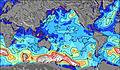 |  |  |  | 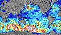 | 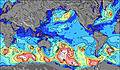 | ||||||||||
Onda Altezza (m) Direzione Periodo (s) | W 12 | W 12 | WSW 12 | WSW 12 | WSW 12 | WSW 12 | WSW 12 | W 12 | SSE 13 | W 8 | WSW 8 | WSW 8 | WSW 8 | WSW 8 | WSW 12 | SW 9 | SW 8 |
Grafico delle onde | |||||||||||||||||
879 | 687 | 969 | 969 | 1016 | 902 | 1082 | 1310 | 501 | 559 | 416 | 345 | 384 | 410 | 1166 | 418 | 511 | |
Vento (km/h) | |||||||||||||||||
Stato del vento onshore cross-onshore cross-shore cross-offshore offshore piatto | cross | cross-on | cross | cross | cross-off | cross-off | cross-off | cross | cross | cross | cross | cross | cross-on | cross-on | cross-on | cross-on | cross-on |
Alta Marea | 7:30PM0.54m | 8:00AM0.82m | 8:56PM0.56m | 9:12AM0.78m | |||||||||||||
Basso Marea | 1:06AM0.22m | 3:00PM0.20m | 2:32AM0.26m | 4:06PM0.18m | |||||||||||||
— | — | — | 8:04 | — | — | — | — | — | — | — | 8:03 | — | — | — | — | — | |
— | — | — | — | — | — | — | 6:40 | — | — | — | — | — | — | — | 6:42 | — | |
mm | — | — | — | — | — | — | 1 | 1 | 1 | — | — | — | — | — | — | — | — |
Temp. °C | 20 | 20 | 20 | 20 | 20 | 20 | 21 | 21 | 21 | 21 | 21 | 20 | 20 | 20 | 20 | 20 | 20 |
Gelo °C | 17 | 17 | 18 | 18 | 18 | 19 | 18 | 17 | 17 | 18 | 18 | 16 | 16 | 16 | 16 | 16 | 17 |
Onda 1 Altezza (m) Direzione Periodo (s) | SSE 15 | W 12 | WSW 12 | WSW 12 | WSW 12 | WSW 12 | SSE 13 | SW 13 | SSE 13 | SSE 13 | SW 12 | SSE 12 | SSE 12 | SSE 12 | SSE 12 | W 7 | SW 8 |
568 | 687 | 969 | 969 | 1016 | 902 | 572 | 503 | 458 | 451 | 367 | 320 | 255 | 251 | 247 | 109 | 511 | |
Onda 2 Altezza (m) Direzione Periodo (s) | SW 17 | SSE 14 | SSE 14 | SSE 13 | SSE 13 | SSE 13 | SW 14 | SSE 13 | SW 13 | SW 13 | SE 13 | SW 12 | SW 11 | WSW 12 | SW 15 | SSE 12 | SSE 12 |
398 | 663 | 607 | 590 | 581 | 581 | 526 | 528 | 418 | 357 | 382 | 319 | 245 | 183 | 104 | 177 | 171 | |
Onda 3 Altezza (m) Direzione Periodo (s) | — | SW 16 | SW 16 | SW 15 | SW 15 | SW 14 | N 11 | — | W 12 | WSW 12 | WSW 12 | WSW 12 | WSW 12 | SW 15 | N 10 | W 11 | W 11 |
— | 504 | 480 | 565 | 550 | 557 | 2 | — | 299 | 236 | 244 | 232 | 189 | 79 | 2 | 123 | 119 | |
onde vento Altezza (m) Direzione Periodo (s) | W 12 | SW 6 | — | — | — | — | WSW 12 | W 12 | W 7 | W 8 | WSW 8 | WSW 8 | WSW 8 | WSW 8 | WSW 12 | SW 9 | — |
879 | 64 | — | — | — | — | 1082 | 1310 | 501 | 559 | 416 | 345 | 384 | 410 | 1166 | 418 | — | |
Il più vicino Offshore or Glassy | |||||||||||||||||
Distanza (km) | 3664 | 8 | 3676 | 3682 | 3737 | 3 | 3555 | 3535 | 3519 | 3519 | 3519 | 3535 | 3519 | 3519 | 3519 | 3519 | 8 |
Migliori previsioni per le condizioni d'onda in Easter Island | |||||||||||||||||
Migliori previsioni per le condizioni d'onda in Chile | |||||||||||||||||
Trova Onde Globale | |||||||||||||||||
- Map Icons:
 Break
Break Live Wave Height (m)
 Live Wind Speed (km/h)
 Surf Rating (10 Max)
 Ocean Swells (m)
- Wind Speed (km/h)
Widget Free Surf-Forecast.com per il tuo sito
La relazione di surf / widget meteo è disponibile qui sotto per incorporare su siti esterni a titolo gratuito e fornisce una sintesi delle nostre Pakaia previsione surf. Basta prendere il frammento di codice html da noi fornito e copiarlo nel proprio sito. È possibile scegliere la lingua preferita e unità metriche / imperiali per il feed delle previsioni surf per soddisfare le esigenze degli utenti del vostro sito .... Clicca qui per ottenere il codice.
 Nearest