
Previsioni:

Previsione a breve terminepioggia leggera (Totale 7mm), per lo più che cade giovedì mattina. Warm (Max 28°C giovedì mattina, Min 26°C giovedì notte). Vento sarà generalmente leggero. | ||||||||||||||||||||||||
Giovedì 16 | Venerdì 17 | Sabato 18 | ||||||||||||||||||||||
1 AM | 4 AM | 7 AM | 10 AM | 1 PM | 4 PM | 7 PM | 10 PM | 1 AM | 4 AM | 7 AM | 10 AM | 1 PM | 4 PM | 7 PM | 10 PM | 1 AM | 4 AM | 7 AM | 10 AM | 1 PM | 4 PM | 7 PM | 10 PM | |
Mappa dell'altezza del moto ondoso | 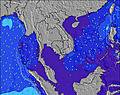 | 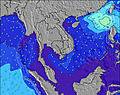 | 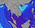 | 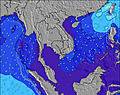 | 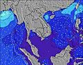 | 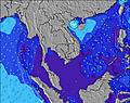 | 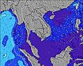 | 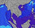 | 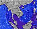 | |||||||||||||||
Onda Altezza (m) Direzione Periodo (s) | W 8 | W 8 | W 8 | W 8 | W 8 | W 8 | W 8 | W 8 | W 8 | W 8 | W 8 | W 8 | W 8 | SW 16 | SW 16 | SW 15 | SW 15 | SW 15 | SW 15 | SW 15 | SW 15 | SW 14 | SW 14 | SW 14 |
Grafico delle onde | ||||||||||||||||||||||||
233 | 239 | 212 | 217 | 187 | 187 | 182 | 149 | 149 | 124 | 124 | 100 | 99 | 124 | 121 | 116 | 112 | 141 | 139 | 136 | 134 | 103 | 103 | 102 | |
Vento (km/h) | ||||||||||||||||||||||||
Stato del vento onshore cross-onshore cross-shore cross-offshore offshore piatto | cross | cross | cross | cross | cross-on | cross-on | cross-on | glassy | glassy | glassy | glassy | cross-on | cross-on | cross-on | cross-on | on | on | cross-on | glassy | cross-on | cross-on | cross-on | cross-on | cross |
Alta Marea | 11:17PM2.26m | 11:27AM2.68m | 00:00AM2.29m | 12:08PM2.62m | 00:40AM2.28m | 12:47PM2.50m | ||||||||||||||||||
Basso Marea | 5:20AM0.19m | 5:59PM-0.03m | 6:02AM0.22m | 6:38PM0.03m | 6:43AM0.30m | 7:14PM0.15m | ||||||||||||||||||
— | 6:15 | — | — | — | — | — | — | — | 6:15 | — | — | — | — | — | — | — | 6:15 | — | — | — | — | — | — | |
— | — | — | — | — | 6:50 | — | — | — | — | — | — | — | 6:50 | — | — | — | — | — | — | — | 6:50 | — | — | |
mm | — | — | — | 1 | 2 | — | 1 | — | — | — | — | — | — | — | — | — | — | 1 | 1 | — | — | — | 1 | — |
Temp. °C | 27 | 27 | 27 | 28 | 28 | 28 | 27 | 27 | 27 | 26 | 27 | 28 | 28 | 28 | 28 | 27 | 27 | 26 | 26 | 28 | 28 | 28 | 27 | 27 |
Gelo °C | 31 | 31 | 31 | 31 | 31 | 31 | 31 | 32 | 32 | 31 | 32 | 32 | 31 | 31 | 32 | 31 | 32 | 30 | 30 | 32 | 31 | 31 | 31 | 31 |
Onda 1 Altezza (m) Direzione Periodo (s) | W 8 | W 8 | W 8 | W 8 | W 8 | W 8 | W 8 | W 8 | W 8 | W 8 | W 8 | W 8 | W 8 | W 8 | W 8 | W 8 | W 8 | W 8 | W 8 | W 8 | W 8 | W 8 | W 8 | W 7 |
233 | 239 | 212 | 217 | 187 | 187 | 182 | 149 | 149 | 124 | 124 | 100 | 99 | 78 | 74 | 72 | 72 | 71 | 71 | 71 | 74 | 74 | 72 | 70 | |
Onda 2 Altezza (m) Direzione Periodo (s) | SW 16 | SW 16 | SW 16 | SW 16 | SW 16 | SW 15 | SW 17 | SW 17 | SW 17 | SW 16 | SW 16 | SW 16 | SW 16 | SW 16 | SW 16 | SW 15 | SW 15 | SW 15 | SW 15 | SW 15 | SW 15 | SW 14 | SW 14 | SW 14 |
41 | 40 | 40 | 39 | 39 | 37 | 45 | 46 | 75 | 90 | 90 | 90 | 89 | 124 | 121 | 116 | 112 | 141 | 139 | 136 | 134 | 103 | 103 | 102 | |
Onda 3 Altezza (m) Direzione Periodo (s) | S 5 | S 5 | S 5 | — | S 5 | S 5 | SW 14 | SW 14 | SW 14 | — | — | — | — | — | — | W 8 | W 8 | — | NW 6 | W 9 | WNW 8 | WSW 7 | — | W 9 |
1 | 1 | 1 | — | 2 | 2 | 8 | 33 | 33 | — | — | — | — | — | — | 1 | 1 | — | 2 | 2 | 6 | 18 | — | 2 | |
onde vento Altezza (m) Direzione Periodo (s) | — | — | — | — | — | — | — | — | — | — | — | — | — | — | — | — | — | — | — | — | — | — | — | — |
— | — | — | — | — | — | — | — | — | — | — | — | — | — | — | — | — | — | — | — | — | — | — | — | |
Il più vicino Offshore or Glassy | ||||||||||||||||||||||||
Distanza (km) | 6 | 73 | 38 | 85 | 85 | 85 | 85 | 0 | 0 | 0 | 0 | 85 | 104 | 104 | 85 | 85 | 85 | 85 | 0 | 85 | 104 | 104 | 85 | 85 |
Migliori previsioni per le condizioni d'onda in Andaman Sea | ||||||||||||||||||||||||
Migliori previsioni per le condizioni d'onda in Thailand | ||||||||||||||||||||||||
Trova Onde Globale | ||||||||||||||||||||||||
- Map Icons:
 Break
Break Live Wave Height (m)
 Live Wind Speed (km/h)
 Surf Rating (10 Max)
 Ocean Swells (m)
- Wind Speed (km/h)
Widget Free Surf-Forecast.com per il tuo sito
La relazione di surf / widget meteo è disponibile qui sotto per incorporare su siti esterni a titolo gratuito e fornisce una sintesi delle nostre Cape Pakarang Left previsione surf. Basta prendere il frammento di codice html da noi fornito e copiarlo nel proprio sito. È possibile scegliere la lingua preferita e unità metriche / imperiali per il feed delle previsioni surf per soddisfare le esigenze degli utenti del vostro sito .... Clicca qui per ottenere il codice.
 Nearest