
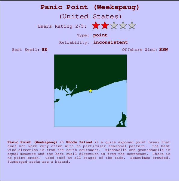
Panic Point (Weekapaug) Surf Guide
Panic Point (Weekapaug) in Rhode Island is a fairly exposed point break that has inconsistent surf with no particular seasonal pattern. Offshore winds blow from the south southwest. Windswells and groundswells in equal measure and the best swell direction is from the southeast. There is no point break. Good surf at all stages of the tide. Sometimes crowded. Submerged rocks are a hazard.
Panic Point (Weekapaug) Spot Info
| Type: | Rating: | Reliability: | Todays Sea Temp*: |
|---|---|---|---|
| inconsistent | 19.3°C*ocean temperature recorded from satellite |
Surfing Panic Point (Weekapaug):
The best conditions reported for surf at Panic Point (Weekapaug) occur when a Southeast swell combines with an offshore wind direction from the South-southwest.

Previsioni Energia d'onda (Potenza): 12hrs


Panic Point (Weekapaug) Surf:
Tuesday, 21 July 2026, 02:11 Local time| Lun | Martedì 21 | |||
| 11PM | 2AM | 5AM | 8AM | |
| Wave (m) | ||||
| Periodo (s) | 7 | 7 | 7 | 7 |
| Vento (km/h) | ||||
| Stato del vento | off | off | off | cross- off |
- /breaks/Panic-Point-Weekapaug/forecasts/latest
Panic Point (Weekapaug) Surf Guide
Panic Point (Weekapaug) in Rhode Island is a fairly exposed point break that has inconsistent surf with no particular seasonal pattern. Offshore winds blow from the south southwest. Windswells and groundswells in equal measure and the best swell direction is from the southeast. There is no point break. Good surf at all stages of the tide. Sometimes crowded. Submerged rocks are a hazard.
Panic Point (Weekapaug) Spot Info
Type: Rating: Reliability: Todays Sea Temp*:  Point
Point 2
2inconsistent 19.3°C*ocean temperature recorded from satelliteSurfing Panic Point (Weekapaug):
The best conditions reported for surf at Panic Point (Weekapaug) occur when a Southeast swell combines with an offshore wind direction from the South-southwest.
Previsioni Energia d'onda (Potenza): 12hrs
Utilizzare la scheda di navigazione in alto per visualizzare Panic Point (Weekapaug) temperatura del mare, Panic Point (Weekapaug) fotografie, Panic Point (Weekapaug) dettagliate previsioni onde, il vento e le previsioni meteo, Panic Point (Weekapaug) webcam, vento corrente da Rhode Island stazioni meteo e Panic Point (Weekapaug) previsioni marea. Il link United States mappe maree apre l'immagine grande, che mostra United States e dei mari circostanti. Queste mappe possono essere animate per mostrare le diverse componenti del moto ondoso, energia delle onde, periodo d'onda, altezza delle onde, insieme con le previsioni del vento e meteo, meteo corrente e osservazioni sullo stato del mare dal United States onda-boe, le navi passanti e stazioni meteo costiere. Ciascuna delle pagine di previsioni per questo surf break rappresenta uno strumento di wavefinder globale e regionale per individuare le migliori condizioni di surf nella zona intorno Panic Point (Weekapaug).
Panic Point (Weekapaug) Surf:
Tuesday, 21 July 2026, 02:11 Local timeLun Martedì 21 11PM 2AM 5AM 8AM Wave (m) Periodo (s) 7 7 7 7 Vento (km/h) Stato del vento off off off cross-
off- /breaks/Panic-Point-Weekapaug/forecasts/latest
- /breaks/Panic-Point-Weekapaug/forecasts/latest/six_day
Panic Point (Weekapaug) Surf Guide
Panic Point (Weekapaug) in Rhode Island is a fairly exposed point break that has inconsistent surf with no particular seasonal pattern. Offshore winds blow from the south southwest. Windswells and groundswells in equal measure and the best swell direction is from the southeast. There is no point break. Good surf at all stages of the tide. Sometimes crowded. Submerged rocks are a hazard.
Panic Point (Weekapaug) Spot Info
Type: Rating: Reliability: Todays Sea Temp*: Point2inconsistent 19.3°C*ocean temperature recorded from satelliteSurfing Panic Point (Weekapaug):
The best conditions reported for surf at Panic Point (Weekapaug) occur when a Southeast swell combines with an offshore wind direction from the South-southwest.
Previsioni Energia d'onda (Potenza): 12hrs
Utilizzare la scheda di navigazione in alto per visualizzare Panic Point (Weekapaug) temperatura del mare, Panic Point (Weekapaug) fotografie, Panic Point (Weekapaug) dettagliate previsioni onde, il vento e le previsioni meteo, Panic Point (Weekapaug) webcam, vento corrente da Rhode Island stazioni meteo e Panic Point (Weekapaug) previsioni marea. Il link United States mappe maree apre l'immagine grande, che mostra United States e dei mari circostanti. Queste mappe possono essere animate per mostrare le diverse componenti del moto ondoso, energia delle onde, periodo d'onda, altezza delle onde, insieme con le previsioni del vento e meteo, meteo corrente e osservazioni sullo stato del mare dal United States onda-boe, le navi passanti e stazioni meteo costiere. Ciascuna delle pagine di previsioni per questo surf break rappresenta uno strumento di wavefinder globale e regionale per individuare le migliori condizioni di surf nella zona intorno Panic Point (Weekapaug).
Panic Point (Weekapaug) Surf:
Tuesday, 21 July 2026, 02:11 Local timeLun Martedì 21 11PM 2AM 5AM 8AM Wave (m) Periodo (s) 7 7 7 7 Vento (km/h) Stato del vento off off off cross-
off- /breaks/Panic-Point-Weekapaug/forecasts/latest
Panic Point (Weekapaug) Surf Guide
Panic Point (Weekapaug) in Rhode Island is a fairly exposed point break that has inconsistent surf with no particular seasonal pattern. Offshore winds blow from the south southwest. Windswells and groundswells in equal measure and the best swell direction is from the southeast. There is no point break. Good surf at all stages of the tide. Sometimes crowded. Submerged rocks are a hazard.
Panic Point (Weekapaug) Spot Info
Type: Rating: Reliability: Todays Sea Temp*: Point2inconsistent 19.3°C*ocean temperature recorded from satelliteSurfing Panic Point (Weekapaug):
The best conditions reported for surf at Panic Point (Weekapaug) occur when a Southeast swell combines with an offshore wind direction from the South-southwest.
Previsioni Energia d'onda (Potenza): 12hrs
Utilizzare la scheda di navigazione in alto per visualizzare Panic Point (Weekapaug) temperatura del mare, Panic Point (Weekapaug) fotografie, Panic Point (Weekapaug) dettagliate previsioni onde, il vento e le previsioni meteo, Panic Point (Weekapaug) webcam, vento corrente da Rhode Island stazioni meteo e Panic Point (Weekapaug) previsioni marea. Il link United States mappe maree apre l'immagine grande, che mostra United States e dei mari circostanti. Queste mappe possono essere animate per mostrare le diverse componenti del moto ondoso, energia delle onde, periodo d'onda, altezza delle onde, insieme con le previsioni del vento e meteo, meteo corrente e osservazioni sullo stato del mare dal United States onda-boe, le navi passanti e stazioni meteo costiere. Ciascuna delle pagine di previsioni per questo surf break rappresenta uno strumento di wavefinder globale e regionale per individuare le migliori condizioni di surf nella zona intorno Panic Point (Weekapaug).
Panic Point (Weekapaug) Surf:
Tuesday, 21 July 2026, 02:11 Local timeLun Martedì 21 11PM 2AM 5AM 8AM Wave (m) Periodo (s) 7 7 7 7 Vento (km/h) Stato del vento off off off cross-
offTide Times:
Per Weekapaug Point, Block Island Sound, Rhode Island, %{dist} %{km} da %{location}.
PROSSIMA È ALLE (ora locale) rimanente alta marea bassa marea Panic Point (Weekapaug) Tide Times and Tide Chart
Live Weather:
At Westerly Airport, 5 km from Panic Point (Weekapaug).
calm
(km/h)
ClearAir temperature
15.6°CCurrent weather near Panic Point (Weekapaug)
Buoy Data:
At Block Island, RI, 40 miles from Panic Point (Weekapaug).
8PM 9PM 10PM 11PM Attualità dei dati 4 hr 3 hr 2 hr 1 hr Altezza delle onde (m) 

Periodo dominante (s) 8 7 8 8 foto dall' album
Contorni: Strade e fiumi: seleziona un surf break dal menu 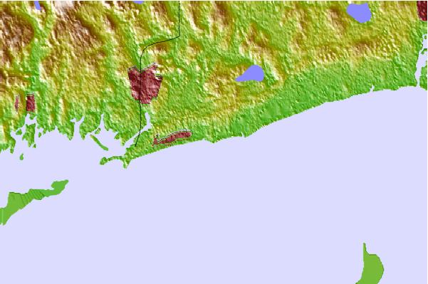
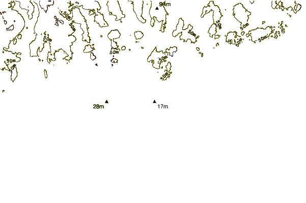
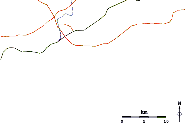
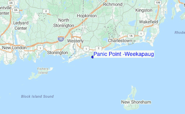
Utilizzare questa mappa sollievo per navigare Rhode Island surf breaks e stazioni di marea che si trovano nella zona diPanic Point (Weekapaug)
Altri surf breaks più vicini al Panic Point (Weekapaug):
(clicca sul nome del luogo per maggiori informazioni)- Closest località surf1 mi
- Second closest località surf2 mi
- Third closest località surf6 mi
- Fourth closest località surf6 mi
- Fifth closest località surf6 mi
Onda boe più vicina a Panic Point (Weekapaug):
- Closest Onda boa40 mi
- Second closest Onda boa47 mi
- Third closest Onda boa49 mi
- Fourth closest Onda boa81 mi
- Fifth closest Onda boa81 mi
Stazioni di marea più vicina alla Panic Point (Weekapaug):
- Closest marea stazioneWeekapaug Point, Block Island Sound1 mi
- Second closest marea stazioneWatch Hill Point6 mi
- Third closest marea stazioneWesterly, Pawcatuck River6 mi
- Fourth closest marea stazioneCharlestown7 mi
- Fifth closest marea stazioneStonington, Fishers Island Sound7 mi
- /breaks/Panic-Point-Weekapaug/forecasts/latest
 Nearest