
Previsioni:

Previsione a breve termineQualche pioggerella, più pesante durante venerdì mattina. Warm (Max 22°C giovedì pomeriggio, Min 21°C giovedì notte). Principalmente raffiche di vento. | |||||||||||||||||||
Gio 16 | Venerdì 17 | Sabato 18 | |||||||||||||||||
4 PM | 7 PM | 10 PM | 1 AM | 4 AM | 7 AM | 10 AM | 1 PM | 4 PM | 7 PM | 10 PM | 1 AM | 4 AM | 7 AM | 10 AM | 1 PM | 4 PM | 7 PM | 10 PM | |
Mappa dell'altezza del moto ondoso | 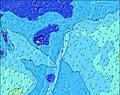 | 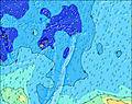 | 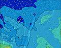 | 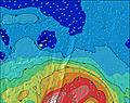 | 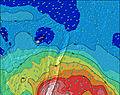 | 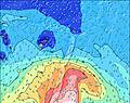 | 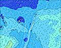 | ||||||||||||
Onda Altezza (m) Direzione Periodo (s) | SE 8 | SE 8 | SE 7 | SE 7 | SE 7 | SW 18 | SE 7 | SE 8 | SE 8 | SE 17 | SE 17 | SE 16 | SSE 16 | SE 16 | SE 15 | SSE 15 | SSE 15 | SSE 15 | SSE 15 |
Grafico delle onde | |||||||||||||||||||
470 | 499 | 485 | 456 | 452 | 263 | 465 | 648 | 693 | 687 | 702 | 748 | 832 | 883 | 930 | 1001 | 987 | 974 | 974 | |
Vento (km/h) | |||||||||||||||||||
Stato del vento onshore cross-onshore cross-shore cross-offshore offshore piatto | cross-off | cross-off | cross-off | cross-off | cross-off | off | cross-off | cross-off | cross-off | off | cross-off | cross-off | cross-off | cross-off | cross-off | cross-off | cross-off | cross-off | cross-off |
Alta Marea | 8:55PM1.20m | 9:08AM1.29m | 9:51PM1.20m | 10:05AM1.23m | |||||||||||||||
Basso Marea | 2:57AM0.13m | 3:33PM0.01m | 3:55AM0.15m | 4:26PM0.06m | |||||||||||||||
— | — | — | — | — | 7:07 | — | — | — | — | — | — | — | 7:07 | — | — | — | — | — | |
6:15 | — | — | — | — | — | — | — | 6:15 | — | — | — | — | — | — | — | 6:15 | — | — | |
mm | — | — | — | — | — | — | 1 | — | — | — | — | — | — | — | — | — | — | — | — |
Temp. °C | 22 | 22 | 22 | 22 | 22 | 21 | 21 | 21 | 22 | 22 | 21 | 21 | 22 | 22 | 21 | 22 | 22 | 22 | 22 |
Gelo °C | 15 | 14 | 14 | 15 | 16 | 14 | 14 | 14 | 15 | 15 | 14 | 14 | 15 | 15 | 14 | 15 | 15 | 15 | 15 |
Onda 1 Altezza (m) Direzione Periodo (s) | WNW 15 | WNW 15 | SW 20 | SW 19 | SW 19 | SW 18 | SW 18 | SW 18 | SW 17 | SE 17 | SE 17 | SE 16 | SSE 16 | SE 16 | SE 15 | SSE 15 | SSE 15 | SSE 15 | SSE 15 |
84 | 85 | 192 | 293 | 284 | 263 | 388 | 522 | 611 | 687 | 702 | 748 | 832 | 883 | 930 | 1001 | 987 | 974 | 974 | |
Onda 2 Altezza (m) Direzione Periodo (s) | SW 14 | SW 20 | WNW 15 | NW 15 | SE 12 | SE 12 | SE 19 | SE 19 | SE 18 | SW 16 | SW 16 | SW 16 | SW 15 | SW 15 | SW 16 | SW 16 | SW 16 | SW 16 | SW 16 |
29 | 62 | 85 | 54 | 39 | 53 | 293 | 414 | 522 | 589 | 581 | 553 | 499 | 505 | 546 | 553 | 489 | 411 | 406 | |
Onda 3 Altezza (m) Direzione Periodo (s) | SW 20 | SW 13 | SW 14 | SW 14 | NW 14 | NW 14 | SW 13 | NW 14 | NW 14 | NW 14 | NW 14 | NW 14 | WNW 14 | WNW 14 | WNW 14 | WNW 14 | WNW 14 | WNW 14 | WNW 14 |
63 | 28 | 29 | 31 | 54 | 54 | 63 | 54 | 53 | 53 | 53 | 52 | 19 | 18 | 18 | 18 | 18 | 18 | 18 | |
onde vento Altezza (m) Direzione Periodo (s) | SE 8 | SE 8 | SE 7 | SE 7 | SE 7 | ESE 7 | SE 7 | SE 8 | SE 8 | SE 8 | ESE 7 | ESE 8 | ESE 8 | ESE 8 | ESE 8 | ESE 8 | ESE 7 | ESE 7 | ESE 7 |
470 | 499 | 485 | 456 | 452 | 428 | 465 | 648 | 693 | 600 | 584 | 673 | 632 | 606 | 522 | 469 | 417 | 412 | 412 | |
Il più vicino Offshore or Glassy | |||||||||||||||||||
Distanza (km) | 925 | 925 | 925 | 925 | 925 | 925 | 925 | 925 | 925 | 925 | 925 | 925 | 934 | 925 | 925 | 925 | 925 | 2070 | 925 |
Migliori previsioni per le condizioni d'onda in Tonga Vava'u | |||||||||||||||||||
Migliori previsioni per le condizioni d'onda in Tonga | |||||||||||||||||||
Trova Onde Globale | |||||||||||||||||||
- Map Icons:
 Break
Break Live Wave Height (m)
 Live Wind Speed (km/h)
 Surf Rating (10 Max)
 Ocean Swells (m)
- Wind Speed (km/h)
Widget Free Surf-Forecast.com per il tuo sito
La relazione di surf / widget meteo è disponibile qui sotto per incorporare su siti esterni a titolo gratuito e fornisce una sintesi delle nostre Peaking previsione surf. Basta prendere il frammento di codice html da noi fornito e copiarlo nel proprio sito. È possibile scegliere la lingua preferita e unità metriche / imperiali per il feed delle previsioni surf per soddisfare le esigenze degli utenti del vostro sito .... Clicca qui per ottenere il codice.
 Nearest