
Previsioni:

Previsione a breve termineper lo più asciutto. Very mild (Max 17°C mercoledì mattina, Min 14°C Lunedì mattina). Vento sarà generalmente leggero. | ||||||||||||||||||||||||
Lunedì 27 | Martedì 28 | Mercoledì 29 | ||||||||||||||||||||||
2 AM | 5 AM | 8 AM | 11 AM | 2 PM | 5 PM | 8 PM | 11 PM | 2 AM | 5 AM | 8 AM | 11 AM | 2 PM | 5 PM | 8 PM | 11 PM | 2 AM | 5 AM | 8 AM | 11 AM | 2 PM | 5 PM | 8 PM | 11 PM | |
Mappa dell'altezza del moto ondoso |  | 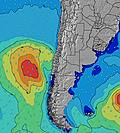 |  |  | 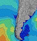 |  |  | 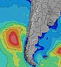 |  | |||||||||||||||
Onda Altezza (m) Direzione Periodo (s) | SW 18 | SW 18 | SW 16 | SW 16 | SW 16 | SW 16 | WSW 16 | WSW 15 | SW 15 | SW 15 | SW 15 | SW 14 | SW 14 | SW 14 | SW 13 | SW 13 | SW 13 | SW 13 | SW 13 | SW 11 | SW 11 | SW 12 | SW 12 | SW 12 |
Grafico delle onde | ||||||||||||||||||||||||
330 | 330 | 534 | 527 | 521 | 595 | 1141 | 1069 | 1088 | 784 | 844 | 1163 | 2090 | 2166 | 1657 | 1435 | 1391 | 1651 | 1475 | 555 | 617 | 960 | 880 | 760 | |
Vento (km/h) | ||||||||||||||||||||||||
Stato del vento onshore cross-onshore cross-shore cross-offshore offshore piatto | glassy | cross-off | cross-off | glassy | cross | cross | cross | cross | cross | cross-off | cross | cross | cross | cross | cross | cross | cross | cross | cross | cross-on | cross | cross | cross | cross |
Alta Marea | 8:18AM1.10m | 8:46PM0.65m | 8:57AM1.15m | 9:23PM0.68m | 9:32AM1.19m | 9:58PM0.71m | ||||||||||||||||||
Basso Marea | 3:15PM0.17m | 2:11AM0.20m | 3:49PM0.14m | 2:49AM0.17m | 4:21PM0.11m | |||||||||||||||||||
— | 7:18 | — | — | — | — | — | — | — | 7:18 | — | — | — | — | — | — | — | 7:18 | — | — | — | — | — | — | |
— | — | — | — | — | 6:17 | — | — | — | — | — | — | — | 6:17 | — | — | — | — | — | — | — | 6:19 | — | — | |
mm | — | — | — | — | — | — | — | — | — | — | — | — | — | — | — | — | — | — | — | — | — | — | — | — |
Temp. °C | 14 | 14 | 14 | 16 | 16 | 16 | 14 | 14 | 15 | 15 | 16 | 16 | 16 | 16 | 15 | 16 | 16 | 16 | 15 | 17 | 17 | 16 | 15 | 15 |
Gelo °C | 14 | 13 | 13 | 16 | 15 | 14 | 12 | 11 | 14 | 14 | 14 | 13 | 13 | 14 | 11 | 13 | 13 | 14 | 13 | 16 | 15 | 14 | 13 | 14 |
Onda 1 Altezza (m) Direzione Periodo (s) | WSW 13 | WSW 13 | SW 16 | WSW 13 | WSW 13 | SW 16 | WSW 16 | WSW 15 | SW 15 | SW 15 | SW 15 | SW 14 | SW 14 | SW 14 | SW 13 | SW 13 | SW 13 | SW 13 | SW 13 | SW 11 | SW 11 | SW 12 | SW 12 | SW 12 |
277 | 273 | 534 | 357 | 326 | 595 | 1141 | 1069 | 1088 | 784 | 844 | 1163 | 2090 | 2166 | 1657 | 1435 | 1391 | 1651 | 1475 | 543 | 617 | 960 | 880 | 760 | |
Onda 2 Altezza (m) Direzione Periodo (s) | SW 6 | SSW 6 | WSW 13 | SW 16 | SW 16 | WSW 12 | SSW 10 | WNW 15 | SSW 9 | WSW 12 | WSW 12 | WSW 15 | WNW 14 | WNW 14 | WNW 14 | SSW 12 | SSW 12 | SSW 11 | SSW 11 | WSW 13 | WSW 13 | S 10 | SSW 11 | SSW 11 |
32 | 41 | 195 | 527 | 521 | 278 | 109 | 42 | 29 | 294 | 371 | 443 | 41 | 20 | 20 | 56 | 44 | 22 | 22 | 555 | 346 | 8 | 41 | 64 | |
Onda 3 Altezza (m) Direzione Periodo (s) | SW 18 | SW 18 | SSW 6 | SSW 6 | SSW 6 | SSW 6 | WNW 15 | SSW 9 | WNW 14 | SSW 5 | SSW 6 | W 14 | WNW 14 | — | — | WNW 14 | WNW 14 | WNW 14 | WNW 14 | SSW 11 | SSW 10 | NW 14 | — | — |
330 | 330 | 41 | 29 | 28 | 28 | 42 | 29 | 41 | 42 | 43 | 16 | 20 | — | — | 21 | 20 | 20 | 20 | 40 | 20 | 8 | — | — | |
onde vento Altezza (m) Direzione Periodo (s) | — | — | — | — | — | — | — | SSW 10 | SSW 5 | — | — | SSW 5 | SSW 5 | — | SSW 5 | SSW 6 | SSW 6 | SSW 6 | SSW 6 | — | — | — | — | — |
— | — | — | — | — | — | — | 103 | 33 | — | — | 42 | 37 | — | 48 | 77 | 82 | 107 | 91 | — | — | — | — | — | |
Il più vicino Offshore or Glassy | ||||||||||||||||||||||||
Distanza (km) | 0 | 0 | 0 | 0 | 139 | 3 | 139 | 67 | 3 | 0 | 25 | 187 | 139 | 363 | 357 | 25 | 32 | 32 | 32 | 139 | 139 | 187 | 3 | 3 |
Migliori previsioni per le condizioni d'onda in Antofagasta | ||||||||||||||||||||||||
Migliori previsioni per le condizioni d'onda in Chile | ||||||||||||||||||||||||
Trova Onde Globale | ||||||||||||||||||||||||
- Map Icons:
 Break
Break Live Wave Height (m)
 Live Wind Speed (km/h)
 Surf Rating (10 Max)
 Ocean Swells (m)
- Wind Speed (km/h)
Widget Free Surf-Forecast.com per il tuo sito
La relazione di surf / widget meteo è disponibile qui sotto per incorporare su siti esterni a titolo gratuito e fornisce una sintesi delle nostre Penarol previsione surf. Basta prendere il frammento di codice html da noi fornito e copiarlo nel proprio sito. È possibile scegliere la lingua preferita e unità metriche / imperiali per il feed delle previsioni surf per soddisfare le esigenze degli utenti del vostro sito .... Clicca qui per ottenere il codice.
 Nearest