
Previsioni:

Previsione a breve termineper lo più asciutto. Warm (Max 30°C giovedì pomeriggio, Min 25°C giovedì mattina). Venti decrescenti (venti freschi da SSW giovedì pomeriggio, calma per venerdì mattina). | ||||||||||||||||||||||||
Giovedì 16 | Venerdì 17 | Sabato 18 | Dom 19 | |||||||||||||||||||||
5 AM | 8 AM | 11 AM | 2 PM | 5 PM | 8 PM | 11 PM | 2 AM | 5 AM | 8 AM | 11 AM | 2 PM | 5 PM | 8 PM | 11 PM | 2 AM | 5 AM | 8 AM | 11 AM | 2 PM | 5 PM | 8 PM | 11 PM | 2 AM | |
Mappa dell'altezza del moto ondoso |  |  |  |  | 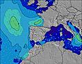 |  |  | 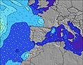 |  |  | ||||||||||||||
Onda Altezza (m) Direzione Periodo (s) | ESE 5 | ESE 5 | E 5 | SE 5 | ESE 4 | ESE 4 | S 5 | S 5 | S 5 | S 5 | S 5 | S 5 | S 5 | S 4 | S 4 | S 4 | S 4 | S 4 | — | ENE 4 | E 4 | E 4 | ENE 4 | ENE 4 |
Grafico delle onde | ||||||||||||||||||||||||
3 | 2 | 2 | 1 | 2 | 2 | 15 | 25 | 29 | 20 | 13 | 7 | 7 | 6 | 3 | 3 | 1 | 1 | 0 | 11 | 13 | 9 | 5 | 3 | |
Vento (km/h) | ||||||||||||||||||||||||
Stato del vento onshore cross-onshore cross-shore cross-offshore offshore piatto | cross | cross-off | cross | cross-off | cross-off | cross | on | cross | cross | glassy | cross-on | on | on | cross-on | on | off | cross-on | glassy | on | on | cross-on | cross-on | glassy | cross-off |
Alta Marea | 7:20PM0.15m | 4:28AM0.19m | 7:50PM0.15m | 5:12AM0.18m | 8:16PM0.15m | |||||||||||||||||||
Basso Marea | 11:41AM-0.01m | 10:46PM0.13m | 12:19PM-0.00m | 11:44PM0.13m | 12:53PM0.01m | 00:52AM0.12m | ||||||||||||||||||
6:52 | — | — | — | — | — | — | — | 6:54 | — | — | — | — | — | — | — | 6:54 | — | — | — | — | — | — | 6:54 | |
— | — | — | — | — | 9:23 | — | — | — | — | — | — | — | 9:22 | — | — | — | — | — | — | — | 9:22 | — | 9:22 | |
mm | — | — | — | — | — | — | — | — | — | — | — | — | — | — | — | — | — | — | — | — | — | — | — | — |
Temp. °C | 26 | 25 | 27 | 28 | 30 | 30 | 26 | 26 | 25 | 25 | 29 | 26 | 26 | 29 | 27 | 27 | 28 | 29 | 26 | 26 | 26 | 27 | 26 | 25 |
Gelo °C | 27 | 26 | 28 | 26 | 28 | 31 | 29 | 29 | 28 | 29 | 31 | 28 | 28 | 30 | 30 | 30 | 29 | 31 | 27 | 28 | 28 | 29 | 31 | 28 |
Onda 1 Altezza (m) Direzione Periodo (s) | ESE 5 | ESE 5 | E 5 | SE 5 | ESE 4 | ESE 4 | S 5 | S 5 | S 5 | S 5 | S 5 | S 5 | S 5 | S 4 | S 4 | S 4 | S 4 | S 4 | — | — | — | — | ENE 4 | ENE 4 |
3 | 2 | 2 | 1 | 2 | 2 | 15 | 25 | 29 | 20 | 13 | 7 | 7 | 6 | 3 | 3 | 1 | 1 | — | — | — | — | 5 | 3 | |
Onda 2 Altezza (m) Direzione Periodo (s) | — | — | — | — | — | — | E 4 | E 4 | — | — | — | — | — | — | — | — | — | — | — | — | — | — | — | ESE 3 |
— | — | — | — | — | — | 1 | 1 | — | — | — | — | — | — | — | — | — | — | — | — | — | — | — | 1 | |
Onda 3 Altezza (m) Direzione Periodo (s) | — | — | — | — | — | — | — | — | — | — | E 5 | E 5 | — | — | — | — | — | — | — | — | — | — | — | — |
— | — | — | — | — | — | — | — | — | — | 1 | 1 | — | — | — | — | — | — | — | — | — | — | — | — | |
onde vento Altezza (m) Direzione Periodo (s) | E 5 | — | — | SSW 3 | SSW 4 | SSW 4 | SW 5 | SSW 5 | — | SW 6 | — | — | — | — | — | — | — | — | — | ENE 4 | E 4 | E 4 | — | — |
2 | — | — | 5 | 24 | 20 | 22 | 33 | — | 50 | — | — | — | — | — | — | — | — | — | 11 | 13 | 9 | — | — | |
Il più vicino Offshore or Glassy | ||||||||||||||||||||||||
Distanza (km) | 507 | 752 | 753 | 1150 | 1584 | 1328 | 358 | 340 | 295 | 268 | 1150 | 1151 | 1759 | 1150 | 1150 | 1134 | 502 | 514 | 559 | 687 | 1588 | 687 | 798 | 507 |
Migliori previsioni per le condizioni d'onda in Murcia | ||||||||||||||||||||||||
Migliori previsioni per le condizioni d'onda in Spain (Europe) | ||||||||||||||||||||||||
Trova Onde Globale | ||||||||||||||||||||||||
- Map Icons:
 Break
Break Live Wave Height (m)
 Live Wind Speed (km/h)
 Surf Rating (10 Max)
 Ocean Swells (m)
- Wind Speed (km/h)
Widget Free Surf-Forecast.com per il tuo sito
La relazione di surf / widget meteo è disponibile qui sotto per incorporare su siti esterni a titolo gratuito e fornisce una sintesi delle nostre Pico de la Autopista previsione surf. Basta prendere il frammento di codice html da noi fornito e copiarlo nel proprio sito. È possibile scegliere la lingua preferita e unità metriche / imperiali per il feed delle previsioni surf per soddisfare le esigenze degli utenti del vostro sito .... Clicca qui per ottenere il codice.
 Nearest