
Previsioni:

Previsione a breve termineQualche pioggerella, più pesante durante mercoledì notte. Warm (Max 29°C mercoledì pomeriggio, Min 26°C giovedì notte). Vento sarà generalmente leggero. | ||||||||||||||||||||||||
Mer 15 | Giovedì 16 | Venerdì 17 | 18 | |||||||||||||||||||||
3 PM | 6 PM | 9 PM | 12 AM | 3 AM | 6 AM | 9 AM | 12 PM | 3 PM | 6 PM | 9 PM | 12 AM | 3 AM | 6 AM | 9 AM | 12 PM | 3 PM | 6 PM | 9 PM | 12 AM | 3 AM | 6 AM | 9 AM | 12 PM | |
Mappa dell'altezza del moto ondoso | 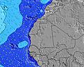 | 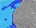 | 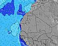 | 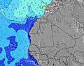 | 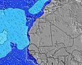 | 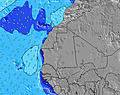 | 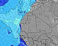 | 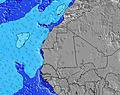 | 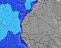 | |||||||||||||||
Onda Altezza (m) Direzione Periodo (s) | SW 12 | SW 12 | SSW 7 | SSW 7 | SSW 7 | SSW 7 | SSW 7 | SW 19 | SW 19 | SSW 8 | SSW 7 | SSW 7 | SSW 7 | SSW 7 | SSW 7 | SSW 7 | SW 7 | SW 7 | SW 7 | SW 7 | SW 7 | SW 7 | SW 7 | SW 7 |
Grafico delle onde | ||||||||||||||||||||||||
23 | 23 | 48 | 36 | 34 | 82 | 82 | 133 | 133 | 128 | 181 | 144 | 117 | 113 | 127 | 127 | 143 | 125 | 121 | 131 | 135 | 160 | 152 | 156 | |
Vento (km/h) | ||||||||||||||||||||||||
Stato del vento onshore cross-onshore cross-shore cross-offshore offshore piatto | cross-on | cross-on | cross-on | cross-on | cross-on | cross-on | cross-on | cross | cross | cross-on | cross-on | cross-on | cross-on | cross-on | cross-on | cross-on | cross-on | cross-on | cross-on | on | on | on | on | on |
Alta Marea | 10:07PM1.20m | 10:27AM1.51m | 10:53PM1.21m | 11:13AM1.50m | 11:38PM1.19m | 11:56AM1.45m | ||||||||||||||||||
Basso Marea | 3:54PM-0.01m | 3:53AM0.01m | 4:41PM-0.01m | 4:38AM0.02m | 5:26PM0.02m | 5:23AM0.06m | ||||||||||||||||||
— | — | — | — | — | 6:47 | — | — | — | — | — | — | — | 6:47 | — | — | — | — | — | — | — | 6:48 | — | — | |
— | 7:40 | — | — | — | — | — | — | — | 7:40 | — | — | — | — | — | — | — | 7:40 | — | — | — | — | — | 7:40 | |
mm | — | — | 1 | — | — | — | — | — | — | — | — | — | — | — | — | — | — | — | — | — | — | — | — | — |
Temp. °C | 29 | 28 | 28 | 27 | 27 | 27 | 27 | 28 | 28 | 27 | 27 | 26 | 26 | 26 | 27 | 27 | 27 | 27 | 27 | 26 | 26 | 26 | 27 | 27 |
Gelo °C | 32 | 30 | 30 | 29 | 29 | 29 | 29 | 30 | 29 | 27 | 28 | 27 | 27 | 27 | 28 | 28 | 28 | 28 | 28 | 27 | 26 | 27 | 29 | 28 |
Onda 1 Altezza (m) Direzione Periodo (s) | SSW 6 | SSW 7 | NW 7 | SSW 7 | SSW 7 | SSW 7 | NW 8 | SSW 7 | SW 19 | SW 19 | SW 19 | SW 18 | SSW 7 | SW 18 | SW 18 | SW 18 | SW 7 | SW 7 | SW 16 | SW 16 | SW 16 | SW 16 | SW 7 | SW 7 |
15 | 18 | 14 | 36 | 34 | 82 | 16 | 66 | 133 | 95 | 57 | 50 | 117 | 109 | 109 | 78 | 143 | 125 | 90 | 90 | 125 | 89 | 152 | 156 | |
Onda 2 Altezza (m) Direzione Periodo (s) | NW 7 | NW 7 | SW 12 | NW 8 | NW 7 | NW 8 | SW 11 | SW 19 | NW 8 | NW 8 | NNW 8 | NNW 8 | SW 18 | NNW 8 | NNW 8 | NNW 8 | SW 17 | SW 16 | NNW 8 | WNW 9 | WNW 9 | WNW 8 | SW 16 | SW 15 |
14 | 19 | 22 | 17 | 14 | 16 | 18 | 133 | 16 | 15 | 11 | 11 | 109 | 13 | 13 | 13 | 46 | 42 | 6 | 7 | 7 | 7 | 88 | 84 | |
Onda 3 Altezza (m) Direzione Periodo (s) | SW 12 | SW 12 | NNW 9 | SW 11 | SW 11 | SW 11 | SW 19 | NW 8 | WNW 10 | WNW 10 | WNW 10 | WNW 9 | NNW 8 | WNW 9 | WNW 9 | WNW 9 | NNW 8 | NNW 8 | WNW 9 | NNW 7 | NNW 7 | NNW 7 | WNW 8 | NW 8 |
23 | 23 | 8 | 20 | 19 | 19 | 59 | 16 | 10 | 10 | 9 | 9 | 12 | 8 | 8 | 8 | 13 | 6 | 7 | 5 | 5 | 5 | 7 | 11 | |
onde vento Altezza (m) Direzione Periodo (s) | — | SW 7 | SSW 7 | SSW 4 | SSW 5 | — | SSW 7 | — | SSW 7 | SSW 8 | SSW 7 | SSW 7 | SW 7 | SSW 7 | SSW 7 | SSW 7 | SW 7 | SW 7 | SW 7 | SW 7 | SW 7 | SW 7 | — | SW 7 |
— | 18 | 48 | 10 | 22 | — | 82 | — | 101 | 128 | 181 | 144 | 73 | 113 | 127 | 127 | 67 | 69 | 121 | 131 | 135 | 160 | — | 79 | |
Il più vicino Offshore or Glassy | ||||||||||||||||||||||||
Distanza (km) | 39 | 657 | 42 | 657 | 657 | 46 | 46 | 42 | 39 | 46 | 46 | 46 | 46 | 657 | 46 | 671 | 688 | 660 | 660 | 660 | 657 | 657 | 657 | 657 |
Migliori previsioni per le condizioni d'onda in Senegal | ||||||||||||||||||||||||
Migliori previsioni per le condizioni d'onda in Senegal | ||||||||||||||||||||||||
Trova Onde Globale | ||||||||||||||||||||||||
- Map Icons:
 Break
Break Live Wave Height (m)
 Live Wind Speed (km/h)
 Surf Rating (10 Max)
 Ocean Swells (m)
- Wind Speed (km/h)
Widget Free Surf-Forecast.com per il tuo sito
La relazione di surf / widget meteo è disponibile qui sotto per incorporare su siti esterni a titolo gratuito e fornisce una sintesi delle nostre Piere de Lisse previsione surf. Basta prendere il frammento di codice html da noi fornito e copiarlo nel proprio sito. È possibile scegliere la lingua preferita e unità metriche / imperiali per il feed delle previsioni surf per soddisfare le esigenze degli utenti del vostro sito .... Clicca qui per ottenere il codice.
 Nearest