
Previsioni:

Aggiornamento in hr min s Forecast update imminent
Previsione a breve terminepioggia leggera (Totale 2mm), per lo più che cade martedì notte. Warm (Max 32°C mercoledì pomeriggio, Min 26°C Lunedì notte). Vento sarà generalmente leggero. | ||||||||||||||||||||||||
Martedì 30 | Mercoledì 1 | Giovedì 2 | ||||||||||||||||||||||
9 PM | 12 AM | 3 AM | 6 AM | 9 AM | 12 PM | 3 PM | 6 PM | 9 PM | 12 AM | 3 AM | 6 AM | 9 AM | 12 PM | 3 PM | 6 PM | 9 PM | 12 AM | 3 AM | 6 AM | 9 AM | 12 PM | 3 PM | 6 PM | |
Mappa dell'altezza del moto ondoso |  |  |  |  |  |  |  |  |  | 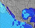 | ||||||||||||||
Onda Altezza (m) Direzione Periodo (s) | SSW 14 | SSW 14 | SSW 14 | SSW 18 | SSW 14 | SSW 18 | SSW 18 | SSW 17 | SSW 17 | SSW 16 | SSW 16 | SSW 16 | SSW 16 | SSW 16 | SSW 16 | SSW 16 | SSW 16 | SSW 16 | SSW 16 | SSW 16 | SSW 16 | SSW 16 | SSW 16 | SSW 15 |
Grafico delle onde | ||||||||||||||||||||||||
325 | 325 | 321 | 356 | 312 | 352 | 395 | 475 | 443 | 422 | 417 | 505 | 505 | 770 | 779 | 779 | 818 | 751 | 742 | 733 | 724 | 706 | 688 | 581 | |
Vento (km/h) | ||||||||||||||||||||||||
Stato del vento onshore cross-onshore cross-shore cross-offshore offshore piatto | cross | off | off | off | glassy | on | cross-on | cross-on | cross | cross-off | cross-off | off | glassy | cross-on | cross-on | cross | cross-off | glassy | off | off | glassy | on | on | cross-on |
Alta Marea | 7:40PM0.64m | 7:45PM0.65m | 7:48PM0.66m | |||||||||||||||||||||
Basso Marea | 4:24AM0.10m | 4:41AM0.13m | 4:51AM0.18m | |||||||||||||||||||||
— | — | — | 6:16 | — | — | — | — | — | — | — | 6:16 | — | — | — | — | — | — | — | 6:18 | — | — | — | — | |
— | — | — | — | — | — | — | 7:29 | — | — | — | — | — | — | — | 7:29 | — | — | — | — | — | — | — | 7:29 | |
mm | — | — | — | — | — | — | — | — | — | — | 2 | — | — | — | — | — | — | — | — | — | — | — | — | — |
Temp. °C | 28 | 27 | 26 | 26 | 29 | 31 | 31 | 30 | 29 | 28 | 27 | 26 | 28 | 31 | 32 | 31 | 28 | 28 | 26 | 26 | 29 | 31 | 31 | 31 |
Gelo °C | 31 | 30 | 28 | 28 | 33 | 33 | 32 | 32 | 33 | 33 | 31 | 30 | 32 | 33 | 32 | 34 | 32 | 32 | 28 | 28 | 32 | 32 | 33 | 34 |
Onda 1 Altezza (m) Direzione Periodo (s) | SSW 14 | SSW 14 | SSW 14 | SSW 14 | SSW 14 | SSW 14 | SSW 18 | SSW 17 | SSW 17 | SSW 16 | SSW 16 | SSW 16 | SSW 16 | SSW 16 | SSW 16 | SSW 16 | SSW 16 | SSW 16 | SSW 16 | SSW 16 | SSW 16 | SSW 16 | SSW 16 | SSW 15 |
325 | 325 | 321 | 257 | 312 | 217 | 395 | 475 | 443 | 422 | 417 | 505 | 505 | 770 | 779 | 779 | 818 | 751 | 742 | 733 | 724 | 706 | 688 | 581 | |
Onda 2 Altezza (m) Direzione Periodo (s) | S 10 | SSW 18 | SSW 18 | SSW 18 | SSW 18 | SSW 18 | SSW 14 | SSW 13 | SSW 13 | SSW 13 | SSW 13 | SSW 13 | SSW 13 | S 9 | S 9 | S 9 | S 9 | SSE 9 | SSE 9 | SSE 9 | S 9 | S 9 | SSW 20 | S 9 |
75 | 289 | 280 | 356 | 276 | 352 | 207 | 156 | 151 | 149 | 149 | 149 | 151 | 63 | 63 | 60 | 61 | 47 | 47 | 46 | 41 | 41 | 75 | 41 | |
Onda 3 Altezza (m) Direzione Periodo (s) | SSW 19 | S 10 | SSE 10 | SSE 10 | SSE 10 | SSE 10 | SSE 10 | SSE 10 | SSE 10 | SSE 10 | SSE 10 | SSE 10 | S 9 | SSE 9 | W 12 | S 24 | NW 12 | WSW 4 | WSW 4 | W 4 | WNW 4 | S 13 | S 20 | SW 10 |
148 | 74 | 80 | 80 | 58 | 78 | 65 | 64 | 63 | 54 | 52 | 72 | 63 | 100 | 3 | 11 | 6 | 5 | 5 | 3 | 6 | 3 | 67 | 24 | |
onde vento Altezza (m) Direzione Periodo (s) | W 3 | W 3 | — | — | — | — | SW 3 | WSW 3 | W 4 | W 4 | W 4 | — | — | — | — | — | W 4 | W 4 | — | — | — | — | S 9 | SW 9 |
5 | 3 | — | — | — | — | 5 | 4 | 10 | 10 | 7 | — | — | — | — | — | 9 | 16 | — | — | — | — | 59 | 22 | |
Il più vicino Offshore or Glassy | ||||||||||||||||||||||||
Distanza (km) | 436 | 94 | 65 | 0 | 0 | 0 | 0 | 436 | 436 | 414 | 65 | 0 | 0 | 0 | 0 | 34 | 84 | 34 | 34 | 0 | 0 | 0 | 0 | 283 |
Migliori previsioni per le condizioni d'onda in Michoacan | ||||||||||||||||||||||||
Migliori previsioni per le condizioni d'onda in Mexico | ||||||||||||||||||||||||
Trova Onde Globale | ||||||||||||||||||||||||
- Map Icons:
 Break
Break Live Wave Height (m)
 Live Wind Speed (km/h)
 Surf Rating (10 Max)
 Ocean Swells (m)
- Wind Speed (km/h)
Widget Free Surf-Forecast.com per il tuo sito
La relazione di surf / widget meteo è disponibile qui sotto per incorporare su siti esterni a titolo gratuito e fornisce una sintesi delle nostre Playa Azul previsione surf. Basta prendere il frammento di codice html da noi fornito e copiarlo nel proprio sito. È possibile scegliere la lingua preferita e unità metriche / imperiali per il feed delle previsioni surf per soddisfare le esigenze degli utenti del vostro sito .... Clicca qui per ottenere il codice.
 Nearest