
Previsioni:

Previsione a breve termineper lo più asciutto. Warm (Max 21°C giovedì pomeriggio, Min 16°C Venerdì notte). Vento sarà generalmente leggero. | ||||||||||||||||||||||||
Mercoledì 22 | Giovedì 23 | Venerdì 24 | ||||||||||||||||||||||
2 AM | 5 AM | 8 AM | 11 AM | 2 PM | 5 PM | 8 PM | 11 PM | 2 AM | 5 AM | 8 AM | 11 AM | 2 PM | 5 PM | 8 PM | 11 PM | 2 AM | 5 AM | 8 AM | 11 AM | 2 PM | 5 PM | 8 PM | 11 PM | |
Mappa dell'altezza del moto ondoso |  | 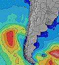 |  |  | 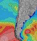 |  | 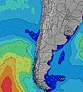 | 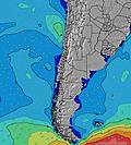 | 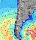 | |||||||||||||||
Onda Altezza (m) Direzione Periodo (s) | WSW 11 | WSW 11 | WSW 11 | WSW 11 | SW 10 | SW 10 | WSW 10 | SW 10 | SW 10 | SW 10 | SW 11 | SW 11 | SW 11 | SW 10 | SW 10 | SW 10 | SW 10 | SW 10 | SW 10 | SW 10 | SW 10 | SW 9 | SW 9 | SW 9 |
Grafico delle onde | ||||||||||||||||||||||||
291 | 265 | 260 | 305 | 310 | 392 | 277 | 377 | 412 | 428 | 453 | 453 | 445 | 478 | 469 | 428 | 377 | 362 | 348 | 341 | 369 | 246 | 246 | 225 | |
Vento (km/h) | ||||||||||||||||||||||||
Stato del vento onshore cross-onshore cross-shore cross-offshore offshore piatto | cross | cross | cross | cross-on | cross-on | cross-on | cross | glassy | cross | cross | cross | cross-on | cross-on | cross-on | cross | glassy | glassy | glassy | glassy | glassy | cross-on | cross | cross-off | cross-off |
Alta Marea | 3:54AM1.11m | 3:36PM0.91m | 4:57AM1.15m | 4:47PM0.84m | 5:55AM1.20m | 5:58PM0.81m | ||||||||||||||||||
Basso Marea | 10:16AM0.60m | 9:56PM0.43m | 11:41AM0.58m | 10:48PM0.45m | 12:51PM0.54m | |||||||||||||||||||
— | 7:13 | — | — | — | — | — | — | — | 7:13 | — | — | — | — | — | — | — | 7:13 | — | — | — | — | — | — | |
— | — | — | — | — | 6:19 | — | — | — | — | — | — | — | 6:20 | — | — | — | — | — | — | — | 6:20 | — | — | |
mm | — | — | — | — | — | — | — | — | — | — | — | — | — | — | — | — | — | — | — | — | — | — | — | — |
Temp. °C | 18 | 18 | 18 | 20 | 20 | 20 | 17 | 18 | 18 | 18 | 18 | 20 | 21 | 20 | 18 | 19 | 19 | 18 | 18 | 19 | 19 | 18 | 16 | 17 |
Gelo °C | 17 | 18 | 17 | 18 | 18 | 19 | 17 | 19 | 18 | 17 | 17 | 19 | 20 | 20 | 18 | 20 | 19 | 19 | 18 | 20 | 19 | 18 | 15 | 16 |
Onda 1 Altezza (m) Direzione Periodo (s) | WSW 11 | WSW 11 | WSW 11 | WSW 11 | SW 10 | SW 10 | WSW 10 | SW 10 | SW 10 | SW 10 | SW 11 | SW 11 | SW 11 | SW 10 | SW 10 | SW 10 | SW 10 | SW 10 | SW 10 | SW 10 | SW 10 | SW 9 | SW 9 | SW 9 |
291 | 265 | 260 | 305 | 310 | 392 | 277 | 377 | 412 | 428 | 453 | 453 | 445 | 478 | 469 | 428 | 377 | 362 | 348 | 341 | 369 | 246 | 246 | 225 | |
Onda 2 Altezza (m) Direzione Periodo (s) | SSW 11 | SSW 11 | SSW 11 | SSW 11 | SSW 11 | WNW 20 | SSW 5 | WNW 19 | SW 24 | SW 24 | SW 24 | SW 23 | SW 22 | SW 22 | SW 21 | SW 21 | SW 21 | SW 20 | SW 20 | SW 19 | SW 20 | SW 19 | SW 13 | SW 13 |
78 | 78 | 66 | 45 | 47 | 75 | 19 | 74 | 198 | 142 | 87 | 85 | 165 | 163 | 162 | 162 | 159 | 136 | 186 | 133 | 134 | 133 | 109 | 163 | |
Onda 3 Altezza (m) Direzione Periodo (s) | WNW 21 | SW 4 | W 20 | WNW 20 | WNW 20 | SW 26 | WNW 20 | SW 24 | WNW 19 | WNW 19 | WNW 19 | WNW 19 | WNW 18 | WNW 18 | W 18 | WNW 18 | WNW 18 | WNW 18 | SW 13 | SW 13 | WNW 17 | SW 14 | SW 19 | SW 18 |
42 | 4 | 30 | 38 | 75 | 105 | 75 | 93 | 73 | 72 | 72 | 69 | 64 | 62 | 56 | 66 | 65 | 64 | 41 | 42 | 59 | 66 | 125 | 113 | |
onde vento Altezza (m) Direzione Periodo (s) | SW 4 | — | SSW 4 | SSW 5 | SSW 5 | SSW 6 | — | — | — | — | — | — | — | — | — | — | — | — | — | — | — | — | — | — |
4 | — | 8 | 15 | 22 | 20 | — | — | — | — | — | — | — | — | — | — | — | — | — | — | — | — | — | — | |
Il più vicino Offshore or Glassy | ||||||||||||||||||||||||
Distanza (km) | 2 | 2 | 2 | 2 | 2 | 2 | 2 | 0 | 2 | 2 | 2 | 2 | 2 | 2 | 2 | 0 | 0 | 0 | 0 | 0 | 1 | 0 | 0 | 0 |
Migliori previsioni per le condizioni d'onda in Tarapaca | ||||||||||||||||||||||||
Migliori previsioni per le condizioni d'onda in Chile | ||||||||||||||||||||||||
Trova Onde Globale | ||||||||||||||||||||||||
- Map Icons:
 Break
Break Live Wave Height (m)
 Live Wind Speed (km/h)
 Surf Rating (10 Max)
 Ocean Swells (m)
- Wind Speed (km/h)
Widget Free Surf-Forecast.com per il tuo sito
La relazione di surf / widget meteo è disponibile qui sotto per incorporare su siti esterni a titolo gratuito e fornisce una sintesi delle nostre Playa Cavancha previsione surf. Basta prendere il frammento di codice html da noi fornito e copiarlo nel proprio sito. È possibile scegliere la lingua preferita e unità metriche / imperiali per il feed delle previsioni surf per soddisfare le esigenze degli utenti del vostro sito .... Clicca qui per ottenere il codice.
 Nearest