
Previsioni:

Previsione a breve termineQualche pioggerella, più pesante durante sabato pomeriggio. Warm (Max 31°C giovedì mattina, Min 25°C mercoledì notte). Vento sarà generalmente leggero. | |||||||||||||||||
Giovedì 16 | Venerdì 17 | ||||||||||||||||
9 PM | 12 AM | 3 AM | 6 AM | 9 AM | 12 PM | 3 PM | 6 PM | 9 PM | 12 AM | 3 AM | 6 AM | 9 AM | 12 PM | 3 PM | 6 PM | 9 PM | |
Mappa dell'altezza del moto ondoso |  |  | 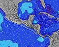 |  |  | 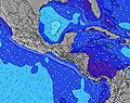 |  | ||||||||||
Onda Altezza (m) Direzione Periodo (s) | SW 16 | SW 16 | SW 16 | SW 16 | SW 13 | SSW 13 | SSW 13 | SSW 14 | SW 14 | SW 14 | SSW 14 | SSW 14 | SW 15 | SSW 13 | SSW 13 | SSW 13 | SSW 13 |
Grafico delle onde | |||||||||||||||||
206 | 206 | 206 | 206 | 172 | 261 | 326 | 198 | 251 | 103 | 276 | 215 | 75 | 239 | 178 | 178 | 184 | |
Vento (km/h) | |||||||||||||||||
Stato del vento onshore cross-onshore cross-shore cross-offshore offshore piatto | off | cross-off | cross-off | off | cross-off | cross-off | cross-off | cross-off | cross-off | cross-off | cross-off | cross-off | cross-off | cross-off | cross-off | off | cross-off |
Alta Marea | 3:48AM2.52m | 4:04PM2.62m | 4:39AM2.59m | 4:53PM2.56m | |||||||||||||
Basso Marea | 9:33PM-0.03m | 9:54AM0.15m | 10:22PM-0.04m | 10:47AM0.16m | |||||||||||||
— | — | 5:28 | — | — | — | — | — | — | — | 5:28 | — | — | — | — | — | — | |
— | — | — | — | — | — | — | 6:08 | — | — | — | — | — | — | — | 6:08 | — | |
mm | — | — | — | — | — | — | — | — | — | — | — | — | — | — | — | — | — |
Temp. °C | 27 | 26 | 25 | 25 | 28 | 31 | 31 | 29 | 28 | 27 | 26 | 26 | 28 | 31 | 30 | 29 | 28 |
Gelo °C | 30 | 27 | 27 | 26 | 28 | 32 | 34 | 30 | 28 | 27 | 27 | 26 | 27 | 32 | 32 | 29 | 27 |
Onda 1 Altezza (m) Direzione Periodo (s) | SW 16 | SW 16 | SW 16 | S 12 | SW 13 | SSW 13 | SSW 13 | SSW 14 | SSW 14 | S 14 | SSW 14 | SSW 14 | S 14 | SSW 13 | SSW 13 | SSW 13 | SSW 13 |
206 | 206 | 206 | 108 | 172 | 261 | 326 | 198 | 215 | 203 | 276 | 215 | 195 | 239 | 178 | 178 | 184 | |
Onda 2 Altezza (m) Direzione Periodo (s) | SW 13 | SW 13 | SW 13 | SW 16 | S 12 | NNE 5 | N 5 | SW 14 | SW 14 | SW 12 | SW 15 | SW 12 | SW 12 | SW 15 | SW 15 | SW 11 | SW 12 |
82 | 80 | 79 | 206 | 77 | 8 | 8 | 158 | 251 | 68 | 104 | 68 | 67 | 75 | 76 | 64 | 68 | |
Onda 3 Altezza (m) Direzione Periodo (s) | S 12 | S 12 | S 12 | SW 13 | SW 16 | SW 16 | SW 16 | SSW 19 | SSW 20 | SW 14 | SW 11 | SW 15 | SW 15 | SW 12 | SW 12 | SSW 16 | S 16 |
75 | 72 | 72 | 78 | 91 | 91 | 40 | 36 | 37 | 103 | 63 | 104 | 75 | 37 | 52 | 81 | 79 | |
onde vento Altezza (m) Direzione Periodo (s) | — | NNE 5 | N 5 | N 5 | N 5 | — | — | N 5 | NNE 4 | NNE 4 | NNE 3 | NNE 4 | NNE 4 | NNE 5 | N 5 | NNE 3 | NNE 4 |
— | 14 | 17 | 12 | 13 | — | — | 13 | 16 | 13 | 9 | 13 | 21 | 27 | 19 | 9 | 16 | |
Il più vicino Offshore or Glassy | |||||||||||||||||
Distanza (km) | 0 | 12 | 0 | 0 | 12 | 9 | 0 | 12 | 30 | 12 | 12 | 12 | 12 | 9 | 0 | 12 | 12 |
Migliori previsioni per le condizioni d'onda in Guanacaste | |||||||||||||||||
Migliori previsioni per le condizioni d'onda in Costa Rica | |||||||||||||||||
Trova Onde Globale | |||||||||||||||||
- Map Icons:
 Break
Break Live Wave Height (m)
 Live Wind Speed (km/h)
 Surf Rating (10 Max)
 Ocean Swells (m)
- Wind Speed (km/h)
Widget Free Surf-Forecast.com per il tuo sito
La relazione di surf / widget meteo è disponibile qui sotto per incorporare su siti esterni a titolo gratuito e fornisce una sintesi delle nostre Playa Grande previsione surf. Basta prendere il frammento di codice html da noi fornito e copiarlo nel proprio sito. È possibile scegliere la lingua preferita e unità metriche / imperiali per il feed delle previsioni surf per soddisfare le esigenze degli utenti del vostro sito .... Clicca qui per ottenere il codice.
 Nearest