
Previsioni:

Previsione a breve termineQualche pioggerella, più pesante durante sabato pomeriggio. Warm (Max 31°C Venerdì mattina, Min 25°C Sabato notte). Vento sarà generalmente leggero. | |||||||||||||||||||||||
Venerdì 17 | Sabato 18 | Domenica 19 | |||||||||||||||||||||
3 AM | 6 AM | 9 AM | 12 PM | 3 PM | 6 PM | 9 PM | 12 AM | 3 AM | 6 AM | 9 AM | 12 PM | 3 PM | 6 PM | 9 PM | 12 AM | 3 AM | 6 AM | 9 AM | 12 PM | 3 PM | 6 PM | 9 PM | |
Mappa dell'altezza del moto ondoso |  |  | 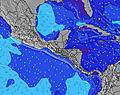 |  | 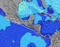 |  |  | 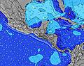 |  | ||||||||||||||
Onda Altezza (m) Direzione Periodo (s) | SSW 12 | SSW 14 | SSW 14 | S 14 | SSW 13 | SSW 13 | SSW 13 | SSW 13 | S 13 | S 14 | SSW 12 | SSW 12 | SSW 12 | SSW 13 | SSW 13 | SSW 13 | SSW 13 | S 13 | S 13 | S 12 | SSW 12 | SSW 12 | SSW 12 |
Grafico delle onde | |||||||||||||||||||||||
206 | 366 | 289 | 232 | 312 | 181 | 232 | 178 | 355 | 200 | 240 | 164 | 164 | 339 | 298 | 303 | 367 | 355 | 361 | 309 | 248 | 248 | 248 | |
Vento (km/h) | |||||||||||||||||||||||
Stato del vento onshore cross-onshore cross-shore cross-offshore offshore piatto | cross-off | cross-off | cross-off | cross-off | glassy | cross-off | cross-off | cross-off | cross-off | cross-off | cross-off | cross | cross-on | glassy | cross-off | cross-off | cross-off | cross-off | cross-off | glassy | off | cross-off | cross-off |
Alta Marea | 4:39AM2.36m | 4:54PM2.32m | 5:27AM2.36m | 5:42PM2.22m | 6:14AM2.31m | 6:31PM2.10m | |||||||||||||||||
Basso Marea | 10:47AM0.15m | 11:09PM0.01m | 11:38AM0.20m | 11:55PM0.10m | 12:28PM0.27m | ||||||||||||||||||
5:28 | — | — | — | — | — | — | — | 5:28 | — | — | — | — | — | — | — | 5:30 | — | — | — | — | — | — | |
— | — | — | — | — | 6:07 | — | — | — | — | — | — | — | 6:07 | — | — | — | — | — | — | — | 6:07 | — | |
mm | — | — | — | — | — | — | — | — | — | — | — | — | — | 1 | — | — | — | — | — | — | — | — | — |
Temp. °C | 26 | 26 | 28 | 31 | 30 | 29 | 27 | 26 | 26 | 26 | 28 | 29 | 29 | 28 | 26 | 26 | 25 | 25 | 28 | 30 | 31 | 29 | 27 |
Gelo °C | 28 | 28 | 30 | 35 | 35 | 34 | 30 | 29 | 29 | 29 | 31 | 32 | 32 | 32 | 29 | 29 | 28 | 28 | 31 | 34 | 34 | 33 | 28 |
Onda 1 Altezza (m) Direzione Periodo (s) | SSW 12 | SSW 14 | SSW 14 | S 14 | SSW 13 | SSW 13 | SSW 13 | SSW 13 | S 13 | S 14 | SSW 12 | SSW 12 | SSW 12 | SSW 13 | SSW 13 | SSW 13 | SSW 13 | S 13 | S 13 | S 12 | SSW 12 | SSW 12 | SSW 12 |
206 | 366 | 289 | 232 | 312 | 181 | 232 | 178 | 355 | 200 | 240 | 164 | 164 | 339 | 298 | 303 | 367 | 355 | 361 | 309 | 248 | 248 | 248 | |
Onda 2 Altezza (m) Direzione Periodo (s) | SW 15 | SW 15 | SW 15 | SW 12 | SW 15 | SW 15 | SSE 7 | SW 14 | SW 13 | S 12 | S 14 | S 14 | S 14 | S 6 | S 7 | S 7 | S 7 | S 7 | S 7 | SSW 7 | SSW 7 | SSW 7 | SSW 6 |
104 | 104 | 75 | 68 | 75 | 75 | 15 | 167 | 61 | 106 | 150 | 150 | 146 | 21 | 24 | 34 | 45 | 47 | 44 | 48 | 47 | 45 | 44 | |
Onda 3 Altezza (m) Direzione Periodo (s) | SSW 15 | SW 19 | SW 19 | SW 15 | SW 20 | SSW 16 | SW 15 | S 7 | SW 17 | SW 13 | SW 18 | SW 19 | S 6 | SW 19 | SW 19 | SW 19 | SW 19 | SW 19 | SW 19 | SW 18 | SW 18 | SW 18 | SW 18 |
72 | 57 | 57 | 75 | 62 | 83 | 75 | 23 | 45 | 108 | 112 | 126 | 19 | 129 | 94 | 94 | 96 | 127 | 170 | 201 | 194 | 194 | 194 | |
onde vento Altezza (m) Direzione Periodo (s) | N 6 | NNE 3 | NE 3 | NNE 5 | — | — | — | N 5 | N 6 | N 6 | N 6 | — | — | — | — | — | — | — | — | — | — | — | — |
12 | 2 | 2 | 3 | — | — | — | 7 | 15 | 18 | 19 | — | — | — | — | — | — | — | — | — | — | — | — | |
Il più vicino Offshore or Glassy | |||||||||||||||||||||||
Distanza (km) | 0 | 1 | 0 | 0 | 0 | 0 | 0 | 0 | 0 | 0 | 0 | 11 | 26 | 0 | 0 | 0 | 0 | 0 | 0 | 0 | 0 | 0 | 0 |
Migliori previsioni per le condizioni d'onda in Guanacaste | |||||||||||||||||||||||
Migliori previsioni per le condizioni d'onda in Costa Rica | |||||||||||||||||||||||
Trova Onde Globale | |||||||||||||||||||||||
- Map Icons:
 Break
Break Live Wave Height (m)
 Live Wind Speed (km/h)
 Surf Rating (10 Max)
 Ocean Swells (m)
- Wind Speed (km/h)
Widget Free Surf-Forecast.com per il tuo sito
La relazione di surf / widget meteo è disponibile qui sotto per incorporare su siti esterni a titolo gratuito e fornisce una sintesi delle nostre Playa Pelada previsione surf. Basta prendere il frammento di codice html da noi fornito e copiarlo nel proprio sito. È possibile scegliere la lingua preferita e unità metriche / imperiali per il feed delle previsioni surf per soddisfare le esigenze degli utenti del vostro sito .... Clicca qui per ottenere il codice.
 Nearest