
Previsioni:

Previsione a breve termineper lo più asciutto. Warm (Max 26°C martedì pomeriggio, Min 17°C Lunedì notte). Vento sarà generalmente leggero. | ||||||||||||||||||||||||
Domenica 19 | Lunedì 20 | Martedì 21 | ||||||||||||||||||||||
2 AM | 5 AM | 8 AM | 11 AM | 2 PM | 5 PM | 8 PM | 11 PM | 2 AM | 5 AM | 8 AM | 11 AM | 2 PM | 5 PM | 8 PM | 11 PM | 2 AM | 5 AM | 8 AM | 11 AM | 2 PM | 5 PM | 8 PM | 11 PM | |
Mappa dell'altezza del moto ondoso |  | 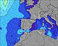 |  |  | 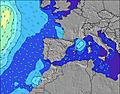 |  |  | 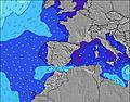 |  | |||||||||||||||
Onda Altezza (m) Direzione Periodo (s) | NNW 10 | NW 9 | NW 9 | NW 9 | NW 9 | N 5 | NNE 6 | NNE 6 | NNE 6 | NNE 7 | NNE 7 | NNE 7 | NE 8 | NE 8 | NE 8 | NE 8 | NE 8 | NE 7 | NE 7 | NE 7 | NE 7 | NE 7 | NE 8 | NE 8 |
Grafico delle onde | ||||||||||||||||||||||||
9 | 13 | 13 | 13 | 20 | 29 | 43 | 57 | 94 | 138 | 204 | 310 | 358 | 469 | 481 | 453 | 382 | 261 | 194 | 233 | 412 | 623 | 681 | 564 | |
Vento (km/h) | ||||||||||||||||||||||||
Stato del vento onshore cross-onshore cross-shore cross-offshore offshore piatto | cross-on | cross-on | cross-on | cross-on | on | on | on | cross-on | cross-on | glassy | glassy | on | on | on | on | cross-on | cross-on | cross | cross | cross-on | on | on | cross-on | cross-on |
Alta Marea | 8:54AM3.21m | 9:12PM3.40m | 9:40AM3.03m | 9:59PM3.11m | 10:28AM2.84m | 10:51PM2.84m | ||||||||||||||||||
Basso Marea | 2:41AM0.27m | 2:51PM0.48m | 3:25AM0.51m | 3:39PM0.71m | 4:12AM0.77m | 4:31PM0.94m | ||||||||||||||||||
— | 7:01 | — | — | — | — | — | — | — | 7:01 | — | — | — | — | — | — | — | 7:03 | — | — | — | — | — | — | |
— | — | — | — | — | — | 10:01 | — | — | — | — | — | — | — | 10:01 | — | — | — | — | — | — | — | 10:00 | — | |
mm | — | — | — | — | — | — | — | — | — | — | — | — | — | — | — | — | — | — | — | — | — | — | — | — |
Temp. °C | 18 | 18 | 18 | 23 | 25 | 24 | 23 | 20 | 19 | 18 | 18 | 23 | 25 | 25 | 22 | 18 | 17 | 17 | 17 | 24 | 26 | 25 | 23 | 18 |
Gelo °C | 19 | 19 | 19 | 24 | 25 | 24 | 23 | 22 | 21 | 20 | 20 | 24 | 25 | 24 | 21 | 18 | 17 | 17 | 17 | 23 | 24 | 23 | 22 | 18 |
Onda 1 Altezza (m) Direzione Periodo (s) | N 4 | N 4 | N 4 | NNE 4 | NW 9 | NW 8 | NW 8 | NNW 7 | NNE 6 | NNE 7 | NNE 7 | NNE 7 | NNW 8 | NNW 7 | NNW 8 | NE 8 | NE 8 | NE 7 | NE 7 | NE 7 | WNW 10 | WNW 10 | WNW 10 | WNW 10 |
2 | 3 | 5 | 11 | 20 | 23 | 31 | 31 | 94 | 138 | 204 | 310 | 22 | 21 | 6 | 453 | 382 | 261 | 194 | 233 | 10 | 10 | 10 | 10 | |
Onda 2 Altezza (m) Direzione Periodo (s) | NNW 10 | NW 9 | NW 9 | NW 9 | — | NW 8 | — | NW 8 | NNW 7 | NNW 7 | NNW 7 | NW 8 | NW 12 | NW 11 | WNW 11 | NNW 7 | WNW 11 | WNW 11 | WNW 11 | NNW 8 | — | — | — | — |
9 | 13 | 13 | 13 | — | 23 | — | 17 | 44 | 48 | 36 | 15 | 6 | 5 | 12 | 5 | 12 | 11 | 11 | 6 | — | — | — | — | |
Onda 3 Altezza (m) Direzione Periodo (s) | WNW 8 | W 8 | WNW 8 | WNW 8 | — | NNW 6 | — | N 13 | NW 13 | NW 13 | NW 12 | NW 12 | W 8 | — | — | NW 11 | — | — | NNW 8 | WNW 10 | — | — | — | — |
6 | 5 | 6 | 6 | — | 4 | — | 3 | 7 | 7 | 6 | 6 | 1 | — | — | 5 | — | — | 6 | 11 | — | — | — | — | |
onde vento Altezza (m) Direzione Periodo (s) | ENE 4 | ENE 4 | ENE 3 | — | N 5 | N 5 | NNE 6 | NNE 6 | — | — | — | — | NE 8 | NE 8 | NE 8 | — | — | — | — | — | NE 7 | NE 7 | NE 8 | NE 8 |
4 | 4 | 4 | — | 17 | 29 | 43 | 57 | — | — | — | — | 358 | 469 | 481 | — | — | — | — | — | 412 | 623 | 681 | 564 | |
Il più vicino Offshore or Glassy | ||||||||||||||||||||||||
Distanza (km) | 265 | 265 | 280 | 301 | 63 | 908 | 10 | 10 | 10 | 0 | 0 | 3 | 206 | 206 | 75 | 10 | 1 | 1 | 1 | 10 | 46 | 46 | 46 | 10 |
Migliori previsioni per le condizioni d'onda in Asturias | ||||||||||||||||||||||||
Migliori previsioni per le condizioni d'onda in Spain (Europe) | ||||||||||||||||||||||||
Trova Onde Globale | ||||||||||||||||||||||||
- Map Icons:
 Break
Break Live Wave Height (m)
 Live Wind Speed (km/h)
 Surf Rating (10 Max)
 Ocean Swells (m)
- Wind Speed (km/h)
Widget Free Surf-Forecast.com per il tuo sito
La relazione di surf / widget meteo è disponibile qui sotto per incorporare su siti esterni a titolo gratuito e fornisce una sintesi delle nostre Playa de Barayo previsione surf. Basta prendere il frammento di codice html da noi fornito e copiarlo nel proprio sito. È possibile scegliere la lingua preferita e unità metriche / imperiali per il feed delle previsioni surf per soddisfare le esigenze degli utenti del vostro sito .... Clicca qui per ottenere il codice.
 Nearest