
Previsioni:

Previsione a breve terminePioggia moderata (Totale 16mm), più pesante giovedì notte. Warm (Max 23°C Sabato pomeriggio, Min 16°C giovedì notte). Vento sarà generalmente leggero. | |||||||||||||||||||||
Gio 16 | Venerdì 17 | Sabato 18 | |||||||||||||||||||
11 AM | 2 PM | 5 PM | 8 PM | 11 PM | 2 AM | 5 AM | 8 AM | 11 AM | 2 PM | 5 PM | 8 PM | 11 PM | 2 AM | 5 AM | 8 AM | 11 AM | 2 PM | 5 PM | 8 PM | 11 PM | |
Mappa dell'altezza del moto ondoso |  |  |  | 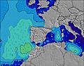 |  |  | 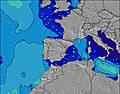 |  | |||||||||||||
Onda Altezza (m) Direzione Periodo (s) | WNW 8 | NNE 5 | NNE 5 | NNE 5 | WNW 9 | WNW 9 | WNW 8 | WNW 8 | WNW 8 | NW 4 | W 8 | W 8 | WNW 8 | N 5 | N 5 | NNE 5 | NNE 5 | N 5 | NNE 5 | NNE 5 | NNE 5 |
Grafico delle onde | |||||||||||||||||||||
7 | 8 | 9 | 8 | 8 | 7 | 7 | 7 | 7 | 7 | 5 | 5 | 6 | 9 | 9 | 9 | 9 | 8 | 14 | 14 | 10 | |
Vento (km/h) | |||||||||||||||||||||
Stato del vento onshore cross-onshore cross-shore cross-offshore offshore piatto | glassy | on | cross | cross-off | cross-off | cross-off | cross-off | cross-off | cross-on | cross-on | on | glassy | glassy | glassy | glassy | cross-off | cross | cross-on | cross-on | cross-on | cross |
Alta Marea | 6:57PM3.93m | 7:25AM3.50m | 7:42PM3.84m | 8:10AM3.38m | 8:27PM3.65m | ||||||||||||||||
Basso Marea | 12:35PM0.10m | 1:10AM-0.05m | 1:20PM0.14m | 1:56AM0.06m | 2:05PM0.27m | ||||||||||||||||
— | — | — | — | — | — | 6:58 | — | — | — | — | — | — | — | 6:58 | — | — | — | — | — | — | |
— | — | — | 10:02 | — | — | — | — | — | — | — | 10:02 | — | — | — | — | — | — | — | 10:01 | — | |
mm | — | — | 3 | 10 | 3 | — | — | — | — | — | — | — | — | — | — | — | — | — | — | — | — |
Temp. °C | 22 | 22 | 21 | 18 | 17 | 16 | 17 | 17 | 21 | 22 | 22 | 21 | 19 | 18 | 17 | 17 | 21 | 23 | 23 | 22 | 19 |
Gelo °C | 24 | 24 | 23 | 19 | 17 | 16 | 17 | 17 | 22 | 22 | 22 | 22 | 21 | 20 | 18 | 18 | 22 | 23 | 23 | 23 | 20 |
Onda 1 Altezza (m) Direzione Periodo (s) | NNE 4 | NNE 5 | NNE 5 | NNE 5 | NNE 5 | NNE 5 | NNE 5 | N 5 | N 4 | WNW 8 | N 4 | N 4 | N 5 | N 5 | N 5 | NNE 5 | NNE 5 | N 5 | WNW 8 | WNW 8 | NNE 5 |
4 | 8 | 9 | 8 | 5 | 5 | 4 | 4 | 3 | 7 | 1 | 3 | 5 | 9 | 9 | 9 | 9 | 8 | 7 | 7 | 8 | |
Onda 2 Altezza (m) Direzione Periodo (s) | WNW 8 | WNW 9 | WNW 9 | WNW 9 | WNW 9 | WNW 9 | WNW 8 | WNW 8 | WNW 8 | — | W 8 | WNW 3 | WNW 8 | WNW 8 | WNW 8 | WNW 8 | WNW 8 | WNW 8 | NW 11 | NW 10 | WNW 8 |
7 | 8 | 8 | 8 | 8 | 7 | 7 | 7 | 7 | — | 5 | 1 | 6 | 6 | 7 | 7 | 7 | 7 | 4 | 4 | 6 | |
Onda 3 Altezza (m) Direzione Periodo (s) | N 6 | N 6 | — | — | N 6 | — | — | N 5 | — | — | N 5 | W 8 | — | — | — | — | — | N 11 | — | — | NNW 10 |
3 | 1 | — | — | 1 | — | — | 1 | — | — | 1 | 5 | — | — | — | — | — | 2 | — | — | 10 | |
onde vento Altezza (m) Direzione Periodo (s) | — | — | — | — | — | — | — | WNW 3 | WNW 3 | NW 4 | NW 3 | — | — | — | — | — | — | — | NNE 5 | NNE 5 | — |
— | — | — | — | — | — | — | 3 | 4 | 7 | 2 | — | — | — | — | — | — | — | 14 | 14 | — | |
Il più vicino Offshore or Glassy | |||||||||||||||||||||
Distanza (km) | 251 | 955 | 955 | 954 | 766 | 781 | 603 | 603 | 913 | 1481 | 1009 | 998 | 687 | 710 | 931 | 1318 | 1318 | 1062 | 309 | ||
Migliori previsioni per le condizioni d'onda in Asturias | |||||||||||||||||||||
Migliori previsioni per le condizioni d'onda in Spain (Europe) | |||||||||||||||||||||
Trova Onde Globale | |||||||||||||||||||||
- Map Icons:
 Break
Break Live Wave Height (m)
 Live Wind Speed (km/h)
 Surf Rating (10 Max)
 Ocean Swells (m)
- Wind Speed (km/h)
Widget Free Surf-Forecast.com per il tuo sito
La relazione di surf / widget meteo è disponibile qui sotto per incorporare su siti esterni a titolo gratuito e fornisce una sintesi delle nostre Playa de San Pedro previsione surf. Basta prendere il frammento di codice html da noi fornito e copiarlo nel proprio sito. È possibile scegliere la lingua preferita e unità metriche / imperiali per il feed delle previsioni surf per soddisfare le esigenze degli utenti del vostro sito .... Clicca qui per ottenere il codice.
 Nearest