
Previsioni:

Previsione a breve termineper lo più asciutto. Warm (Max 34°C Venerdì pomeriggio, Min 27°C mercoledì notte). Principalmente venti freschi. | ||||||||||||||||||||||||
Giovedì 16 | Venerdì 17 | Sabato 18 | ||||||||||||||||||||||
9 PM | 12 AM | 3 AM | 6 AM | 9 AM | 12 PM | 3 PM | 6 PM | 9 PM | 12 AM | 3 AM | 6 AM | 9 AM | 12 PM | 3 PM | 6 PM | 9 PM | 12 AM | 3 AM | 6 AM | 9 AM | 12 PM | 3 PM | 6 PM | |
Mappa dell'altezza del moto ondoso |  |  | 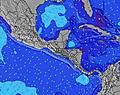 |  |  | 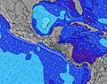 |  |  | 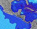 | 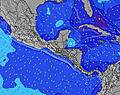 | ||||||||||||||
Onda Altezza (m) Direzione Periodo (s) | SW 16 | SW 16 | SW 16 | SW 16 | SW 16 | SSW 13 | SW 13 | SW 13 | SW 14 | SW 15 | SW 15 | SSW 15 | SSW 15 | SSW 15 | SSW 15 | SSW 13 | SSW 13 | SSW 13 | SSW 13 | SSW 13 | SSW 14 | SW 13 | SW 13 | SW 13 |
Grafico delle onde | ||||||||||||||||||||||||
367 | 206 | 206 | 206 | 206 | 147 | 172 | 172 | 280 | 171 | 171 | 142 | 142 | 142 | 142 | 225 | 149 | 229 | 229 | 229 | 232 | 172 | 172 | 172 | |
Vento (km/h) | ||||||||||||||||||||||||
Stato del vento onshore cross-onshore cross-shore cross-offshore offshore piatto | off | off | off | off | off | cross-off | cross-off | off | off | off | off | off | off | off | cross-off | off | off | off | off | off | off | cross-off | cross-off | cross-off |
Alta Marea | 3:50AM2.43m | 4:05PM2.56m | 4:40AM2.50m | 4:55PM2.49m | 5:29AM2.51m | 5:44PM2.39m | ||||||||||||||||||
Basso Marea | 9:36PM-0.04m | 9:55AM0.14m | 10:25PM-0.05m | 10:48AM0.15m | 11:12PM-0.01m | 11:40AM0.20m | ||||||||||||||||||
— | — | 5:28 | — | — | — | — | — | — | — | 5:28 | — | — | — | — | — | — | — | 5:30 | — | — | — | — | — | |
— | — | — | — | — | — | — | 6:14 | — | — | — | — | — | — | — | 6:14 | — | — | — | — | — | — | — | 6:14 | |
mm | — | — | — | — | — | — | — | — | — | — | — | — | — | — | — | — | — | — | — | — | — | — | — | — |
Temp. °C | 28 | 27 | 27 | 27 | 30 | 33 | 33 | 30 | 28 | 28 | 28 | 27 | 29 | 33 | 34 | 31 | 29 | 28 | 28 | 27 | 30 | 33 | 33 | 31 |
Gelo °C | 27 | 26 | 26 | 26 | 28 | 31 | 31 | 29 | 27 | 27 | 27 | 25 | 27 | 30 | 32 | 29 | 27 | 27 | 28 | 27 | 27 | 31 | 32 | 31 |
Onda 1 Altezza (m) Direzione Periodo (s) | SW 16 | SW 16 | SW 16 | SSW 13 | SSW 13 | SSW 13 | SW 13 | SW 13 | SW 14 | SW 15 | SW 15 | SSW 15 | SSW 12 | SSW 15 | SSW 12 | SSW 13 | SSW 13 | SSW 13 | SSW 13 | SSW 13 | SSW 14 | SW 13 | SW 13 | SW 13 |
367 | 206 | 206 | 145 | 147 | 147 | 172 | 172 | 280 | 171 | 171 | 142 | 94 | 142 | 91 | 225 | 149 | 229 | 229 | 229 | 232 | 172 | 172 | 172 | |
Onda 2 Altezza (m) Direzione Periodo (s) | S 7 | SSW 13 | SSW 13 | SW 16 | SW 16 | SW 16 | SW 16 | SW 16 | SW 20 | SSW 12 | SSW 12 | SSW 12 | SSW 15 | SW 12 | SSW 15 | SW 21 | SW 15 | SW 21 | SW 17 | SSW 17 | SW 20 | SW 18 | SW 19 | SW 19 |
4 | 108 | 108 | 206 | 206 | 125 | 125 | 66 | 16 | 96 | 96 | 94 | 142 | 67 | 142 | 69 | 77 | 18 | 43 | 28 | 65 | 119 | 125 | 127 | |
Onda 3 Altezza (m) Direzione Periodo (s) | SW 22 | SW 22 | SW 21 | SW 21 | ESE 5 | SW 21 | SW 21 | SW 20 | SSW 20 | SSW 20 | SW 19 | SW 19 | SW 19 | SW 19 | SW 19 | SW 15 | SW 21 | SSW 16 | ESE 5 | S 7 | S 7 | SSW 15 | SSW 15 | SSW 15 |
19 | 18 | 18 | 18 | 3 | 17 | 17 | 16 | 38 | 38 | 58 | 57 | 57 | 57 | 57 | 33 | 69 | 50 | 2 | 4 | 4 | 42 | 42 | 42 | |
onde vento Altezza (m) Direzione Periodo (s) | ENE 3 | E 3 | ENE 3 | ENE 4 | ENE 4 | E 4 | E 4 | E 4 | E 3 | ENE 3 | ENE 3 | ENE 3 | ENE 3 | ENE 3 | ENE 4 | ENE 3 | ENE 3 | ENE 3 | NE 3 | NE 3 | ENE 3 | E 3 | E 3 | E 3 |
8 | 8 | 9 | 13 | 10 | 12 | 13 | 12 | 5 | 8 | 9 | 7 | 9 | 9 | 13 | 8 | 6 | 7 | 6 | 5 | 7 | 8 | 5 | 8 | |
Il più vicino Offshore or Glassy | ||||||||||||||||||||||||
Distanza (km) | 132 | 0 | 0 | 0 | 132 | 132 | 126 | 132 | 0 | 0 | 0 | 57 | 132 | 126 | 132 | 132 | 0 | 0 | 0 | 0 | 57 | 126 | 126 | 140 |
Migliori previsioni per le condizioni d'onda in Leon Province | ||||||||||||||||||||||||
Migliori previsioni per le condizioni d'onda in Nicaragua | ||||||||||||||||||||||||
Trova Onde Globale | ||||||||||||||||||||||||
- Map Icons:
 Break
Break Live Wave Height (m)
 Live Wind Speed (km/h)
 Surf Rating (10 Max)
 Ocean Swells (m)
- Wind Speed (km/h)
Widget Free Surf-Forecast.com per il tuo sito
La relazione di surf / widget meteo è disponibile qui sotto per incorporare su siti esterni a titolo gratuito e fornisce una sintesi delle nostre Pochomil Viejo previsione surf. Basta prendere il frammento di codice html da noi fornito e copiarlo nel proprio sito. È possibile scegliere la lingua preferita e unità metriche / imperiali per il feed delle previsioni surf per soddisfare le esigenze degli utenti del vostro sito .... Clicca qui per ottenere il codice.
 Nearest