
Previsioni:

Previsione a breve terminepioggia leggera (Totale 8mm), per lo più che cade martedì pomeriggio. Warm (Max 26°C martedì pomeriggio, Min 16°C mercoledì notte). Venti decrescenti (raffiche di vento da SW martedì mattina, venti deboli da NW per mercoledì notte). | |||||||||||||||||||
Lun 20 | Martedì 21 | Mercoledì 22 | |||||||||||||||||
5 PM | 8 PM | 11 PM | 2 AM | 5 AM | 8 AM | 11 AM | 2 PM | 5 PM | 8 PM | 11 PM | 2 AM | 5 AM | 8 AM | 11 AM | 2 PM | 5 PM | 8 PM | 11 PM | |
Mappa dell'altezza del moto ondoso | 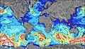 | 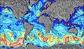 | 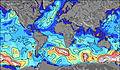 | 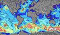 |  |  |  | ||||||||||||
Onda Altezza (m) Direzione Periodo (s) | SSW 2 | SSW 2 | SSE 3 | SSW 4 | SSW 6 | SW 7 | SW 7 | SW 7 | SW 7 | SW 6 | SW 5 | WSW 5 | NW 4 | NW 4 | NW 4 | NW 4 | NNW 4 | NNW 3 | NNW 3 |
Grafico delle onde | |||||||||||||||||||
1 | 1 | 1 | 27 | 176 | 374 | 554 | 440 | 220 | 60 | 13 | 2 | 0 | 0 | 0 | 0 | 0 | 0 | 0 | |
Vento (km/h) | |||||||||||||||||||
Stato del vento onshore cross-onshore cross-shore cross-offshore offshore piatto | cross-on | on | on | on | on | cross-on | cross-on | cross-on | cross-on | cross-off | cross-off | cross-off | cross-off | cross-off | cross | cross | cross-off | cross-off | cross-off |
Alta Marea | |||||||||||||||||||
Basso Marea | |||||||||||||||||||
— | — | — | — | 6:03 | — | — | — | — | — | — | — | 6:03 | — | — | — | — | — | — | |
— | 8:54 | — | — | — | — | — | — | — | 8:53 | — | — | — | — | — | — | — | 8:52 | — | |
mm | — | — | — | — | — | — | — | 3 | 3 | 2 | — | — | — | — | — | — | — | — | — |
Temp. °C | 24 | 23 | 23 | 23 | 24 | 24 | 24 | 25 | 26 | 24 | 20 | 17 | 17 | 17 | 18 | 20 | 22 | 20 | 17 |
Gelo °C | 22 | 22 | 22 | 22 | 21 | 20 | 18 | 21 | 23 | 23 | 17 | 13 | 12 | 14 | 13 | 15 | 17 | 15 | 14 |
Onda 1 Altezza (m) Direzione Periodo (s) | — | — | — | — | — | — | — | — | — | SW 6 | SW 5 | WSW 5 | — | — | — | — | — | — | — |
— | — | — | — | — | — | — | — | — | 60 | 13 | 2 | — | — | — | — | — | — | — | |
Onda 2 Altezza (m) Direzione Periodo (s) | — | — | — | — | — | — | — | — | — | — | — | — | — | — | — | — | — | — | — |
— | — | — | — | — | — | — | — | — | — | — | — | — | — | — | — | — | — | — | |
Onda 3 Altezza (m) Direzione Periodo (s) | — | — | — | — | — | — | — | — | — | — | — | — | — | — | — | — | — | — | — |
— | — | — | — | — | — | — | — | — | — | — | — | — | — | — | — | — | — | — | |
onde vento Altezza (m) Direzione Periodo (s) | SSW 2 | SSW 2 | SSE 3 | SSW 4 | SSW 6 | SW 7 | SW 7 | SW 7 | SW 7 | WNW 4 | NW 4 | NW 4 | NW 4 | NW 4 | NW 4 | NW 4 | NNW 4 | NNW 3 | NNW 3 |
1 | 1 | 1 | 27 | 176 | 374 | 554 | 440 | 220 | 8 | 16 | 27 | 23 | 21 | 18 | 17 | 9 | 6 | 2 | |
Il più vicino Offshore or Glassy | |||||||||||||||||||
Distanza (km) | 930 | 1292 | 1406 | 596 | 1371 | 1181 | 1803 | 1803 | 1664 | 1803 | 765 | 1272 | 751 | 754 | 610 | 613 | 613 | 378 | 383 |
Migliori previsioni per le condizioni d'onda in Lake Erie - Canada | |||||||||||||||||||
Migliori previsioni per le condizioni d'onda in Canada | |||||||||||||||||||
Trova Onde Globale | |||||||||||||||||||
- Map Icons:
 Break
Break Live Wave Height (m)
 Live Wind Speed (km/h)
 Surf Rating (10 Max)
 Ocean Swells (m)
- Wind Speed (km/h)
Widget Free Surf-Forecast.com per il tuo sito
La relazione di surf / widget meteo è disponibile qui sotto per incorporare su siti esterni a titolo gratuito e fornisce una sintesi delle nostre Point Burwell previsione surf. Basta prendere il frammento di codice html da noi fornito e copiarlo nel proprio sito. È possibile scegliere la lingua preferita e unità metriche / imperiali per il feed delle previsioni surf per soddisfare le esigenze degli utenti del vostro sito .... Clicca qui per ottenere il codice.
 Nearest