
Previsioni:

Previsione a breve terminepioggia leggera (Totale 9mm), per lo più che cade martedì mattina. Very mild (Max 18°C giovedì pomeriggio, Min 14°C martedì mattina). Vento sarà generalmente leggero. | |||||||||||||||||||||||
Martedì 28 | Mercoledì 29 | Giovedì 30 | |||||||||||||||||||||
5 AM | 8 AM | 11 AM | 2 PM | 5 PM | 8 PM | 11 PM | 2 AM | 5 AM | 8 AM | 11 AM | 2 PM | 5 PM | 8 PM | 11 PM | 2 AM | 5 AM | 8 AM | 11 AM | 2 PM | 5 PM | 8 PM | 11 PM | |
Mappa dell'altezza del moto ondoso | 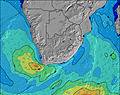 |  |  |  | 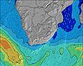 |  |  | 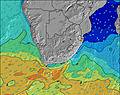 |  | ||||||||||||||
Onda Altezza (m) Direzione Periodo (s) | SSW 16 | SSW 15 | SSW 15 | SSW 15 | SW 14 | SW 14 | SW 14 | SW 14 | SW 14 | SW 13 | SW 13 | SW 13 | SW 14 | SSW 13 | SSW 13 | SSW 13 | SW 13 | SW 13 | SW 13 | SW 13 | SW 13 | SW 13 | SW 13 |
Grafico delle onde | |||||||||||||||||||||||
5747 | 5052 | 4326 | 3933 | 2708 | 2554 | 2356 | 2141 | 1788 | 1613 | 1387 | 1327 | 1347 | 1444 | 1444 | 1444 | 1327 | 1308 | 1127 | 1110 | 1011 | 1011 | 1011 | |
Vento (km/h) | |||||||||||||||||||||||
Stato del vento onshore cross-onshore cross-shore cross-offshore offshore piatto | cross | cross-on | cross-on | cross-on | cross-on | cross-on | cross-on | cross-on | cross-on | cross-on | cross-on | cross-on | cross-on | on | on | cross-on | cross-on | cross-on | cross-on | cross-on | cross-on | cross-on | on |
Alta Marea | 3:33PM1.44m | 3:37AM1.50m | 4:02PM1.53m | 4:06AM1.55m | 4:31PM1.59m | ||||||||||||||||||
Basso Marea | 9:22AM0.24m | 9:34PM0.31m | 9:50AM0.16m | 10:04PM0.25m | 10:17AM0.10m | 10:34PM0.20m | |||||||||||||||||
7:16 | — | — | — | — | — | — | — | 7:15 | — | — | — | — | — | — | — | 7:13 | — | — | — | — | — | — | |
— | — | — | — | 5:37 | — | — | — | — | — | — | — | 5:37 | — | — | — | — | — | — | — | 5:37 | — | — | |
mm | — | 1 | 1 | 1 | 1 | 1 | 1 | — | 1 | 1 | 1 | — | — | — | — | — | — | — | — | — | — | — | — |
Temp. °C | 16 | 15 | 14 | 15 | 15 | 14 | 14 | 14 | 14 | 14 | 15 | 16 | 16 | 15 | 14 | 14 | 14 | 14 | 16 | 18 | 17 | 15 | 15 |
Gelo °C | 12 | 12 | 11 | 10 | 10 | 11 | 10 | 11 | 11 | 11 | 9 | 11 | 12 | 12 | 12 | 12 | 13 | 13 | 13 | 13 | 12 | 11 | 12 |
Onda 1 Altezza (m) Direzione Periodo (s) | SSW 16 | SSW 15 | SSW 15 | SSW 15 | SW 14 | SW 14 | SW 14 | SW 14 | SW 14 | SW 13 | SW 13 | SW 13 | SW 14 | SSW 13 | SSW 13 | SSW 13 | SW 13 | SW 13 | SW 13 | SW 13 | SW 13 | SW 13 | SW 13 |
5747 | 5052 | 4326 | 3933 | 2708 | 2554 | 2356 | 2141 | 1788 | 1613 | 1387 | 1327 | 1347 | 1444 | 1444 | 1444 | 1327 | 1308 | 1127 | 1110 | 1011 | 1011 | 1011 | |
Onda 2 Altezza (m) Direzione Periodo (s) | E 10 | E 9 | ENE 9 | — | — | SSE 8 | — | — | — | — | — | — | SSW 15 | E 9 | ESE 7 | ESE 8 | ESE 8 | ESE 9 | ESE 9 | — | — | — | — |
7 | 7 | 15 | — | — | 140 | — | — | — | — | — | — | 627 | 80 | 261 | 291 | 336 | 371 | 427 | — | — | — | — | |
Onda 3 Altezza (m) Direzione Periodo (s) | — | — | — | — | — | — | — | — | — | — | — | — | — | — | — | — | — | — | — | — | — | — | — |
— | — | — | — | — | — | — | — | — | — | — | — | — | — | — | — | — | — | — | — | — | — | — | |
onde vento Altezza (m) Direzione Periodo (s) | — | — | — | SE 8 | SE 8 | SE 6 | SE 6 | ESE 6 | ESE 6 | ESE 7 | ESE 7 | ESE 8 | ESE 7 | ESE 7 | — | — | — | — | — | ESE 9 | ESE 9 | E 9 | E 10 |
— | — | — | 382 | 403 | 239 | 245 | 231 | 249 | 317 | 456 | 540 | 482 | 349 | — | — | — | — | — | 432 | 451 | 577 | 580 | |
Il più vicino Offshore or Glassy | |||||||||||||||||||||||
Distanza (km) | 172 | 180 | 198 | 198 | 198 | 198 | 198 | 180 | 172 | 180 | 183 | 446 | 198 | 198 | 30 | 1 | 1 | 1 | 30 | 352 | 352 | 198 | 30 |
Migliori previsioni per le condizioni d'onda in Eastern Cape (South) | |||||||||||||||||||||||
Migliori previsioni per le condizioni d'onda in South Africa | |||||||||||||||||||||||
Trova Onde Globale | |||||||||||||||||||||||
- Map Icons:
 Break
Break Live Wave Height (m)
 Live Wind Speed (km/h)
 Surf Rating (10 Max)
 Ocean Swells (m)
- Wind Speed (km/h)
Widget Free Surf-Forecast.com per il tuo sito
La relazione di surf / widget meteo è disponibile qui sotto per incorporare su siti esterni a titolo gratuito e fornisce una sintesi delle nostre Point previsione surf. Basta prendere il frammento di codice html da noi fornito e copiarlo nel proprio sito. È possibile scegliere la lingua preferita e unità metriche / imperiali per il feed delle previsioni surf per soddisfare le esigenze degli utenti del vostro sito .... Clicca qui per ottenere il codice.
 Nearest