
Previsioni:

Aggiornamento in hr min s Forecast update imminent
Previsione a breve termineper lo più asciutto. Warm (Max 25°C Venerdì pomeriggio, Min 24°C Venerdì mattina). Principalmente venti freschi. | ||||||||||||||||||||||||
Ven 3 | Sabato 4 | Domenica 5 | Lun 6 | |||||||||||||||||||||
10 AM | 1 PM | 4 PM | 7 PM | 10 PM | 1 AM | 4 AM | 7 AM | 10 AM | 1 PM | 4 PM | 7 PM | 10 PM | 1 AM | 4 AM | 7 AM | 10 AM | 1 PM | 4 PM | 7 PM | 10 PM | 1 AM | 4 AM | 7 AM | |
Mappa dell'altezza del moto ondoso |  |  | 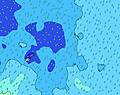 | 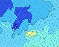 | 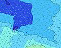 |  | 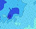 | 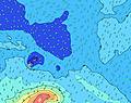 |  | |||||||||||||||
Onda Altezza (m) Direzione Periodo (s) | NE 9 | NE 9 | NE 9 | NE 9 | NE 9 | NE 9 | NE 9 | NE 8 | E 7 | E 7 | NE 8 | NE 8 | NE 8 | NE 8 | E 7 | E 8 | E 9 | E 8 | ENE 8 | ENE 8 | ENE 8 | ENE 9 | NE 8 | NE 8 |
Grafico delle onde | ||||||||||||||||||||||||
21 | 21 | 20 | 20 | 20 | 20 | 19 | 18 | 47 | 36 | 18 | 18 | 18 | 18 | 27 | 28 | 39 | 37 | 22 | 21 | 22 | 16 | 18 | 18 | |
Vento (km/h) | ||||||||||||||||||||||||
Stato del vento onshore cross-onshore cross-shore cross-offshore offshore piatto | off | off | off | off | off | off | off | off | off | off | off | off | off | off | cross-off | cross-off | cross-off | off | off | off | cross-off | cross-off | cross-off | cross-off |
Alta Marea | 9:17AM0.92m | 9:52PM0.83m | 9:59AM0.90m | 10:36PM0.85m | 10:45AM0.88m | 11:24PM0.87m | ||||||||||||||||||
Basso Marea | 3:36PM0.23m | 3:42AM0.31m | 4:16PM0.25m | 4:30AM0.31m | 5:00PM0.25m | 5:25AM0.31m | ||||||||||||||||||
6:48 | — | — | — | — | — | 6:48 | — | — | — | — | — | — | — | 6:48 | — | — | — | — | — | — | — | 6:48 | — | |
— | — | 6:06 | — | — | — | — | — | — | — | 6:06 | — | — | — | — | — | — | — | 6:07 | — | — | — | — | 6:07 | |
mm | — | — | — | — | — | — | — | — | — | — | — | — | — | — | — | — | — | — | — | — | — | — | — | — |
Temp. °C | 24 | 24 | 24 | 25 | 24 | 24 | 24 | 24 | 24 | 24 | 24 | 24 | 24 | 24 | 24 | 24 | 24 | 24 | 24 | 24 | 24 | 24 | 24 | 24 |
Gelo °C | 21 | 21 | 21 | 22 | 21 | 22 | 22 | 21 | 21 | 21 | 21 | 22 | 22 | 22 | 22 | 22 | 22 | 21 | 21 | 20 | 20 | 21 | 21 | 21 |
Onda 1 Altezza (m) Direzione Periodo (s) | SSW 14 | SSW 14 | SSW 13 | S 13 | S 13 | SSE 13 | SSE 13 | SSE 13 | E 7 | E 7 | SSE 12 | S 12 | SSE 12 | SSE 12 | S 11 | S 11 | S 11 | SSE 11 | S 11 | S 11 | SSE 11 | SSE 11 | SSE 10 | SSE 10 |
327 | 247 | 239 | 225 | 289 | 1236 | 1316 | 1316 | 47 | 36 | 1064 | 911 | 819 | 718 | 596 | 565 | 555 | 494 | 403 | 338 | 245 | 240 | 184 | 320 | |
Onda 2 Altezza (m) Direzione Periodo (s) | SW 14 | SW 14 | NE 9 | NE 9 | NE 9 | S 14 | S 15 | S 16 | S 15 | NE 8 | SSW 14 | E 6 | SSW 14 | SSW 14 | E 7 | E 8 | NE 8 | E 8 | ENE 8 | ENE 8 | ENE 8 | NNE 8 | NE 8 | NE 8 |
66 | 46 | 20 | 20 | 20 | 192 | 218 | 179 | 157 | 18 | 66 | 22 | 63 | 61 | 27 | 28 | 11 | 37 | 22 | 21 | 22 | 7 | 18 | 18 | |
Onda 3 Altezza (m) Direzione Periodo (s) | NE 9 | NE 9 | SW 13 | ENE 7 | SW 13 | NE 9 | NE 9 | NE 8 | NE 8 | SSW 15 | NE 8 | NE 8 | NE 8 | NE 8 | SSW 14 | NE 9 | ESE 10 | SSW 14 | NE 9 | NE 9 | SSW 14 | ENE 9 | ENE 9 | S 12 |
21 | 21 | 46 | 11 | 45 | 20 | 19 | 18 | 18 | 42 | 18 | 18 | 18 | 18 | 63 | 12 | 10 | 36 | 12 | 12 | 39 | 16 | 8 | 12 | |
onde vento Altezza (m) Direzione Periodo (s) | SSE 13 | SSE 13 | SSE 13 | SSE 13 | SSE 13 | — | — | — | S 12 | S 12 | — | — | — | — | — | — | E 9 | — | SE 4 | SE 5 | SE 6 | SE 6 | SE 6 | ESE 7 |
1295 | 1295 | 1275 | 1236 | 1236 | — | — | — | 1116 | 1065 | — | — | — | — | — | — | 39 | — | 34 | 60 | 119 | 161 | 184 | 135 | |
Il più vicino Offshore or Glassy | ||||||||||||||||||||||||
Distanza (km) | 885 | 885 | 885 | 2088 | 1335 | 664 | 885 | 885 | 885 | 1328 | 885 | 885 | 885 | 604 | 604 | 604 | 213 | 604 | 885 | 886 | 888 | 1220 | 886 | 1220 |
Migliori previsioni per le condizioni d'onda in American-Samoa - Tutuila | ||||||||||||||||||||||||
Migliori previsioni per le condizioni d'onda in American Samoa | ||||||||||||||||||||||||
Trova Onde Globale | ||||||||||||||||||||||||
- Map Icons:
 Break
Break Live Wave Height (m)
 Live Wind Speed (km/h)
 Surf Rating (10 Max)
 Ocean Swells (m)
- Wind Speed (km/h)
Widget Free Surf-Forecast.com per il tuo sito
La relazione di surf / widget meteo è disponibile qui sotto per incorporare su siti esterni a titolo gratuito e fornisce una sintesi delle nostre Poloa previsione surf. Basta prendere il frammento di codice html da noi fornito e copiarlo nel proprio sito. È possibile scegliere la lingua preferita e unità metriche / imperiali per il feed delle previsioni surf per soddisfare le esigenze degli utenti del vostro sito .... Clicca qui per ottenere il codice.
 Nearest