
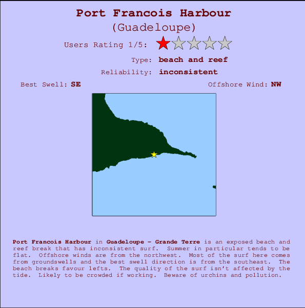
Port Francois Harbour Surf Guide
Port Francois Harbour in Grande Terre is an exposed beach and reef break that only works once in a while. Summer in particular tends to be flat. Works best in offshore winds from the northwest. Waves just as likely from local windswells as from distant groundswells and the best swell direction is from the southeast. The beach break offers both left and right hand waves. Good surf at all stages of the tide. Often Crowded. Beware of urchins and pollution.
Port Francois Harbour Spot Info
| Type: | Rating: | Reliability: | Todays Sea Temp*: |
|---|---|---|---|
| inconsistent | 28.0°C*ocean temperature recorded from satellite |
Surfing Port Francois Harbour:
The best conditions reported for surf at Port Francois Harbour occur when a Southeast swell combines with an offshore wind direction from the Northwest.

Previsioni Energia d'onda (Potenza): 12hrs


Port Francois Harbour Surf:
Wednesday, 15 July 2026, 11:15 Local time| Mercoledì 15 | ||||
| 11AM | 2PM | 5PM | 8PM | |
| Wave (m) | ||||
| Periodo (s) | 7 | 7 | 7 | 7 |
| Vento (km/h) | ||||
| Stato del vento | cross- on |
cross- on |
cross- on |
cross- on |
- /breaks/Port-Francois-Harbour/forecasts/latest
Port Francois Harbour Surf Guide
Port Francois Harbour in Grande Terre is an exposed beach and reef break that only works once in a while. Summer in particular tends to be flat. Works best in offshore winds from the northwest. Waves just as likely from local windswells as from distant groundswells and the best swell direction is from the southeast. The beach break offers both left and right hand waves. Good surf at all stages of the tide. Often Crowded. Beware of urchins and pollution.
Port Francois Harbour Spot Info
Type: Rating: Reliability: Todays Sea Temp*:  Beach and reef
 1
1inconsistent 28.0°C*ocean temperature recorded from satelliteSurfing Port Francois Harbour:
The best conditions reported for surf at Port Francois Harbour occur when a Southeast swell combines with an offshore wind direction from the Northwest.
Previsioni Energia d'onda (Potenza): 12hrs
Utilizzare la scheda di navigazione in alto per visualizzare Port Francois Harbour temperatura del mare, Port Francois Harbour fotografie, Port Francois Harbour dettagliate previsioni onde, il vento e le previsioni meteo, Port Francois Harbour webcam, vento corrente da Grande Terre stazioni meteo e Port Francois Harbour previsioni marea. Il link Guadeloupe mappe maree apre l'immagine grande, che mostra Guadeloupe e dei mari circostanti. Queste mappe possono essere animate per mostrare le diverse componenti del moto ondoso, energia delle onde, periodo d'onda, altezza delle onde, insieme con le previsioni del vento e meteo, meteo corrente e osservazioni sullo stato del mare dal Guadeloupe onda-boe, le navi passanti e stazioni meteo costiere. Ciascuna delle pagine di previsioni per questo surf break rappresenta uno strumento di wavefinder globale e regionale per individuare le migliori condizioni di surf nella zona intorno Port Francois Harbour.
Port Francois Harbour Surf:
Wednesday, 15 July 2026, 11:15 Local timeMercoledì 15 11AM 2PM 5PM 8PM Wave (m) Periodo (s) 7 7 7 7 Vento (km/h) Stato del vento cross-
oncross-
oncross-
oncross-
on- /breaks/Port-Francois-Harbour/forecasts/latest
- /breaks/Port-Francois-Harbour/forecasts/latest/six_day
Port Francois Harbour Surf Guide
Port Francois Harbour in Grande Terre is an exposed beach and reef break that only works once in a while. Summer in particular tends to be flat. Works best in offshore winds from the northwest. Waves just as likely from local windswells as from distant groundswells and the best swell direction is from the southeast. The beach break offers both left and right hand waves. Good surf at all stages of the tide. Often Crowded. Beware of urchins and pollution.
Port Francois Harbour Spot Info
Type: Rating: Reliability: Todays Sea Temp*: Beach and reef1inconsistent 28.0°C*ocean temperature recorded from satelliteSurfing Port Francois Harbour:
The best conditions reported for surf at Port Francois Harbour occur when a Southeast swell combines with an offshore wind direction from the Northwest.
Previsioni Energia d'onda (Potenza): 12hrs
Utilizzare la scheda di navigazione in alto per visualizzare Port Francois Harbour temperatura del mare, Port Francois Harbour fotografie, Port Francois Harbour dettagliate previsioni onde, il vento e le previsioni meteo, Port Francois Harbour webcam, vento corrente da Grande Terre stazioni meteo e Port Francois Harbour previsioni marea. Il link Guadeloupe mappe maree apre l'immagine grande, che mostra Guadeloupe e dei mari circostanti. Queste mappe possono essere animate per mostrare le diverse componenti del moto ondoso, energia delle onde, periodo d'onda, altezza delle onde, insieme con le previsioni del vento e meteo, meteo corrente e osservazioni sullo stato del mare dal Guadeloupe onda-boe, le navi passanti e stazioni meteo costiere. Ciascuna delle pagine di previsioni per questo surf break rappresenta uno strumento di wavefinder globale e regionale per individuare le migliori condizioni di surf nella zona intorno Port Francois Harbour.
Port Francois Harbour Surf:
Wednesday, 15 July 2026, 11:15 Local timeMercoledì 15 11AM 2PM 5PM 8PM Wave (m) Periodo (s) 7 7 7 7 Vento (km/h) Stato del vento cross-
oncross-
oncross-
oncross-
on- /breaks/Port-Francois-Harbour/forecasts/latest
Port Francois Harbour Surf Guide
Port Francois Harbour in Grande Terre is an exposed beach and reef break that only works once in a while. Summer in particular tends to be flat. Works best in offshore winds from the northwest. Waves just as likely from local windswells as from distant groundswells and the best swell direction is from the southeast. The beach break offers both left and right hand waves. Good surf at all stages of the tide. Often Crowded. Beware of urchins and pollution.
Port Francois Harbour Spot Info
Type: Rating: Reliability: Todays Sea Temp*: Beach and reef1inconsistent 28.0°C*ocean temperature recorded from satelliteSurfing Port Francois Harbour:
The best conditions reported for surf at Port Francois Harbour occur when a Southeast swell combines with an offshore wind direction from the Northwest.
Previsioni Energia d'onda (Potenza): 12hrs
Utilizzare la scheda di navigazione in alto per visualizzare Port Francois Harbour temperatura del mare, Port Francois Harbour fotografie, Port Francois Harbour dettagliate previsioni onde, il vento e le previsioni meteo, Port Francois Harbour webcam, vento corrente da Grande Terre stazioni meteo e Port Francois Harbour previsioni marea. Il link Guadeloupe mappe maree apre l'immagine grande, che mostra Guadeloupe e dei mari circostanti. Queste mappe possono essere animate per mostrare le diverse componenti del moto ondoso, energia delle onde, periodo d'onda, altezza delle onde, insieme con le previsioni del vento e meteo, meteo corrente e osservazioni sullo stato del mare dal Guadeloupe onda-boe, le navi passanti e stazioni meteo costiere. Ciascuna delle pagine di previsioni per questo surf break rappresenta uno strumento di wavefinder globale e regionale per individuare le migliori condizioni di surf nella zona intorno Port Francois Harbour.
Port Francois Harbour Surf:
Wednesday, 15 July 2026, 11:15 Local timeMercoledì 15 11AM 2PM 5PM 8PM Wave (m) Periodo (s) 7 7 7 7 Vento (km/h) Stato del vento cross-
oncross-
oncross-
oncross-
onTide Times:
Per Saint-Francois, %{dist} %{km} da %{location}.
PROSSIMA È ALLE (ora locale) rimanente alta marea bassa marea Port Francois Harbour Tide Times and Tide Chart
Live Weather:
At 876, 17 km from Port Francois Harbour.
strong winds from the SE
(km/h)Air temperature
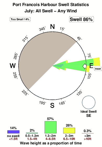
29.3°COverall Port Francois Harbour Surf Consistency and Wind Distribution in Luglio


Wind stats for Port Francois Harbour: see the variation in direction and stength by month.
foto dall' album
Contorni: Strade e fiumi: seleziona un surf break dal menu 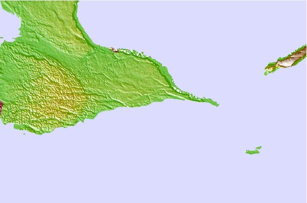
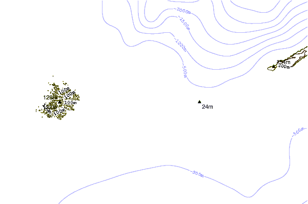
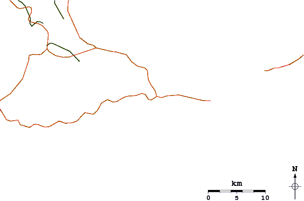
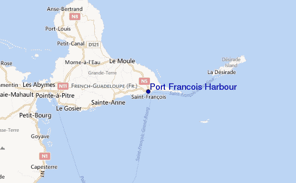
Utilizzare questa mappa sollievo per navigare Grande Terre surf breaks e stazioni di marea che si trovano nella zona diPort Francois Harbour
Altri surf breaks più vicini al Port Francois Harbour:
(clicca sul nome del luogo per maggiori informazioni)- Closest località surf3 mi
- Second closest località surf3 mi
- Third closest località surf4 mi
- Fourth closest località surf5 mi
- Fifth closest località surf5 mi
Onda boe più vicina a Port Francois Harbour:
- Closest Onda boa149 mi
- Second closest Onda boa268 mi
- Third closest Onda boa309 mi
- Fourth closest Onda boa353 mi
- Fifth closest Onda boa357 mi
Stazioni di marea più vicina alla Port Francois Harbour:
- Closest marea stazioneSaint-Francois1 mi
- Second closest marea stazioneSainte-Anne6 mi
- Third closest marea stazioneLe Moule7 mi
- Fourth closest marea stazioneBasse-Terre11 mi
- Fifth closest marea stazioneLe Gosier14 mi
Airports
- The closest passenger airport to Port Francois Harbour is Le Raizet (Pointe-a-pitre) Airport (PTP) in Antilles, 27 km (17 miles) away (directly).
- The second nearest airport to Port Francois Harbour is Melville Hall (Dominica) Airport (DOM) in Dominica, 79 km (49 miles) away.
- Third is Canefield Airport (DCF) in Dominica, 103 km (64 miles) away.
- V C Bird International (Antigua) Airport (ANU) in Leeward Islands is 113 km (70 miles) away.
- Le Lamentin (Fort-de-france) Airport (FDF) in Antilles is the fifth nearest airport to Port Francois Harbour and is 187 km (116 miles) away.
- /breaks/Port-Francois-Harbour/forecasts/latest

 Nearest