
Previsioni:

Previsione a breve terminePioggia abbondante (Totale 46mm), più pesante durante giovedì mattina. Warm (Max 28°C mercoledì mattina, Min 25°C mercoledì notte). Vento sarà generalmente leggero. | ||||||||||||||||||||||||
Mer 15 | Giovedì 16 | Venerdì 17 | 18 | |||||||||||||||||||||
9 AM | 12 PM | 3 PM | 6 PM | 9 PM | 12 AM | 3 AM | 6 AM | 9 AM | 12 PM | 3 PM | 6 PM | 9 PM | 12 AM | 3 AM | 6 AM | 9 AM | 12 PM | 3 PM | 6 PM | 9 PM | 12 AM | 3 AM | 6 AM | |
Mappa dell'altezza del moto ondoso |  |  |  | 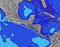 |  |  | 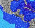 |  |  | |||||||||||||||
Onda Altezza (m) Direzione Periodo (s) | ENE 9 | ENE 9 | ENE 9 | ENE 9 | ENE 9 | ENE 9 | ENE 10 | ENE 10 | ENE 10 | ENE 10 | ENE 10 | ENE 10 | ENE 10 | ENE 10 | ENE 11 | ENE 11 | ENE 10 | ENE 10 | ENE 10 | ENE 10 | ENE 10 | ENE 10 | ENE 10 | ENE 10 |
Grafico delle onde | ||||||||||||||||||||||||
469 | 497 | 486 | 497 | 547 | 674 | 848 | 964 | 945 | 1067 | 1067 | 1045 | 1147 | 1241 | 1410 | 1410 | 1332 | 1170 | 1022 | 1001 | 1022 | 1020 | 1060 | 1040 | |
Vento (km/h) | ||||||||||||||||||||||||
Stato del vento onshore cross-onshore cross-shore cross-offshore offshore piatto | cross-on | on | on | glassy | glassy | cross-off | cross | cross | cross-on | cross-on | on | glassy | glassy | glassy | cross | cross-off | cross-off | glassy | glassy | glassy | cross | cross-off | cross-off | cross-off |
Alta Marea | 2:26PM0.05m | 00:45AM0.38m | 3:23PM0.11m | 1:43AM0.33m | 4:10PM0.17m | 2:43AM0.27m | ||||||||||||||||||
Basso Marea | 8:06AM-0.12m | 4:55PM0.05m | 8:47AM-0.11m | 6:49PM0.08m | 9:25AM-0.10m | 8:43PM0.09m | ||||||||||||||||||
5:18 | — | — | — | — | — | 5:18 | — | — | — | — | — | — | — | 5:18 | — | — | — | — | — | — | — | 5:18 | — | |
— | — | 5:57 | — | — | — | — | — | — | — | 5:57 | — | — | — | — | — | — | — | 5:57 | — | — | — | — | 5:57 | |
mm | — | — | 1 | 2 | 2 | 1 | 1 | 1 | 2 | 4 | 3 | 4 | 3 | 2 | 2 | 3 | 2 | 2 | 3 | 4 | 2 | 2 | — | — |
Temp. °C | 27 | 28 | 28 | 27 | 26 | 25 | 25 | 25 | 27 | 27 | 27 | 26 | 26 | 26 | 25 | 25 | 25 | 26 | 26 | 26 | 25 | 25 | 26 | 26 |
Gelo °C | 30 | 31 | 31 | 32 | 30 | 28 | 28 | 28 | 31 | 31 | 31 | 30 | 31 | 31 | 29 | 29 | 29 | 30 | 31 | 30 | 29 | 28 | 30 | 30 |
Onda 1 Altezza (m) Direzione Periodo (s) | ENE 9 | ENE 9 | ENE 9 | ENE 9 | ENE 9 | ENE 9 | ENE 10 | ENE 10 | ENE 10 | ENE 10 | ENE 10 | ENE 10 | ENE 10 | ENE 10 | ENE 11 | ENE 11 | ENE 10 | ENE 10 | ENE 10 | ENE 10 | ENE 10 | ENE 10 | ENE 10 | ENE 10 |
469 | 497 | 486 | 497 | 547 | 674 | 848 | 964 | 945 | 1067 | 1067 | 1045 | 1147 | 1241 | 1410 | 1410 | 1332 | 1170 | 1022 | 1001 | 1022 | 1020 | 1060 | 1040 | |
Onda 2 Altezza (m) Direzione Periodo (s) | — | — | — | — | — | — | — | — | — | — | — | — | — | — | — | — | — | — | — | — | — | — | — | — |
— | — | — | — | — | — | — | — | — | — | — | — | — | — | — | — | — | — | — | — | — | — | — | — | |
Onda 3 Altezza (m) Direzione Periodo (s) | — | — | — | — | — | — | — | — | — | — | — | — | — | — | — | — | — | — | — | — | — | — | — | — |
— | — | — | — | — | — | — | — | — | — | — | — | — | — | — | — | — | — | — | — | — | — | — | — | |
onde vento Altezza (m) Direzione Periodo (s) | — | — | — | — | — | — | — | — | — | — | — | — | — | — | — | — | — | — | — | — | — | — | — | — |
— | — | — | — | — | — | — | — | — | — | — | — | — | — | — | — | — | — | — | — | — | — | — | — | |
Il più vicino Offshore or Glassy | ||||||||||||||||||||||||
Distanza (km) | 24 | 24 | 24 | 0 | 0 | 0 | 10 | 10 | 10 | 231 | 116 | 0 | 0 | 0 | 10 | 0 | 0 | 0 | 0 | 0 | 10 | 0 | 0 | 0 |
Migliori previsioni per le condizioni d'onda in Limon | ||||||||||||||||||||||||
Migliori previsioni per le condizioni d'onda in Costa Rica | ||||||||||||||||||||||||
Trova Onde Globale | ||||||||||||||||||||||||
- Map Icons:
 Break
Break Live Wave Height (m)
 Live Wind Speed (km/h)
 Surf Rating (10 Max)
 Ocean Swells (m)
- Wind Speed (km/h)
Widget Free Surf-Forecast.com per il tuo sito
La relazione di surf / widget meteo è disponibile qui sotto per incorporare su siti esterni a titolo gratuito e fornisce una sintesi delle nostre Portete previsione surf. Basta prendere il frammento di codice html da noi fornito e copiarlo nel proprio sito. È possibile scegliere la lingua preferita e unità metriche / imperiali per il feed delle previsioni surf per soddisfare le esigenze degli utenti del vostro sito .... Clicca qui per ottenere il codice.
 Nearest