
Poverty Beach Surf Guide
Poverty Beach in New Jersey is an exposed beach and reef break Works best in offshore winds from the north northwest. Windswells and groundswells in equal measure and the ideal swell direction is from the south southeast. The beach breaks offer lefts and rights. The quality of the surf isn't affected by the tide. Likely to be crowded if working. Beware of rips, man-made danger (buoys etc..) and locals.
Poverty Beach Spot Info
| Type: | Rating: | Reliability: | Todays Sea Temp*: |
|---|---|---|---|
| rarely breaks | 24.2°C*ocean temperature recorded from satellite |
Surfing Poverty Beach:
The best conditions reported for surf at Poverty Beach occur when a South-southeast swell combines with an offshore wind direction from the North-northwest.
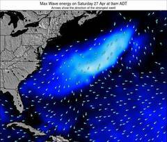
Previsioni Energia d'onda (Potenza): 12hrs
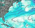

Poverty Beach Surf:
Saturday, 18 July 2026, 06:36 Local time| Sabato 18 | ||||
| 5AM | 8AM | 11AM | 2PM | |
| Wave (m) | ||||
| Periodo (s) | 8 | 8 | 3 | 4 |
| Vento (km/h) | ||||
| Stato del vento | cross- on |
cross- on |
on | on |
- /breaks/Poverty-Beach/forecasts/latest
Poverty Beach Surf Guide
Poverty Beach in New Jersey is an exposed beach and reef break Works best in offshore winds from the north northwest. Windswells and groundswells in equal measure and the ideal swell direction is from the south southeast. The beach breaks offer lefts and rights. The quality of the surf isn't affected by the tide. Likely to be crowded if working. Beware of rips, man-made danger (buoys etc..) and locals.
Poverty Beach Spot Info
Type: Rating: Reliability: Todays Sea Temp*:  Beach and reef
 3
3rarely breaks 24.2°C*ocean temperature recorded from satelliteSurfing Poverty Beach:
The best conditions reported for surf at Poverty Beach occur when a South-southeast swell combines with an offshore wind direction from the North-northwest.
Previsioni Energia d'onda (Potenza): 12hrs
Utilizzare la scheda di navigazione in alto per visualizzare Poverty Beach temperatura del mare, Poverty Beach fotografie, Poverty Beach dettagliate previsioni onde, il vento e le previsioni meteo, Poverty Beach webcam, vento corrente da New Jersey stazioni meteo e Poverty Beach previsioni marea. Il link United States mappe maree apre l'immagine grande, che mostra United States e dei mari circostanti. Queste mappe possono essere animate per mostrare le diverse componenti del moto ondoso, energia delle onde, periodo d'onda, altezza delle onde, insieme con le previsioni del vento e meteo, meteo corrente e osservazioni sullo stato del mare dal United States onda-boe, le navi passanti e stazioni meteo costiere. Ciascuna delle pagine di previsioni per questo surf break rappresenta uno strumento di wavefinder globale e regionale per individuare le migliori condizioni di surf nella zona intorno Poverty Beach.
Poverty Beach Surf:
Saturday, 18 July 2026, 06:36 Local timeSabato 18 5AM 8AM 11AM 2PM Wave (m) Periodo (s) 8 8 3 4 Vento (km/h) Stato del vento cross-
oncross-
onon on - /breaks/Poverty-Beach/forecasts/latest
- /breaks/Poverty-Beach/forecasts/latest/six_day
Poverty Beach Surf Guide
Poverty Beach in New Jersey is an exposed beach and reef break Works best in offshore winds from the north northwest. Windswells and groundswells in equal measure and the ideal swell direction is from the south southeast. The beach breaks offer lefts and rights. The quality of the surf isn't affected by the tide. Likely to be crowded if working. Beware of rips, man-made danger (buoys etc..) and locals.
Poverty Beach Spot Info
Type: Rating: Reliability: Todays Sea Temp*: Beach and reef3rarely breaks 24.2°C*ocean temperature recorded from satelliteSurfing Poverty Beach:
The best conditions reported for surf at Poverty Beach occur when a South-southeast swell combines with an offshore wind direction from the North-northwest.
Previsioni Energia d'onda (Potenza): 12hrs
Utilizzare la scheda di navigazione in alto per visualizzare Poverty Beach temperatura del mare, Poverty Beach fotografie, Poverty Beach dettagliate previsioni onde, il vento e le previsioni meteo, Poverty Beach webcam, vento corrente da New Jersey stazioni meteo e Poverty Beach previsioni marea. Il link United States mappe maree apre l'immagine grande, che mostra United States e dei mari circostanti. Queste mappe possono essere animate per mostrare le diverse componenti del moto ondoso, energia delle onde, periodo d'onda, altezza delle onde, insieme con le previsioni del vento e meteo, meteo corrente e osservazioni sullo stato del mare dal United States onda-boe, le navi passanti e stazioni meteo costiere. Ciascuna delle pagine di previsioni per questo surf break rappresenta uno strumento di wavefinder globale e regionale per individuare le migliori condizioni di surf nella zona intorno Poverty Beach.
Poverty Beach Surf:
Saturday, 18 July 2026, 06:36 Local timeSabato 18 5AM 8AM 11AM 2PM Wave (m) Periodo (s) 8 8 3 4 Vento (km/h) Stato del vento cross-
oncross-
onon on - /breaks/Poverty-Beach/forecasts/latest
Poverty Beach Surf Guide
Poverty Beach in New Jersey is an exposed beach and reef break Works best in offshore winds from the north northwest. Windswells and groundswells in equal measure and the ideal swell direction is from the south southeast. The beach breaks offer lefts and rights. The quality of the surf isn't affected by the tide. Likely to be crowded if working. Beware of rips, man-made danger (buoys etc..) and locals.
Poverty Beach Spot Info
Type: Rating: Reliability: Todays Sea Temp*: Beach and reef3rarely breaks 24.2°C*ocean temperature recorded from satelliteSurfing Poverty Beach:
The best conditions reported for surf at Poverty Beach occur when a South-southeast swell combines with an offshore wind direction from the North-northwest.
Previsioni Energia d'onda (Potenza): 12hrs
Utilizzare la scheda di navigazione in alto per visualizzare Poverty Beach temperatura del mare, Poverty Beach fotografie, Poverty Beach dettagliate previsioni onde, il vento e le previsioni meteo, Poverty Beach webcam, vento corrente da New Jersey stazioni meteo e Poverty Beach previsioni marea. Il link United States mappe maree apre l'immagine grande, che mostra United States e dei mari circostanti. Queste mappe possono essere animate per mostrare le diverse componenti del moto ondoso, energia delle onde, periodo d'onda, altezza delle onde, insieme con le previsioni del vento e meteo, meteo corrente e osservazioni sullo stato del mare dal United States onda-boe, le navi passanti e stazioni meteo costiere. Ciascuna delle pagine di previsioni per questo surf break rappresenta uno strumento di wavefinder globale e regionale per individuare le migliori condizioni di surf nella zona intorno Poverty Beach.
Poverty Beach Surf:
Saturday, 18 July 2026, 06:36 Local timeSabato 18 5AM 8AM 11AM 2PM Wave (m) Periodo (s) 8 8 3 4 Vento (km/h) Stato del vento cross-
oncross-
onon on Tide Times:
Per Cape May Harbor, New Jersey, %{dist} %{km} da %{location}.
PROSSIMA È ALLE (ora locale) rimanente alta marea bassa marea Poverty Beach Tide Times and Tide Chart
Live Weather:
At Wildwood Airport, 9 km from Poverty Beach.
light winds from the S
(km/h)
Mist -Air temperature
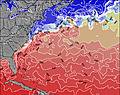
22.8°COverall Poverty Beach Surf Consistency and Wind Distribution in Luglio


Wind stats for Poverty Beach: see the variation in direction and stength by month.
foto dall' album
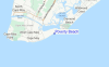
Contorni: Strade e fiumi: seleziona un surf break dal menu 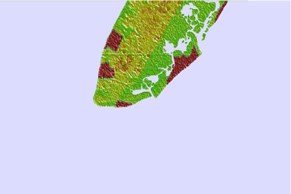

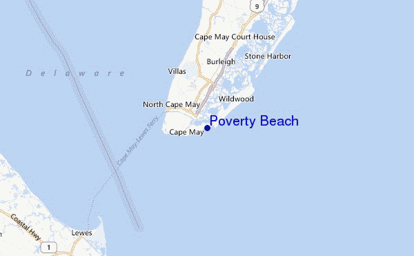
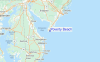
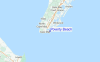
Utilizzare questa mappa sollievo per navigare New Jersey surf breaks e stazioni di marea che si trovano nella zona diPoverty Beach
Altri surf breaks più vicini al Poverty Beach:
(clicca sul nome del luogo per maggiori informazioni)- Closest località surf1 mi
- Second closest località surf1 mi
- Third closest località surf2 mi
- Fourth closest località surf2 mi
- Fifth closest località surf3 mi
Onda boe più vicina a Poverty Beach:
- Closest Onda boa35 mi
- Second closest Onda boa59 mi
- Third closest Onda boa82 mi
- Fourth closest Onda boa83 mi
- Fifth closest Onda boa85 mi
Stazioni di marea più vicina alla Poverty Beach:
- Closest marea stazioneCape May Harbor1 mi
- Second closest marea stazioneCape Island Creek, Cape May2 mi
- Third closest marea stazioneCape May, Atlantic Ocean3 mi
- Fourth closest marea stazioneSwain Channel, Taylor Sound3 mi
- Fifth closest marea stazioneWildwood Crest, ocean pier4 mi
Airports
- The closest passenger airport to Poverty Beach is Cape May Co (Wildwood) Airport (WWD) in USA, 8 km (5 miles) away (directly).
- The second nearest airport to Poverty Beach is Millville Muni Airport (MIV), also in USA, 50 km (31 miles) away.
- Third is Dover Afb Airport (DOV) in USA, 55 km (34 miles) away.
- Atlantic City International Airport (ACY) in USA is 63 km (39 miles) away.
- Salisbury Ocean City Wicomico Rgnl Airport (SBY), also in USA is the fifth nearest airport to Poverty Beach and is 86 km (53 miles) away.

- /breaks/Poverty-Beach/forecasts/latest

 Nearest