
Previsioni:

Previsione a breve termineper lo più asciutto. Warm (Max 21°C Lunedì mattina, Min 19°C Venerdì notte). Vento sarà generalmente leggero. | ||||||||||||||||||||||||
Sabato 18 | Domenica 19 | Lunedì 20 | ||||||||||||||||||||||
1 AM | 4 AM | 7 AM | 10 AM | 1 PM | 4 PM | 7 PM | 10 PM | 1 AM | 4 AM | 7 AM | 10 AM | 1 PM | 4 PM | 7 PM | 10 PM | 1 AM | 4 AM | 7 AM | 10 AM | 1 PM | 4 PM | 7 PM | 10 PM | |
Mappa dell'altezza del moto ondoso |  | 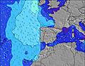 |  |  | 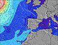 |  |  | 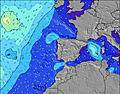 |  | |||||||||||||||
Onda Altezza (m) Direzione Periodo (s) | WNW 8 | WNW 8 | WNW 8 | WNW 8 | WNW 8 | NW 5 | NW 5 | NNW 5 | NNW 5 | NNW 5 | NNW 6 | NNW 6 | NNW 6 | NNW 6 | NNW 6 | NNW 5 | NW 9 | NW 8 | NNW 7 | NNW 7 | NNW 7 | NNW 7 | NNW 7 | NNW 7 |
Grafico delle onde | ||||||||||||||||||||||||
13 | 13 | 13 | 13 | 16 | 23 | 23 | 36 | 45 | 42 | 49 | 56 | 50 | 35 | 24 | 23 | 20 | 18 | 83 | 83 | 99 | 102 | 108 | 111 | |
Vento (km/h) | ||||||||||||||||||||||||
Stato del vento onshore cross-onshore cross-shore cross-offshore offshore piatto | cross-on | cross-on | cross-on | cross-on | cross-on | cross-on | cross-on | cross-on | cross-on | cross-on | cross-on | cross-on | cross | cross | cross | cross | cross-on | cross-on | cross | cross | cross | cross | cross | cross-on |
Alta Marea | 6:23AM3.26m | 6:39PM3.53m | 7:09AM3.12m | 7:25PM3.33m | 7:56AM2.97m | 8:14PM3.11m | ||||||||||||||||||
Basso Marea | 00:13AM0.62m | 12:19PM0.85m | 00:58AM0.78m | 1:05PM1.00m | 1:45AM0.98m | 1:54PM1.18m | ||||||||||||||||||
— | 6:24 | — | — | — | — | — | — | — | 6:24 | — | — | — | — | — | — | — | 6:26 | — | — | — | — | — | — | |
— | — | — | — | — | — | 9:01 | — | — | — | — | — | — | — | 9:00 | — | — | — | — | — | — | — | 9:00 | — | |
mm | — | — | — | — | — | — | — | — | — | — | — | — | — | — | — | — | — | — | — | — | — | — | — | — |
Temp. °C | 19 | 19 | 19 | 20 | 20 | 20 | 20 | 19 | 19 | 19 | 19 | 20 | 20 | 20 | 20 | 20 | 19 | 19 | 19 | 21 | 21 | 21 | 21 | 20 |
Gelo °C | 18 | 19 | 19 | 20 | 19 | 19 | 19 | 18 | 18 | 19 | 19 | 20 | 19 | 19 | 20 | 20 | 19 | 19 | 19 | 21 | 20 | 21 | 21 | 21 |
Onda 1 Altezza (m) Direzione Periodo (s) | WNW 8 | WNW 8 | WNW 8 | WNW 8 | WNW 8 | WNW 8 | WNW 8 | WNW 8 | WNW 8 | WNW 8 | WNW 8 | NNW 6 | NNW 6 | NNW 6 | NNW 6 | NNW 5 | NNW 5 | NNW 6 | NNW 7 | NNW 7 | NNW 7 | NNW 7 | NNW 7 | NNW 7 |
13 | 13 | 13 | 13 | 13 | 13 | 13 | 13 | 6 | 6 | 11 | 56 | 50 | 35 | 24 | 23 | 16 | 18 | 83 | 83 | 99 | 102 | 108 | 111 | |
Onda 2 Altezza (m) Direzione Periodo (s) | SW 6 | SW 5 | SW 5 | W 5 | — | — | W 11 | W 11 | NW 8 | NW 8 | NW 10 | WNW 8 | NW 8 | W 9 | WNW 9 | WNW 4 | WNW 4 | NW 8 | W 8 | W 8 | W 8 | W 8 | W 8 | WNW 11 |
1 | 1 | 1 | 1 | — | — | 2 | 2 | 3 | 3 | 4 | 11 | 14 | 14 | 15 | 7 | 7 | 16 | 12 | 12 | 11 | 10 | 10 | 12 | |
Onda 3 Altezza (m) Direzione Periodo (s) | — | — | — | — | — | — | — | N 11 | NW 11 | NW 10 | W 10 | NNW 10 | NNW 9 | NW 8 | NW 8 | WNW 8 | NW 9 | WNW 8 | NNW 8 | NW 8 | WNW 12 | WNW 12 | WNW 11 | W 7 |
— | — | — | — | — | — | — | 2 | 4 | 4 | 2 | 9 | 8 | 9 | 9 | 14 | 20 | 13 | 7 | 11 | 15 | 13 | 12 | 10 | |
onde vento Altezza (m) Direzione Periodo (s) | NNW 4 | NNW 4 | NNW 4 | NNW 4 | NW 4 | NW 5 | NW 5 | NNW 5 | NNW 5 | NNW 5 | NNW 6 | — | WNW 4 | WNW 5 | WNW 5 | — | — | WNW 4 | — | — | — | — | — | — |
10 | 11 | 12 | 12 | 16 | 23 | 23 | 36 | 45 | 42 | 49 | — | 7 | 7 | 7 | — | — | 6 | — | — | — | — | — | — | |
Il più vicino Offshore or Glassy | ||||||||||||||||||||||||
Distanza (km) | 949 | 214 | 214 | 1023 | 1399 | 1016 | 978 | 280 | 168 | 99 | 142 | 633 | 1019 | 362 | 280 | 227 | 116 | 116 | 95 | 183 | 634 | 362 | 258 | 130 |
Migliori previsioni per le condizioni d'onda in Peniche | ||||||||||||||||||||||||
Migliori previsioni per le condizioni d'onda in Portugal | ||||||||||||||||||||||||
Trova Onde Globale | ||||||||||||||||||||||||
- Map Icons:
 Break
Break Live Wave Height (m)
 Live Wind Speed (km/h)
 Surf Rating (10 Max)
 Ocean Swells (m)
- Wind Speed (km/h)
Widget Free Surf-Forecast.com per il tuo sito
La relazione di surf / widget meteo è disponibile qui sotto per incorporare su siti esterni a titolo gratuito e fornisce una sintesi delle nostre Praia do Cerro previsione surf. Basta prendere il frammento di codice html da noi fornito e copiarlo nel proprio sito. È possibile scegliere la lingua preferita e unità metriche / imperiali per il feed delle previsioni surf per soddisfare le esigenze degli utenti del vostro sito .... Clicca qui per ottenere il codice.
 Nearest