
Previsioni:

Previsione a breve termineper lo più asciutto. Warm (Max 25°C mercoledì pomeriggio, Min 24°C mercoledì notte). Vento sarà generalmente leggero. | ||||||||||||||||||||||||
Mer 15 | Giovedì 16 | Venerdì 17 | 18 | |||||||||||||||||||||
3 PM | 6 PM | 9 PM | 12 AM | 3 AM | 6 AM | 9 AM | 12 PM | 3 PM | 6 PM | 9 PM | 12 AM | 3 AM | 6 AM | 9 AM | 12 PM | 3 PM | 6 PM | 9 PM | 12 AM | 3 AM | 6 AM | 9 AM | 12 PM | |
Mappa dell'altezza del moto ondoso | 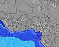 | 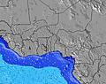 | 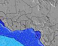 | 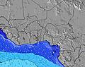 | 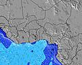 | 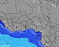 | 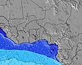 | 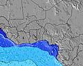 | 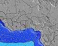 | |||||||||||||||
Onda Altezza (m) Direzione Periodo (s) | S 6 | SSW 6 | SSW 6 | SSW 12 | SSW 6 | SSW 19 | SSW 19 | SSW 16 | SSW 16 | SSW 17 | SSW 18 | SSW 18 | SSW 18 | S 18 | SSW 16 | SSW 16 | SSW 16 | SSW 16 | SSW 16 | SSW 16 | SSW 16 | SSW 15 | SSW 15 | SSW 14 |
Grafico delle onde | ||||||||||||||||||||||||
194 | 165 | 139 | 115 | 115 | 125 | 125 | 84 | 147 | 229 | 240 | 318 | 240 | 156 | 280 | 337 | 337 | 421 | 337 | 416 | 400 | 365 | 355 | 350 | |
Vento (km/h) | ||||||||||||||||||||||||
Stato del vento onshore cross-onshore cross-shore cross-offshore offshore piatto | on | on | on | on | on | on | on | on | on | cross-on | on | on | on | cross-on | on | cross-on | cross-on | on | on | on | on | on | cross-on | cross-on |
Alta Marea | 4:44PM1.43m | 5:40AM1.50m | 5:30PM1.39m | 6:25AM1.50m | 6:15PM1.32m | 7:07AM1.47m | ||||||||||||||||||
Basso Marea | 11:03PM-0.04m | 11:33AM0.33m | 11:45PM0.00m | 12:21PM0.36m | 00:26AM0.08m | |||||||||||||||||||
— | — | — | — | — | 6:03 | — | — | — | — | — | — | — | 6:03 | — | — | — | — | — | — | — | 6:03 | — | — | |
— | 6:24 | — | — | — | — | — | — | — | 6:24 | — | — | — | — | — | — | — | 6:24 | — | — | — | — | — | 6:24 | |
mm | — | — | — | — | — | — | — | — | — | — | — | — | — | — | — | — | — | — | — | — | — | — | — | — |
Temp. °C | 25 | 25 | 24 | 25 | 24 | 24 | 24 | 25 | 25 | 24 | 24 | 24 | 24 | 24 | 24 | 25 | 25 | 24 | 24 | 24 | 24 | 24 | 25 | 25 |
Gelo °C | 25 | 26 | 24 | 26 | 24 | 24 | 24 | 24 | 25 | 25 | 25 | 25 | 25 | 25 | 25 | 26 | 25 | 25 | 25 | 25 | 25 | 25 | 26 | 25 |
Onda 1 Altezza (m) Direzione Periodo (s) | SSW 12 | S 13 | SSW 12 | SSW 12 | SSW 11 | S 6 | S 6 | S 7 | S 7 | S 7 | S 7 | S 7 | S 8 | S 8 | S 8 | S 8 | S 9 | SSW 16 | S 9 | SSW 16 | S 9 | S 9 | S 9 | S 9 |
147 | 92 | 77 | 106 | 95 | 81 | 68 | 72 | 79 | 82 | 68 | 70 | 72 | 80 | 84 | 111 | 165 | 421 | 130 | 416 | 133 | 164 | 157 | 130 | |
Onda 2 Altezza (m) Direzione Periodo (s) | SSW 17 | SSW 12 | SSW 14 | SSW 18 | SSW 19 | SSW 11 | SSW 10 | SSW 10 | SSW 11 | SSW 17 | SSW 18 | SSW 18 | SSW 18 | SSW 14 | SSW 16 | SSW 16 | SSW 16 | S 9 | SSW 16 | S 9 | SSW 16 | SSW 15 | SSW 15 | SSW 14 |
30 | 55 | 61 | 62 | 72 | 64 | 63 | 63 | 64 | 229 | 240 | 318 | 240 | 115 | 280 | 337 | 337 | 130 | 337 | 133 | 400 | 365 | 355 | 350 | |
Onda 3 Altezza (m) Direzione Periodo (s) | SSW 21 | SSW 18 | SSW 18 | S 13 | S 13 | SSW 19 | SSW 19 | SSW 16 | SSW 16 | SSW 11 | SSW 10 | SSW 10 | SSW 10 | S 18 | SW 10 | SW 10 | SW 10 | SSW 12 | SSW 12 | SW 12 | SSW 9 | SW 9 | SSW 9 | SW 11 |
44 | 61 | 30 | 14 | 14 | 125 | 125 | 84 | 147 | 64 | 62 | 59 | 57 | 156 | 23 | 24 | 23 | 86 | 29 | 37 | 8 | 12 | 8 | 30 | |
onde vento Altezza (m) Direzione Periodo (s) | S 6 | SSW 6 | SSW 6 | SSW 6 | SSW 6 | WSW 5 | WSW 5 | WSW 5 | WSW 5 | W 5 | WSW 5 | WSW 5 | WSW 4 | WSW 4 | WSW 4 | WSW 4 | SW 4 | SW 4 | WSW 4 | WSW 4 | WSW 4 | SW 4 | SW 4 | — |
194 | 165 | 139 | 115 | 115 | 20 | 27 | 19 | 17 | 11 | 13 | 12 | 12 | 12 | 12 | 7 | 9 | 9 | 7 | 7 | 7 | 6 | 7 | — | |
Il più vicino Offshore or Glassy | ||||||||||||||||||||||||
Distanza (km) | 2011 | 2598 | 2014 | 533 | 533 | 191 | 533 | 533 | 533 | 1302 | 533 | 15 | 159 | 159 | 159 | 196 | 533 | 15 | 15 | 533 | 533 | 15 | 204 | 533 |
Migliori previsioni per le condizioni d'onda in Ghana - Gold Coast | ||||||||||||||||||||||||
Migliori previsioni per le condizioni d'onda in Ghana | ||||||||||||||||||||||||
Trova Onde Globale | ||||||||||||||||||||||||
- Map Icons:
 Break
Break Live Wave Height (m)
 Live Wind Speed (km/h)
 Surf Rating (10 Max)
 Ocean Swells (m)
- Wind Speed (km/h)
Widget Free Surf-Forecast.com per il tuo sito
La relazione di surf / widget meteo è disponibile qui sotto per incorporare su siti esterni a titolo gratuito e fornisce una sintesi delle nostre Princes Town previsione surf. Basta prendere il frammento di codice html da noi fornito e copiarlo nel proprio sito. È possibile scegliere la lingua preferita e unità metriche / imperiali per il feed delle previsioni surf per soddisfare le esigenze degli utenti del vostro sito .... Clicca qui per ottenere il codice.
 Nearest