Previsioni:

Previsione a breve terminePioggia abbondante (Totale 41mm), più pesante durante lunedì mattina. Very mild (Max 14°C Sabato mattina, Min 10°C Lunedì mattina). Venti in aumento (calma Domenica mattina, venti freschi da N per lunedì notte). | |||||||||||||||||||||||
Sabato 18 | Domenica 19 | Lunedì 20 | |||||||||||||||||||||
5 AM | 8 AM | 11 AM | 2 PM | 5 PM | 8 PM | 11 PM | 2 AM | 5 AM | 8 AM | 11 AM | 2 PM | 5 PM | 8 PM | 11 PM | 2 AM | 5 AM | 8 AM | 11 AM | 2 PM | 5 PM | 8 PM | 11 PM | |
Mappa dell'altezza del moto ondoso |  |  | 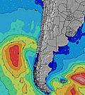 |  | 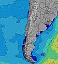 |  |  | 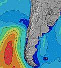 |  | ||||||||||||||
Onda Altezza (m) Direzione Periodo (s) | SSW 13 | SSW 13 | WNW 9 | WNW 9 | WNW 9 | WNW 10 | WNW 10 | WNW 12 | WNW 12 | WNW 11 | W 11 | WNW 11 | W 11 | W 11 | W 11 | W 11 | W 11 | W 11 | W 11 | W 11 | W 11 | W 11 | W 11 |
Grafico delle onde | |||||||||||||||||||||||
563 | 546 | 460 | 431 | 508 | 596 | 720 | 983 | 828 | 657 | 545 | 478 | 396 | 403 | 410 | 411 | 357 | 354 | 303 | 246 | 246 | 202 | 157 | |
Vento (km/h) | |||||||||||||||||||||||
Stato del vento onshore cross-onshore cross-shore cross-offshore offshore piatto | cross-on | cross | cross | cross | cross | cross | cross | cross-off | cross-off | cross-off | glassy | cross-on | cross | off | cross-off | off | cross-off | cross-off | cross-off | off | cross-off | cross-off | cross-off |
Alta Marea | 1:16PM1.43m | 1:59AM1.08m | 2:01PM1.27m | 2:49AM1.08m | 2:48PM1.10m | ||||||||||||||||||
Basso Marea | 6:51AM0.17m | 7:53PM0.06m | 7:45AM0.26m | 8:34PM0.14m | 8:46AM0.35m | 9:16PM0.23m | |||||||||||||||||
7:48 | — | — | — | — | — | — | — | 7:48 | — | — | — | — | — | — | — | 7:48 | — | — | — | — | — | — | |
— | — | — | — | 5:58 | — | — | — | — | — | — | — | 5:59 | — | — | — | — | — | — | — | 6:00 | — | — | |
mm | 2 | 1 | 1 | 1 | — | — | — | — | — | — | — | — | — | — | — | — | 1 | 6 | 10 | 4 | 1 | 2 | 1 |
Temp. °C | 13 | 13 | 14 | 14 | 14 | 13 | 12 | 12 | 11 | 11 | 13 | 13 | 13 | 12 | 12 | 12 | 11 | 11 | 10 | 11 | 13 | 13 | 13 |
Gelo °C | 9 | 9 | 9 | 8 | 9 | 9 | 9 | 9 | 8 | 8 | 12 | 11 | 11 | 10 | 10 | 10 | 10 | 9 | 8 | 8 | 9 | 10 | 9 |
Onda 1 Altezza (m) Direzione Periodo (s) | WNW 10 | SSW 13 | WNW 9 | WNW 9 | WNW 9 | WNW 10 | WNW 10 | WNW 12 | WNW 12 | WNW 11 | W 11 | WNW 11 | W 11 | W 11 | W 11 | W 11 | W 11 | W 11 | W 11 | W 11 | W 11 | W 11 | W 11 |
428 | 546 | 460 | 431 | 508 | 596 | 720 | 983 | 828 | 657 | 545 | 478 | 396 | 403 | 410 | 411 | 357 | 354 | 303 | 246 | 246 | 202 | 157 | |
Onda 2 Altezza (m) Direzione Periodo (s) | SSW 13 | W 13 | SW 12 | SSW 12 | SSW 12 | SSW 12 | SW 12 | SW 11 | SW 11 | SW 11 | SW 11 | SW 12 | SW 12 | SW 11 | SSW 11 | SSW 11 | SSW 11 | SSW 11 | SSW 11 | SSW 11 | SSW 11 | SW 10 | SW 10 |
563 | 90 | 442 | 390 | 378 | 371 | 309 | 288 | 283 | 283 | 293 | 303 | 309 | 288 | 251 | 207 | 207 | 204 | 204 | 180 | 143 | 106 | 104 | |
Onda 3 Altezza (m) Direzione Periodo (s) | WSW 13 | WSW 13 | W 13 | W 13 | W 12 | W 12 | W 12 | N 7 | N 7 | N 7 | N 7 | N 6 | N 6 | N 6 | NW 11 | NW 11 | NW 11 | NW 11 | NW 11 | NW 11 | NW 11 | NW 11 | NW 11 |
59 | 59 | 90 | 86 | 76 | 110 | 106 | 53 | 47 | 36 | 22 | 13 | 13 | 7 | 5 | 5 | 5 | 5 | 5 | 5 | 5 | 5 | 5 | |
onde vento Altezza (m) Direzione Periodo (s) | N 9 | NNW 9 | N 8 | N 8 | N 8 | N 8 | N 8 | — | — | — | — | — | — | — | — | — | — | — | — | — | ENE 3 | NE 4 | N 5 |
707 | 909 | 311 | 298 | 181 | 113 | 89 | — | — | — | — | — | — | — | — | — | — | — | — | — | 2 | 12 | 60 | |
Il più vicino Offshore or Glassy | |||||||||||||||||||||||
Distanza (km) | 374 | 59 | 173 | 173 | 134 | 59 | 16 | 0 | 0 | 0 | 0 | 16 | 33 | 0 | 0 | 0 | 0 | 0 | 0 | 0 | 34 | 33 | 39 |
Migliori previsioni per le condizioni d'onda in Santiago | |||||||||||||||||||||||
Migliori previsioni per le condizioni d'onda in Chile | |||||||||||||||||||||||
Trova Onde Globale | |||||||||||||||||||||||
- Map Icons:
 Break
Break Live Wave Height (m)
 Live Wind Speed (km/h)
 Surf Rating (10 Max)
 Ocean Swells (m)
- Wind Speed (km/h)
Widget Free Surf-Forecast.com per il tuo sito
La relazione di surf / widget meteo è disponibile qui sotto per incorporare su siti esterni a titolo gratuito e fornisce una sintesi delle nostre Puertecillo previsione surf. Basta prendere il frammento di codice html da noi fornito e copiarlo nel proprio sito. È possibile scegliere la lingua preferita e unità metriche / imperiali per il feed delle previsioni surf per soddisfare le esigenze degli utenti del vostro sito .... Clicca qui per ottenere il codice.
 Nearest