
Previsioni:

Previsione a breve terminepioggia leggera (Totale 4mm), per lo più che cade Domenica mattina. Warm (Max 32°C Domenica mattina, Min 28°C Domenica mattina). Venti decrescenti (venti freschi da SE Domenica mattina, calma per lunedì notte). | ||||||||||||||||||||||||
Sabato 18 | Domenica 19 | Lunedì 20 | ||||||||||||||||||||||
2 AM | 5 AM | 8 AM | 11 AM | 2 PM | 5 PM | 8 PM | 11 PM | 2 AM | 5 AM | 8 AM | 11 AM | 2 PM | 5 PM | 8 PM | 11 PM | 2 AM | 5 AM | 8 AM | 11 AM | 2 PM | 5 PM | 8 PM | 11 PM | |
Mappa dell'altezza del moto ondoso |  |  |  |  |  |  |  |  | 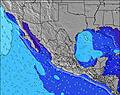 | |||||||||||||||
Onda Altezza (m) Direzione Periodo (s) | SW 18 | S 10 | SW 18 | SSW 10 | SSW 10 | SSW 10 | SSW 10 | SSW 10 | SSW 17 | SW 17 | SW 17 | SW 17 | SW 17 | SSW 17 | SSW 17 | SSW 16 | SSW 16 | SW 16 | SW 16 | SSW 16 | SSW 16 | SSW 16 | SSW 16 | SSW 15 |
Grafico delle onde | ||||||||||||||||||||||||
150 | 196 | 155 | 140 | 160 | 163 | 210 | 194 | 195 | 305 | 305 | 302 | 295 | 195 | 193 | 334 | 326 | 371 | 371 | 330 | 330 | 441 | 425 | 294 | |
Vento (km/h) | ||||||||||||||||||||||||
Stato del vento onshore cross-onshore cross-shore cross-offshore offshore piatto | glassy | glassy | glassy | cross-on | on | on | cross-on | cross-on | cross-on | glassy | on | on | on | cross-on | cross-on | cross-on | glassy | cross-off | off | cross-off | cross-off | cross-off | glassy | glassy |
Alta Marea | 11:55AM1.31m | 11:09PM1.23m | 12:24PM1.32m | 11:56PM1.04m | 12:55PM1.32m | |||||||||||||||||||
Basso Marea | 5:13AM0.36m | 5:33PM0.77m | 5:32AM0.53m | 6:38PM0.78m | 5:42AM0.67m | 8:19PM0.76m | ||||||||||||||||||
— | 5:41 | — | — | — | — | — | — | — | 5:41 | — | — | — | — | — | — | — | 5:41 | — | — | — | — | — | — | |
— | — | — | — | — | 7:06 | — | — | — | — | — | — | — | 7:06 | — | — | — | — | — | — | — | 7:05 | — | — | |
mm | — | — | — | — | — | — | — | — | — | — | — | — | — | — | — | — | 1 | 1 | 1 | — | — | — | — | 1 |
Temp. °C | 30 | 30 | 30 | 31 | 31 | 31 | 30 | 30 | 29 | 29 | 29 | 31 | 32 | 32 | 30 | 29 | 29 | 28 | 28 | 30 | 31 | 30 | 29 | 29 |
Gelo °C | 34 | 34 | 33 | 32 | 32 | 33 | 32 | 33 | 32 | 34 | 33 | 32 | 31 | 32 | 32 | 31 | 33 | 31 | 30 | 32 | 33 | 32 | 33 | 33 |
Onda 1 Altezza (m) Direzione Periodo (s) | S 8 | S 10 | SSW 9 | SSW 10 | SSW 10 | SSW 10 | SSW 10 | SSW 10 | SSW 10 | SSW 10 | SW 10 | S 12 | S 12 | S 12 | S 12 | SSW 16 | SSW 16 | SW 16 | SW 16 | SSW 16 | SSW 16 | SSW 16 | S 11 | S 11 |
84 | 196 | 153 | 140 | 160 | 163 | 210 | 194 | 163 | 154 | 102 | 184 | 187 | 138 | 102 | 334 | 326 | 371 | 371 | 330 | 330 | 441 | 188 | 188 | |
Onda 2 Altezza (m) Direzione Periodo (s) | SSW 10 | SW 18 | S 13 | S 13 | S 13 | S 13 | S 13 | SSW 16 | SSW 17 | SW 17 | S 12 | SW 17 | SW 17 | SSW 17 | SSW 17 | S 12 | S 12 | S 12 | S 12 | S 11 | SSE 11 | S 11 | SSW 16 | SSW 15 |
82 | 152 | 87 | 87 | 123 | 85 | 87 | 177 | 195 | 305 | 146 | 302 | 295 | 195 | 193 | 100 | 100 | 68 | 97 | 123 | 123 | 110 | 425 | 294 | |
Onda 3 Altezza (m) Direzione Periodo (s) | SW 18 | S 13 | SW 18 | SW 16 | SW 16 | SW 13 | SW 16 | S 13 | S 12 | S 12 | SW 17 | SW 10 | SW 10 | SW 9 | SW 9 | SW 9 | SSW 9 | SW 9 | SSE 7 | SW 13 | SW 13 | SSE 13 | SW 8 | SSE 15 |
150 | 88 | 155 | 67 | 68 | 56 | 67 | 82 | 110 | 107 | 305 | 77 | 59 | 42 | 41 | 41 | 54 | 40 | 17 | 84 | 84 | 35 | 11 | 71 | |
onde vento Altezza (m) Direzione Periodo (s) | — | — | — | — | — | — | — | SSW 2 | — | — | — | — | SSE 3 | S 3 | S 3 | SSW 3 | — | — | — | — | — | — | — | — |
— | — | — | — | — | — | — | 1 | — | — | — | — | 3 | 3 | 2 | 3 | — | — | — | — | — | — | — | — | |
Il più vicino Offshore or Glassy | ||||||||||||||||||||||||
Distanza (km) | 0 | 0 | 0 | 135 | 151 | 486 | 263 | 7 | 7 | 0 | 7 | 263 | 426 | 75 | 7 | 7 | 0 | 0 | 0 | 0 | 0 | 0 | 0 | 0 |
Migliori previsioni per le condizioni d'onda in Baja Sur | ||||||||||||||||||||||||
Migliori previsioni per le condizioni d'onda in Mexico | ||||||||||||||||||||||||
Trova Onde Globale | ||||||||||||||||||||||||
- Map Icons:
 Break
Break Live Wave Height (m)
 Live Wind Speed (km/h)
 Surf Rating (10 Max)
 Ocean Swells (m)
- Wind Speed (km/h)
Widget Free Surf-Forecast.com per il tuo sito
La relazione di surf / widget meteo è disponibile qui sotto per incorporare su siti esterni a titolo gratuito e fornisce una sintesi delle nostre Punta Arenas previsione surf. Basta prendere il frammento di codice html da noi fornito e copiarlo nel proprio sito. È possibile scegliere la lingua preferita e unità metriche / imperiali per il feed delle previsioni surf per soddisfare le esigenze degli utenti del vostro sito .... Clicca qui per ottenere il codice.
 Nearest