
Previsioni:

Previsione a breve termineper lo più asciutto. Warm (Max 22°C giovedì pomeriggio, Min 19°C mercoledì notte). Vento sarà generalmente leggero. | ||||||||||||||||||
Mer 15 | Giovedì 16 | Venerdì 17 | ||||||||||||||||
8 PM | 11 PM | 2 AM | 5 AM | 8 AM | 11 AM | 2 PM | 5 PM | 8 PM | 11 PM | 2 AM | 5 AM | 8 AM | 11 AM | 2 PM | 5 PM | 8 PM | 11 PM | |
Mappa dell'altezza del moto ondoso |  | 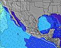 |  |  |  |  |  | |||||||||||
Onda Altezza (m) Direzione Periodo (s) | SW 16 | SW 16 | SW 16 | SW 16 | SW 16 | SW 16 | SW 16 | SW 15 | SW 15 | SW 19 | SW 19 | SW 19 | SW 19 | SW 14 | SW 14 | SW 14 | SW 14 | SW 14 |
Grafico delle onde | ||||||||||||||||||
254 | 251 | 248 | 248 | 248 | 159 | 155 | 183 | 176 | 177 | 231 | 231 | 231 | 138 | 138 | 141 | 145 | 128 | |
Vento (km/h) | ||||||||||||||||||
Stato del vento onshore cross-onshore cross-shore cross-offshore offshore piatto | cross-on | cross-on | glassy | glassy | cross | cross | cross-on | cross-on | glassy | cross-off | cross-off | cross-off | cross-off | cross-off | cross | cross-on | glassy | cross-off |
Alta Marea | 10:08PM2.37m | 11:45AM1.70m | 10:53PM2.18m | 12:24PM1.74m | ||||||||||||||
Basso Marea | 5:15AM0.04m | 4:49PM0.95m | 5:52AM0.21m | 5:46PM0.96m | ||||||||||||||
— | — | — | 5:52 | — | — | — | — | — | — | — | 5:52 | — | — | — | — | — | — | |
— | — | — | — | — | — | — | 7:44 | — | — | — | — | — | — | — | 7:44 | — | — | |
mm | — | — | — | — | — | — | — | — | — | — | — | — | — | — | — | — | — | — |
Temp. °C | 20 | 19 | 19 | 19 | 20 | 21 | 22 | 21 | 20 | 20 | 20 | 20 | 21 | 22 | 21 | 21 | 20 | 20 |
Gelo °C | 20 | 20 | 21 | 20 | 21 | 21 | 22 | 21 | 22 | 21 | 21 | 20 | 20 | 21 | 20 | 21 | 21 | 21 |
Onda 1 Altezza (m) Direzione Periodo (s) | SW 16 | SW 16 | SW 16 | SW 16 | SW 16 | SW 16 | WNW 8 | WNW 8 | NW 8 | WNW 9 | WNW 9 | WNW 9 | WNW 9 | WNW 9 | WNW 9 | WNW 9 | WNW 9 | NW 9 |
254 | 251 | 248 | 248 | 248 | 159 | 41 | 52 | 65 | 96 | 141 | 141 | 141 | 138 | 138 | 141 | 145 | 118 | |
Onda 2 Altezza (m) Direzione Periodo (s) | SSW 12 | SSW 12 | SSW 12 | WNW 8 | WNW 8 | WNW 8 | SW 16 | SW 15 | SW 15 | SW 15 | SW 14 | SW 14 | SW 14 | SW 14 | SW 14 | SW 14 | SW 14 | SW 14 |
82 | 82 | 56 | 45 | 45 | 44 | 155 | 183 | 176 | 171 | 206 | 169 | 169 | 132 | 132 | 132 | 130 | 128 | |
Onda 3 Altezza (m) Direzione Periodo (s) | NW 9 | WNW 5 | WNW 5 | SSW 12 | SSW 12 | SSW 12 | SSW 12 | SSW 12 | SSW 11 | SW 19 | SW 19 | SW 19 | SW 19 | SW 19 | SW 18 | S 11 | S 11 | S 12 |
19 | 10 | 10 | 47 | 47 | 46 | 46 | 45 | 43 | 177 | 231 | 231 | 231 | 126 | 114 | 39 | 64 | 95 | |
onde vento Altezza (m) Direzione Periodo (s) | WNW 5 | — | — | — | — | — | — | — | — | — | — | — | — | SSE 2 | S 3 | — | — | — |
15 | — | — | — | — | — | — | — | — | — | — | — | — | 1 | 1 | — | — | — | |
Il più vicino Offshore or Glassy | ||||||||||||||||||
Distanza (km) | 243 | 189 | 0 | 0 | 23 | 481 | 481 | 481 | 0 | 0 | 0 | 0 | 300 | 517 | 481 | 307 | 0 | 0 |
Migliori previsioni per le condizioni d'onda in Baja Norte | ||||||||||||||||||
Migliori previsioni per le condizioni d'onda in Mexico | ||||||||||||||||||
Trova Onde Globale | ||||||||||||||||||
- Map Icons:
 Break
Break Live Wave Height (m)
 Live Wind Speed (km/h)
 Surf Rating (10 Max)
 Ocean Swells (m)
- Wind Speed (km/h)
Widget Free Surf-Forecast.com per il tuo sito
La relazione di surf / widget meteo è disponibile qui sotto per incorporare su siti esterni a titolo gratuito e fornisce una sintesi delle nostre Punta San Antonio previsione surf. Basta prendere il frammento di codice html da noi fornito e copiarlo nel proprio sito. È possibile scegliere la lingua preferita e unità metriche / imperiali per il feed delle previsioni surf per soddisfare le esigenze degli utenti del vostro sito .... Clicca qui per ottenere il codice.
 Nearest