
Punta Uva Surf Guide
Punta Uva in Limon is an exposed beach break that has reasonably consistent surf Offshore winds blow from the south southwest. Usually gets local windswells, but groundswells do happen and the ideal wave angle is from the northeast. The beach breaks offer lefts and rights. When the surf is up, it can get quite busy in the water. Beware of rocks and jellyfish.
Punta Uva Spot Info
| Type: | Rating: | Reliability: | Todays Sea Temp*: |
|---|---|---|---|
| fairly consistent | 29.0°C*ocean temperature recorded from satellite |
Surfing Punta Uva:
The best conditions reported for surf at Punta Uva occur when a Northeast swell combines with an offshore wind direction from the South-southwest.

Previsioni Energia d'onda (Potenza): 12hrs


Punta Uva Surf:
Thursday, 16 July 2026, 01:30 Local time| Mercoledì 15 | Gio | |||
| 4PM | 7PM | 10PM | 1AM | |
| Wave (m) | ||||
| Periodo (s) | 9 | 9 | 9 | 10 |
| Vento (km/h) | ||||
| Stato del vento | cross- on |
cross- on |
cross- on |
cross |
- /breaks/Punta-Uva/forecasts/latest
Punta Uva Surf Guide
Punta Uva in Limon is an exposed beach break that has reasonably consistent surf Offshore winds blow from the south southwest. Usually gets local windswells, but groundswells do happen and the ideal wave angle is from the northeast. The beach breaks offer lefts and rights. When the surf is up, it can get quite busy in the water. Beware of rocks and jellyfish.
Punta Uva Spot Info
Type: Rating: Reliability: Todays Sea Temp*:  Reef
Reef 3
3fairly consistent 29.0°C*ocean temperature recorded from satelliteSurfing Punta Uva:
The best conditions reported for surf at Punta Uva occur when a Northeast swell combines with an offshore wind direction from the South-southwest.
Previsioni Energia d'onda (Potenza): 12hrs
Utilizzare la scheda di navigazione in alto per visualizzare Punta Uva temperatura del mare, Punta Uva fotografie, Punta Uva dettagliate previsioni onde, il vento e le previsioni meteo, Punta Uva webcam, vento corrente da Limon stazioni meteo e Punta Uva previsioni marea. Il link Costa Rica mappe maree apre l'immagine grande, che mostra Costa Rica e dei mari circostanti. Queste mappe possono essere animate per mostrare le diverse componenti del moto ondoso, energia delle onde, periodo d'onda, altezza delle onde, insieme con le previsioni del vento e meteo, meteo corrente e osservazioni sullo stato del mare dal Costa Rica onda-boe, le navi passanti e stazioni meteo costiere. Ciascuna delle pagine di previsioni per questo surf break rappresenta uno strumento di wavefinder globale e regionale per individuare le migliori condizioni di surf nella zona intorno Punta Uva.
Punta Uva Surf:
Thursday, 16 July 2026, 01:30 Local timeMercoledì 15 Gio 4PM 7PM 10PM 1AM Wave (m) Periodo (s) 9 9 9 10 Vento (km/h) Stato del vento cross-
oncross-
oncross-
oncross - /breaks/Punta-Uva/forecasts/latest
- /breaks/Punta-Uva/forecasts/latest/six_day
Punta Uva Surf Guide
Punta Uva in Limon is an exposed beach break that has reasonably consistent surf Offshore winds blow from the south southwest. Usually gets local windswells, but groundswells do happen and the ideal wave angle is from the northeast. The beach breaks offer lefts and rights. When the surf is up, it can get quite busy in the water. Beware of rocks and jellyfish.
Punta Uva Spot Info
Type: Rating: Reliability: Todays Sea Temp*: Reef3fairly consistent 29.0°C*ocean temperature recorded from satelliteSurfing Punta Uva:
The best conditions reported for surf at Punta Uva occur when a Northeast swell combines with an offshore wind direction from the South-southwest.
Previsioni Energia d'onda (Potenza): 12hrs
Utilizzare la scheda di navigazione in alto per visualizzare Punta Uva temperatura del mare, Punta Uva fotografie, Punta Uva dettagliate previsioni onde, il vento e le previsioni meteo, Punta Uva webcam, vento corrente da Limon stazioni meteo e Punta Uva previsioni marea. Il link Costa Rica mappe maree apre l'immagine grande, che mostra Costa Rica e dei mari circostanti. Queste mappe possono essere animate per mostrare le diverse componenti del moto ondoso, energia delle onde, periodo d'onda, altezza delle onde, insieme con le previsioni del vento e meteo, meteo corrente e osservazioni sullo stato del mare dal Costa Rica onda-boe, le navi passanti e stazioni meteo costiere. Ciascuna delle pagine di previsioni per questo surf break rappresenta uno strumento di wavefinder globale e regionale per individuare le migliori condizioni di surf nella zona intorno Punta Uva.
Punta Uva Surf:
Thursday, 16 July 2026, 01:30 Local timeMercoledì 15 Gio 4PM 7PM 10PM 1AM Wave (m) Periodo (s) 9 9 9 10 Vento (km/h) Stato del vento cross-
oncross-
oncross-
oncross - /breaks/Punta-Uva/forecasts/latest
Punta Uva Surf Guide
Punta Uva in Limon is an exposed beach break that has reasonably consistent surf Offshore winds blow from the south southwest. Usually gets local windswells, but groundswells do happen and the ideal wave angle is from the northeast. The beach breaks offer lefts and rights. When the surf is up, it can get quite busy in the water. Beware of rocks and jellyfish.
Punta Uva Spot Info
Type: Rating: Reliability: Todays Sea Temp*: Reef3fairly consistent 29.0°C*ocean temperature recorded from satelliteSurfing Punta Uva:
The best conditions reported for surf at Punta Uva occur when a Northeast swell combines with an offshore wind direction from the South-southwest.
Previsioni Energia d'onda (Potenza): 12hrs
Utilizzare la scheda di navigazione in alto per visualizzare Punta Uva temperatura del mare, Punta Uva fotografie, Punta Uva dettagliate previsioni onde, il vento e le previsioni meteo, Punta Uva webcam, vento corrente da Limon stazioni meteo e Punta Uva previsioni marea. Il link Costa Rica mappe maree apre l'immagine grande, che mostra Costa Rica e dei mari circostanti. Queste mappe possono essere animate per mostrare le diverse componenti del moto ondoso, energia delle onde, periodo d'onda, altezza delle onde, insieme con le previsioni del vento e meteo, meteo corrente e osservazioni sullo stato del mare dal Costa Rica onda-boe, le navi passanti e stazioni meteo costiere. Ciascuna delle pagine di previsioni per questo surf break rappresenta uno strumento di wavefinder globale e regionale per individuare le migliori condizioni di surf nella zona intorno Punta Uva.
Punta Uva Surf:
Thursday, 16 July 2026, 01:30 Local timeMercoledì 15 Gio 4PM 7PM 10PM 1AM Wave (m) Periodo (s) 9 9 9 10 Vento (km/h) Stato del vento cross-
oncross-
oncross-
oncross Tide Times:
Per Manzanillo, %{dist} %{km} da %{location}.
PROSSIMA È ALLE (ora locale) rimanente alta marea bassa marea Punta Uva Tide Times and Tide Chart
Live Weather:
At Cahuita wx, 22 km from Punta Uva.
calm
(km/h)
dryAir temperature
26°COverall Punta Uva Surf Consistency and Wind Distribution in Luglio
foto dall' album
Contorni: Strade e fiumi: seleziona un surf break dal menu 


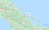
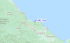
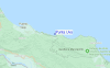
Utilizzare questa mappa sollievo per navigare Limon surf breaks e stazioni di marea che si trovano nella zona diPunta Uva
Altri surf breaks più vicini al Punta Uva:
(clicca sul nome del luogo per maggiori informazioni)- Closest località surf2 mi
- Second closest località surf2 mi
- Third closest località surf3 mi
- Fourth closest località surf4 mi
- Fifth closest località surf7 mi
Onda boe più vicina a Punta Uva:
- Closest Onda boa503 mi
- Second closest Onda boa725 mi
- Third closest Onda boa1112 mi
- Fourth closest Onda boa1140 mi
- Fifth closest Onda boa1145 mi
Stazioni di marea più vicina alla Punta Uva:
- Closest marea stazioneAlmirante31 mi
- Second closest marea stazioneLimon34 mi
- Third closest marea stazioneBocas del Toro, Almirante Bay37 mi
- Fourth closest marea stazioneGolfito76 mi
- Fifth closest marea stazionePedregal90 mi
Airports
- The closest passenger airport to Punta Uva is Cap Manuel Nino International (Changuinola) Airport (CHX) in Panama, 28 km (17 miles) away (directly).
- The second nearest airport to Punta Uva is Limon International Airport (LIO) in Costa Rica, 50 km (31 miles) away.
- Third is Bocas Del Toro Airport (BOC) in Panama, 59 km (37 miles) away.
- Palmar Sur Airport (PMZ) in Costa Rica is 114 km (71 miles) away.
- Coto 47 Airport (OTR), also in Costa Rica is the fifth nearest airport to Punta Uva and is 119 km (74 miles) away.

- /breaks/Punta-Uva/forecasts/latest


 Nearest