
Previsioni:

Previsione a breve termineper lo più asciutto. Warm (Max 31°C mercoledì mattina, Min 26°C Venerdì notte). Venti decrescenti (raffiche di vento da NNE giovedì notte, venti deboli da ENE per venerdì notte). | ||||||||||||||||||||||||
Mer 15 | Giovedì 16 | Venerdì 17 | 18 | |||||||||||||||||||||
10 AM | 1 PM | 4 PM | 7 PM | 10 PM | 1 AM | 4 AM | 7 AM | 10 AM | 1 PM | 4 PM | 7 PM | 10 PM | 1 AM | 4 AM | 7 AM | 10 AM | 1 PM | 4 PM | 7 PM | 10 PM | 1 AM | 4 AM | 7 AM | |
Mappa dell'altezza del moto ondoso | 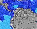 | 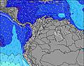 | 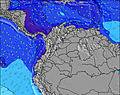 | 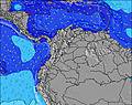 | 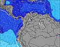 | 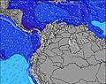 | 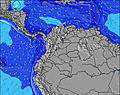 | 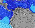 | 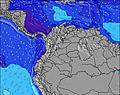 | |||||||||||||||
Onda Altezza (m) Direzione Periodo (s) | NNE 10 | NNE 10 | NNE 9 | NE 9 | NE 10 | NE 10 | NE 10 | NNE 10 | NNE 10 | NNE 10 | NE 9 | NNE 9 | NE 9 | NE 10 | NE 10 | NE 10 | NNE 10 | NNE 9 | NNE 9 | NNE 8 | NNE 9 | NE 10 | NE 10 | NNE 10 |
Grafico delle onde | ||||||||||||||||||||||||
703 | 787 | 802 | 711 | 1055 | 1604 | 1451 | 1093 | 855 | 1007 | 989 | 884 | 1177 | 1824 | 1486 | 1100 | 726 | 739 | 676 | 493 | 723 | 1280 | 1145 | 788 | |
Vento (km/h) | ||||||||||||||||||||||||
Stato del vento onshore cross-onshore cross-shore cross-offshore offshore piatto | cross-off | cross-on | cross | cross | cross | cross-off | cross-off | cross-off | cross | cross-on | cross | cross | cross | cross | cross-off | cross-off | cross | cross-on | cross | cross | cross-on | cross-off | cross-off | off |
Alta Marea | 1:05PM0.12m | 00:35AM0.42m | 2:16PM0.16m | 1:27AM0.38m | 3:24PM0.21m | 2:19AM0.32m | ||||||||||||||||||
Basso Marea | 7:52AM0.01m | 4:29PM0.08m | 8:37AM0.02m | 5:50PM0.13m | 9:18AM0.04m | 8:02PM0.17m | ||||||||||||||||||
5:47 | — | — | — | — | — | 5:47 | — | — | — | — | — | — | — | 5:47 | — | — | — | — | — | — | — | 5:48 | — | |
— | — | 6:28 | — | — | — | — | — | — | — | 6:28 | — | — | — | — | — | — | — | 6:28 | — | — | — | — | 6:28 | |
mm | — | — | — | — | — | — | — | — | — | — | — | — | — | — | — | — | — | — | — | — | — | — | — | — |
Temp. °C | 31 | 30 | 29 | 27 | 27 | 27 | 27 | 27 | 29 | 29 | 28 | 27 | 27 | 27 | 27 | 27 | 31 | 28 | 29 | 27 | 27 | 27 | 26 | 27 |
Gelo °C | 33 | 30 | 28 | 26 | 25 | 27 | 28 | 28 | 30 | 29 | 26 | 25 | 25 | 27 | 29 | 29 | 34 | 28 | 29 | 27 | 26 | 31 | 28 | 31 |
Onda 1 Altezza (m) Direzione Periodo (s) | NNE 10 | — | — | — | — | — | — | — | NNE 10 | — | — | — | — | — | — | — | — | — | — | — | — | — | NE 10 | NNE 10 |
703 | — | — | — | — | — | — | — | 855 | — | — | — | — | — | — | — | — | — | — | — | — | — | 1145 | 788 | |
Onda 2 Altezza (m) Direzione Periodo (s) | — | — | — | — | — | — | — | — | — | — | — | — | — | — | — | — | — | — | — | — | — | — | — | — |
— | — | — | — | — | — | — | — | — | — | — | — | — | — | — | — | — | — | — | — | — | — | — | — | |
Onda 3 Altezza (m) Direzione Periodo (s) | — | — | — | — | — | — | — | — | — | — | — | — | — | — | — | — | — | — | — | — | — | — | — | — |
— | — | — | — | — | — | — | — | — | — | — | — | — | — | — | — | — | — | — | — | — | — | — | — | |
onde vento Altezza (m) Direzione Periodo (s) | — | NNE 10 | NNE 9 | NE 9 | NE 10 | NE 10 | NE 10 | NNE 10 | — | NNE 10 | NE 9 | NNE 9 | NE 9 | NE 10 | NE 10 | NE 10 | NNE 10 | NNE 9 | NNE 9 | NNE 8 | NNE 9 | NE 10 | — | — |
— | 787 | 802 | 711 | 1055 | 1604 | 1451 | 1093 | — | 1007 | 989 | 884 | 1177 | 1824 | 1486 | 1100 | 726 | 739 | 676 | 493 | 723 | 1280 | — | — | |
Il più vicino Offshore or Glassy | ||||||||||||||||||||||||
Distanza (km) | 0 | 469 | 469 | 469 | 469 | 469 | 19 | 469 | 148 | 469 | 469 | 469 | 469 | 469 | 19 | 469 | 148 | 469 | 469 | 469 | 469 | 0 | 469 | 0 |
Migliori previsioni per le condizioni d'onda in Caribbean Coast | ||||||||||||||||||||||||
Migliori previsioni per le condizioni d'onda in Colombia | ||||||||||||||||||||||||
Trova Onde Globale | ||||||||||||||||||||||||
- Map Icons:
 Break
Break Live Wave Height (m)
 Live Wind Speed (km/h)
 Surf Rating (10 Max)
 Ocean Swells (m)
- Wind Speed (km/h)
Widget Free Surf-Forecast.com per il tuo sito
La relazione di surf / widget meteo è disponibile qui sotto per incorporare su siti esterni a titolo gratuito e fornisce una sintesi delle nostre Punta Canoas previsione surf. Basta prendere il frammento di codice html da noi fornito e copiarlo nel proprio sito. È possibile scegliere la lingua preferita e unità metriche / imperiali per il feed delle previsioni surf per soddisfare le esigenze degli utenti del vostro sito .... Clicca qui per ottenere il codice.
 Nearest