
Previsioni:

Previsione a breve termineper lo più asciutto. Warm (Max 28°C mercoledì mattina, Min 25°C mercoledì notte). Principalmente venti freschi. | ||||||||||||||||||||||||
Mercoledì 15 | Giovedì 16 | Venerdì 17 | 18 | |||||||||||||||||||||
7 AM | 10 AM | 1 PM | 4 PM | 7 PM | 10 PM | 1 AM | 4 AM | 7 AM | 10 AM | 1 PM | 4 PM | 7 PM | 10 PM | 1 AM | 4 AM | 7 AM | 10 AM | 1 PM | 4 PM | 7 PM | 10 PM | 1 AM | 4 AM | |
Mappa dell'altezza del moto ondoso |  | 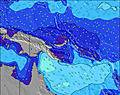 | 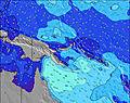 | 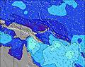 | 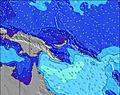 | 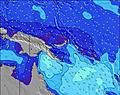 | 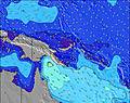 | 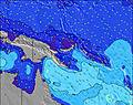 | 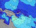 | |||||||||||||||
Onda Altezza (m) Direzione Periodo (s) | SSE 10 | SSE 8 | SSE 8 | SSE 8 | SSE 8 | SSE 8 | SSE 8 | SSE 8 | SSE 8 | SSE 8 | SSE 8 | SSE 8 | SSE 8 | S 8 | SSE 8 | SSE 8 | SSE 8 | SSE 8 | SSE 8 | SSE 8 | SSE 8 | SSE 8 | SSE 8 | SSE 8 |
Grafico delle onde | ||||||||||||||||||||||||
260 | 163 | 264 | 310 | 295 | 300 | 336 | 355 | 406 | 438 | 438 | 395 | 345 | 337 | 308 | 273 | 308 | 345 | 365 | 344 | 314 | 232 | 215 | 223 | |
Vento (km/h) | ||||||||||||||||||||||||
Stato del vento onshore cross-onshore cross-shore cross-offshore offshore piatto | on | on | on | on | on | on | on | on | on | on | on | on | on | on | on | on | on | on | on | on | on | on | on | on |
Alta Marea | 3:26AM0.98m | 3:49AM0.93m | ||||||||||||||||||||||
Basso Marea | 12:06PM-0.08m | 12:27PM0.00m | 12:32PM0.10m | |||||||||||||||||||||
5:58 | — | — | — | — | — | — | 5:58 | — | — | — | — | — | — | — | 5:58 | — | — | — | — | — | — | — | 5:58 | |
— | — | — | 5:52 | — | — | — | — | — | — | — | 5:52 | — | — | — | — | — | — | — | 5:52 | — | — | — | 5:52 | |
mm | — | — | — | — | — | — | — | — | — | — | — | — | — | — | — | — | — | — | — | — | — | — | — | — |
Temp. °C | 25 | 27 | 28 | 27 | 26 | 25 | 25 | 25 | 25 | 27 | 28 | 27 | 26 | 25 | 25 | 25 | 25 | 27 | 28 | 27 | 26 | 25 | 25 | 25 |
Gelo °C | 25 | 27 | 27 | 26 | 25 | 24 | 25 | 24 | 24 | 25 | 25 | 25 | 24 | 24 | 24 | 24 | 24 | 25 | 26 | 25 | 25 | 24 | 25 | 24 |
Onda 1 Altezza (m) Direzione Periodo (s) | E 7 | SSE 10 | E 7 | E 8 | E 8 | E 8 | E 8 | E 8 | E 8 | E 8 | E 8 | E 9 | E 9 | E 9 | E 8 | E 9 | E 9 | E 8 | E 8 | ESE 9 | E 9 | S 9 | S 9 | ESE 8 |
1 | 75 | 1 | 1 | 1 | 1 | 1 | 1 | 1 | 1 | 5 | 13 | 14 | 14 | 12 | 13 | 13 | 12 | 5 | 16 | 6 | 16 | 25 | 7 | |
Onda 2 Altezza (m) Direzione Periodo (s) | — | E 7 | — | — | — | — | — | E 9 | ESE 8 | — | E 9 | E 9 | — | — | E 9 | ESE 9 | E 11 | E 11 | — | — | S 10 | ESE 8 | ESE 8 | E 8 |
— | 1 | — | — | — | — | — | 23 | 14 | — | 6 | 6 | — | — | 13 | 15 | 2 | 2 | — | — | 7 | 7 | 7 | 36 | |
Onda 3 Altezza (m) Direzione Periodo (s) | E 8 | — | SE 12 | ESE 8 | ENE 9 | ENE 9 | ENE 9 | — | NE 9 | — | — | — | — | — | — | NE 10 | E 11 | NE 10 | — | — | — | E 9 | E 9 | E 9 |
20 | — | 6 | 22 | 8 | 8 | 8 | — | 3 | — | — | — | — | — | — | 4 | 2 | 4 | — | — | — | 2 | 2 | 2 | |
onde vento Altezza (m) Direzione Periodo (s) | SSE 10 | SSE 8 | SSE 8 | SSE 8 | SSE 8 | SSE 8 | SSE 8 | SSE 8 | SSE 8 | SSE 8 | SSE 8 | SSE 8 | SSE 8 | S 8 | SSE 8 | SSE 8 | SSE 8 | SSE 8 | SSE 8 | SSE 8 | SSE 8 | SSE 8 | SSE 8 | SSE 8 |
260 | 163 | 264 | 310 | 295 | 300 | 336 | 355 | 406 | 438 | 438 | 395 | 345 | 337 | 308 | 273 | 308 | 345 | 365 | 344 | 314 | 232 | 215 | 223 | |
Il più vicino Offshore or Glassy | ||||||||||||||||||||||||
Distanza (km) | 206 | 206 | 694 | 206 | 694 | 694 | 206 | 206 | 206 | 206 | 2377 | 2377 | 2377 | 2377 | 2371 | 2377 | 2377 | 2307 | 206 | 206 | 206 | 2145 | 2307 | 976 |
Migliori previsioni per le condizioni d'onda in New Britain and Duke of York | ||||||||||||||||||||||||
Migliori previsioni per le condizioni d'onda in Papua New Guinea | ||||||||||||||||||||||||
Trova Onde Globale | ||||||||||||||||||||||||
- Map Icons:
 Break
Break Live Wave Height (m)
 Live Wind Speed (km/h)
 Surf Rating (10 Max)
 Ocean Swells (m)
- Wind Speed (km/h)
Widget Free Surf-Forecast.com per il tuo sito
La relazione di surf / widget meteo è disponibile qui sotto per incorporare su siti esterni a titolo gratuito e fornisce una sintesi delle nostre Raiven previsione surf. Basta prendere il frammento di codice html da noi fornito e copiarlo nel proprio sito. È possibile scegliere la lingua preferita e unità metriche / imperiali per il feed delle previsioni surf per soddisfare le esigenze degli utenti del vostro sito .... Clicca qui per ottenere il codice.
 Nearest