
Previsioni:

Previsione a breve termineper lo più asciutto. Warm (Max 27°C martedì mattina, Min 24°C Sabato notte). Venti in aumento (venti freschi da SW Sabato notte, bufere nelle prossimità da SSW per lunedì pomeriggio). | ||||||||||||||||||
18 | Domenica 19 | Lunedì 20 | ||||||||||||||||
7 PM | 10 PM | 1 AM | 4 AM | 7 AM | 10 AM | 1 PM | 4 PM | 7 PM | 10 PM | 1 AM | 4 AM | 7 AM | 10 AM | 1 PM | 4 PM | 7 PM | 10 PM | |
Mappa dell'altezza del moto ondoso | 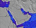 | 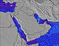 |  | 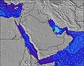 | 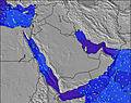 | 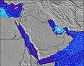 | 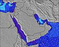 | |||||||||||
Onda Altezza (m) Direzione Periodo (s) | S 10 | S 10 | S 10 | SSW 10 | SSW 10 | S 10 | S 10 | SSW 10 | SSW 10 | SSW 10 | SSW 9 | SSW 9 | SSW 9 | SSW 10 | S 10 | SSW 10 | SSW 10 | SSW 10 |
Grafico delle onde | ||||||||||||||||||
1985 | 1732 | 1586 | 1608 | 1470 | 1347 | 1478 | 1685 | 1618 | 1585 | 1542 | 1477 | 1413 | 1618 | 1763 | 2127 | 2488 | 2790 | |
Vento (km/h) | ||||||||||||||||||
Stato del vento onshore cross-onshore cross-shore cross-offshore offshore piatto | cross-off | cross-off | cross-off | cross-off | off | cross-off | cross-off | cross-off | cross-off | cross-off | cross-off | cross-off | cross-off | cross-off | cross-off | cross-off | cross-off | cross-off |
Alta Marea | 00:35AM1.72m | 1:02PM2.21m | 1:40AM1.62m | 1:30PM2.12m | ||||||||||||||
Basso Marea | 6:58PM0.80m | 6:24AM0.72m | 7:46PM0.72m | 7:00AM0.98m | 8:35PM0.68m | |||||||||||||
— | — | — | 5:33 | — | — | — | — | — | — | — | 5:35 | — | — | — | — | — | — | |
— | — | — | — | — | — | — | 6:46 | — | — | — | — | — | — | — | 6:46 | — | — | |
mm | — | — | — | — | — | — | — | — | — | — | — | — | — | — | — | — | — | — |
Temp. °C | 25 | 24 | 24 | 24 | 24 | 25 | 26 | 25 | 24 | 24 | 24 | 24 | 24 | 25 | 26 | 26 | 25 | 24 |
Gelo °C | 22 | 21 | 22 | 22 | 23 | 24 | 24 | 21 | 20 | 21 | 21 | 21 | 22 | 22 | 22 | 21 | 20 | 19 |
Onda 1 Altezza (m) Direzione Periodo (s) | — | — | SE 10 | SE 11 | — | — | SE 11 | SE 11 | SE 11 | SE 11 | SE 10 | SE 10 | SE 10 | S 21 | S 20 | S 20 | S 20 | S 20 |
— | — | 27 | 18 | — | — | 30 | 30 | 30 | 30 | 27 | 27 | 28 | 8 | 8 | 8 | 30 | 31 | |
Onda 2 Altezza (m) Direzione Periodo (s) | — | — | — | — | — | — | — | — | — | — | — | S 22 | S 21 | S 20 | S 20 | S 20 | S 20 | — |
— | — | — | — | — | — | — | — | — | — | — | 9 | 9 | 8 | 8 | 8 | 30 | — | |
Onda 3 Altezza (m) Direzione Periodo (s) | — | — | — | — | — | — | — | — | — | — | — | — | — | — | — | — | — | — |
— | — | — | — | — | — | — | — | — | — | — | — | — | — | — | — | — | — | |
onde vento Altezza (m) Direzione Periodo (s) | S 10 | S 10 | S 10 | SSW 10 | SSW 10 | S 10 | S 10 | SSW 10 | SSW 10 | SSW 10 | SSW 9 | SSW 9 | SSW 9 | SSW 10 | S 10 | SSW 10 | SSW 10 | SSW 10 |
1985 | 1732 | 1586 | 1608 | 1470 | 1347 | 1478 | 1685 | 1618 | 1585 | 1542 | 1477 | 1413 | 1618 | 1763 | 2127 | 2488 | 2790 | |
Il più vicino Offshore or Glassy | ||||||||||||||||||
Distanza (km) | 1768 | 1870 | 1870 | 707 | 707 | 1768 | 1768 | 1803 | 630 | 630 | 630 | 2361 | 654 | 2390 | 2390 | 2390 | 2390 | 1870 |
Migliori previsioni per le condizioni d'onda in Masirah Island | ||||||||||||||||||
Migliori previsioni per le condizioni d'onda in Oman | ||||||||||||||||||
Trova Onde Globale | ||||||||||||||||||
- Map Icons:
 Break
Break Live Wave Height (m)
 Live Wind Speed (km/h)
 Surf Rating (10 Max)
 Ocean Swells (m)
- Wind Speed (km/h)
Widget Free Surf-Forecast.com per il tuo sito
La relazione di surf / widget meteo è disponibile qui sotto per incorporare su siti esterni a titolo gratuito e fornisce una sintesi delle nostre Ras Kaydah previsione surf. Basta prendere il frammento di codice html da noi fornito e copiarlo nel proprio sito. È possibile scegliere la lingua preferita e unità metriche / imperiali per il feed delle previsioni surf per soddisfare le esigenze degli utenti del vostro sito .... Clicca qui per ottenere il codice.
 Nearest