
Previsioni:

Previsione a breve termineper lo più asciutto. Warm (Max 21°C Venerdì notte, Min 19°C mercoledì notte). Principalmente venti freschi. | ||||||||||||||||||||||||
Mercoledì 15 | Giovedì 16 | Venerdì 17 | 18 | |||||||||||||||||||||
5 AM | 8 AM | 11 AM | 2 PM | 5 PM | 8 PM | 11 PM | 2 AM | 5 AM | 8 AM | 11 AM | 2 PM | 5 PM | 8 PM | 11 PM | 2 AM | 5 AM | 8 AM | 11 AM | 2 PM | 5 PM | 8 PM | 11 PM | 2 AM | |
Mappa dell'altezza del moto ondoso | 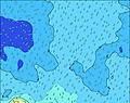 | 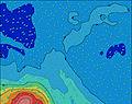 | 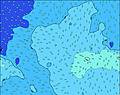 |  | 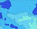 |  |  |  |  | 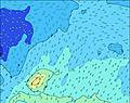 | ||||||||||||||
Onda Altezza (m) Direzione Periodo (s) | S 10 | S 11 | S 11 | S 11 | S 11 | SSE 17 | SSE 17 | SSE 16 | SSE 16 | SSE 16 | SSE 15 | SSE 15 | SSE 14 | SSE 14 | SSE 14 | SSE 14 | SSE 14 | S 14 | S 14 | S 14 | S 14 | S 14 | S 13 | S 13 |
Grafico delle onde | ||||||||||||||||||||||||
802 | 941 | 1011 | 1049 | 1046 | 983 | 3020 | 3111 | 3133 | 3258 | 2831 | 2648 | 2577 | 2725 | 2725 | 2725 | 2725 | 2643 | 2374 | 2341 | 2125 | 1788 | 1561 | 1380 | |
Vento (km/h) | ||||||||||||||||||||||||
Stato del vento onshore cross-onshore cross-shore cross-offshore offshore piatto | cross-on | cross-on | cross-on | cross-on | cross-on | cross-on | cross-on | cross-on | cross-on | cross-on | cross-on | cross-on | cross-on | cross-on | cross-on | cross-on | cross-on | cross-on | cross-on | on | on | on | on | on |
Alta Marea | 9:37AM0.74m | 10:10PM0.57m | 10:27AM0.68m | 11:00PM0.55m | 11:17AM0.61m | 11:52PM0.51m | ||||||||||||||||||
Basso Marea | 3:03AM-0.14m | 3:45PM-0.20m | 3:55AM-0.11m | 4:34PM-0.16m | 4:49AM-0.07m | 5:25PM-0.10m | ||||||||||||||||||
7:16 | — | — | — | — | — | — | — | 7:16 | — | — | — | — | — | — | — | 7:16 | — | — | — | — | — | — | 7:15 | |
— | — | — | — | 6:13 | — | — | — | — | — | — | — | 6:14 | — | — | — | — | — | — | — | 6:14 | — | — | 6:15 | |
mm | — | — | — | — | — | — | — | — | — | — | — | — | — | — | — | — | — | — | — | — | — | — | — | — |
Temp. °C | 20 | 20 | 20 | 20 | 20 | 19 | 20 | 20 | 20 | 20 | 19 | 20 | 20 | 19 | 19 | 20 | 19 | 20 | 20 | 20 | 20 | 20 | 21 | 20 |
Gelo °C | 15 | 14 | 15 | 15 | 14 | 13 | 14 | 14 | 13 | 15 | 14 | 14 | 14 | 13 | 13 | 14 | 14 | 14 | 16 | 16 | 16 | 15 | 17 | 14 |
Onda 1 Altezza (m) Direzione Periodo (s) | S 10 | SSW 14 | S 11 | S 11 | S 11 | SSW 13 | SSE 17 | SSE 16 | SSE 16 | SSE 16 | SSE 15 | SSE 15 | SSE 14 | SSE 14 | SSE 14 | SSE 14 | SSE 14 | S 14 | S 14 | S 14 | S 14 | S 14 | S 13 | SW 18 |
802 | 508 | 1011 | 1049 | 1046 | 983 | 3020 | 3111 | 3133 | 3258 | 2831 | 2648 | 2577 | 2725 | 2725 | 2725 | 2725 | 2643 | 2374 | 2341 | 2125 | 1788 | 1561 | 78 | |
Onda 2 Altezza (m) Direzione Periodo (s) | SSW 14 | SSE 16 | SSW 14 | SSW 14 | SSE 15 | SSE 12 | SSW 13 | SSW 13 | SSW 13 | SSW 13 | SSW 12 | SSW 12 | SSW 12 | SSW 12 | SSW 11 | SSW 11 | SSW 10 | SW 19 | SW 16 | SW 16 | SW 17 | SSW 17 | SSW 17 | SW 15 |
494 | 98 | 325 | 373 | 539 | 512 | 679 | 569 | 569 | 402 | 278 | 304 | 251 | 158 | 166 | 186 | 90 | 179 | 132 | 133 | 140 | 195 | 197 | 55 | |
Onda 3 Altezza (m) Direzione Periodo (s) | SE 16 | WNW 16 | SSW 11 | SSE 16 | SSW 14 | SSE 17 | NW 16 | NW 15 | NW 15 | NW 15 | NW 15 | NW 15 | NW 15 | SW 18 | SW 19 | SW 19 | SSW 19 | NW 15 | NW 15 | NW 15 | NW 15 | NW 15 | WSW 12 | WSW 12 |
61 | 25 | 138 | 280 | 273 | 980 | 39 | 35 | 35 | 35 | 56 | 34 | 34 | 84 | 95 | 183 | 246 | 35 | 34 | 33 | 33 | 33 | 14 | 28 | |
onde vento Altezza (m) Direzione Periodo (s) | — | S 11 | — | — | — | — | — | SSW 13 | — | — | — | — | — | — | — | — | — | — | — | — | — | — | — | S 13 |
— | 941 | — | — | — | — | — | 1044 | — | — | — | — | — | — | — | — | — | — | — | — | — | — | — | 1380 | |
Il più vicino Offshore or Glassy | ||||||||||||||||||||||||
Distanza (km) | 2427 | 2427 | 2427 | 2427 | 2427 | 2427 | 2427 | 2427 | 2427 | 2427 | 8 | 2427 | 2427 | 2427 | 2427 | 2437 | 2437 | 2777 | 2437 | 9 | 9 | 9 | 9 | 1124 |
Migliori previsioni per le condizioni d'onda in Cook-Islands - Rarotonga | ||||||||||||||||||||||||
Migliori previsioni per le condizioni d'onda in Cook Islands | ||||||||||||||||||||||||
Trova Onde Globale | ||||||||||||||||||||||||
- Map Icons:
 Break
Break Live Wave Height (m)
 Live Wind Speed (km/h)
 Surf Rating (10 Max)
 Ocean Swells (m)
- Wind Speed (km/h)
Widget Free Surf-Forecast.com per il tuo sito
La relazione di surf / widget meteo è disponibile qui sotto per incorporare su siti esterni a titolo gratuito e fornisce una sintesi delle nostre Rutaki Passage previsione surf. Basta prendere il frammento di codice html da noi fornito e copiarlo nel proprio sito. È possibile scegliere la lingua preferita e unità metriche / imperiali per il feed delle previsioni surf per soddisfare le esigenze degli utenti del vostro sito .... Clicca qui per ottenere il codice.
 Nearest