
Previsioni:

Previsione a breve terminePioggia abbondante (Totale 22mm), più pesante durante lunedì mattina. Warm (Max 31°C martedì pomeriggio, Min 18°C Lunedì notte). Venti decrescenti (venti freschi da S Lunedì mattina, calma per mercoledì mattina). | ||||||||||||||||||||||||
Lunedì 3 | Martedì 4 | Mercoledì 5 | ||||||||||||||||||||||
2 AM | 5 AM | 8 AM | 11 AM | 2 PM | 5 PM | 8 PM | 11 PM | 2 AM | 5 AM | 8 AM | 11 AM | 2 PM | 5 PM | 8 PM | 11 PM | 2 AM | 5 AM | 8 AM | 11 AM | 2 PM | 5 PM | 8 PM | 11 PM | |
Mappa dell'altezza del moto ondoso | 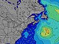 | 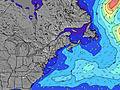 | 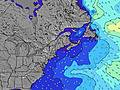 | 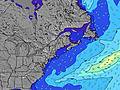 | 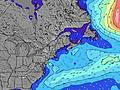 | 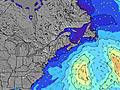 | 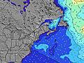 | 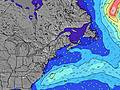 | 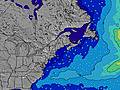 | |||||||||||||||
Onda Altezza (m) Direzione Periodo (s) | SSE 4 | SSE 4 | SE 5 | SSE 5 | SSE 7 | SSE 8 | S 8 | SSE 8 | SSE 8 | SSE 8 | SSE 8 | SSE 8 | SSE 8 | SE 7 | SE 7 | SSE 5 | SSE 5 | SE 7 | SSE 7 | SE 7 | SE 7 | SE 7 | SE 7 | SE 7 |
Grafico delle onde | ||||||||||||||||||||||||
23 | 16 | 22 | 74 | 298 | 494 | 625 | 284 | 157 | 80 | 55 | 42 | 42 | 25 | 27 | 45 | 31 | 17 | 31 | 23 | 23 | 22 | 22 | 24 | |
Vento (km/h) | ||||||||||||||||||||||||
Stato del vento onshore cross-onshore cross-shore cross-offshore offshore piatto | cross | cross | cross | cross | cross | cross-off | cross-off | off | off | cross-off | off | off | off | cross-off | cross-off | cross-off | off | off | glassy | on | cross-on | cross-on | cross | cross-off |
Alta Marea | 2:39AM3.16m | 3:04PM3.21m | 3:24AM3.06m | 3:48PM3.22m | 4:14AM2.97m | 4:37PM3.24m | ||||||||||||||||||
Basso Marea | 8:50AM0.62m | 9:17PM0.68m | 9:32AM0.69m | 10:06PM0.69m | 10:18AM0.77m | |||||||||||||||||||
— | 5:35 | — | — | — | — | — | — | — | 5:35 | — | — | — | — | — | — | — | 5:37 | — | — | — | — | — | — | |
— | — | — | — | — | — | 8:01 | — | — | — | — | — | — | — | 8:00 | — | — | — | — | — | — | 7:59 | — | — | |
mm | 1 | 1 | 11 | 6 | 2 | 1 | 2 | — | — | — | — | — | — | — | — | — | — | — | — | — | — | — | — | — |
Temp. °C | 21 | 22 | 22 | 22 | 23 | 24 | 21 | 20 | 19 | 18 | 20 | 27 | 30 | 31 | 28 | 24 | 23 | 22 | 21 | 24 | 26 | 25 | 25 | 25 |
Gelo °C | 23 | 25 | 23 | 20 | 24 | 23 | 19 | 17 | 15 | 16 | 18 | 24 | 27 | 28 | 26 | 23 | 22 | 22 | 21 | 23 | 26 | 26 | 27 | 26 |
Onda 1 Altezza (m) Direzione Periodo (s) | SE 7 | SE 7 | SE 7 | SE 9 | — | — | SSE 8 | SSE 8 | SSE 8 | SSE 8 | SSE 8 | SSE 8 | SSE 8 | SE 7 | SSE 4 | SSE 5 | SSE 5 | SSE 5 | SSE 7 | SE 7 | SE 7 | SE 7 | SE 7 | SE 7 |
7 | 7 | 7 | 3 | — | — | 419 | 284 | 157 | 80 | 55 | 42 | 42 | 25 | 17 | 30 | 31 | 14 | 31 | 23 | 23 | 22 | 22 | 24 | |
Onda 2 Altezza (m) Direzione Periodo (s) | ESE 9 | ESE 9 | ESE 9 | — | — | — | — | — | — | — | — | — | — | — | SE 7 | SE 7 | SE 7 | SE 7 | E 10 | E 10 | E 9 | E 9 | SSE 9 | S 8 |
7 | 7 | 8 | — | — | — | — | — | — | — | — | — | — | — | 25 | 14 | 13 | 17 | 2 | 2 | 2 | 2 | 8 | 1 | |
Onda 3 Altezza (m) Direzione Periodo (s) | — | — | — | — | — | — | — | — | — | — | E 9 | — | — | — | — | E 10 | E 10 | E 10 | — | — | S 11 | E 9 | E 9 | E 9 |
— | — | — | — | — | — | — | — | — | — | 2 | — | — | — | — | 2 | 2 | 2 | — | — | 2 | 2 | 2 | 2 | |
onde vento Altezza (m) Direzione Periodo (s) | SSE 4 | SSE 4 | SE 5 | SSE 5 | SSE 7 | SSE 8 | S 8 | W 4 | W 3 | W 3 | WSW 3 | SW 3 | SW 3 | S 3 | SSE 4 | SSE 5 | WSW 3 | — | — | — | — | — | SSE 3 | SSE 3 |
23 | 16 | 22 | 74 | 298 | 494 | 625 | 9 | 8 | 3 | 1 | 1 | 1 | 5 | 27 | 45 | 1 | — | — | — | — | — | 1 | 4 | |
Il più vicino Offshore or Glassy | ||||||||||||||||||||||||
Distanza (km) | 1258 | 1269 | 1506 | 612 | 534 | 389 | 64 | 0 | 0 | 0 | 4 | 34 | 34 | 34 | 0 | 0 | 34 | 189 | 166 | 166 | 201 | 133 | 128 | 186 |
Migliori previsioni per le condizioni d'onda in New Hampshire | ||||||||||||||||||||||||
Migliori previsioni per le condizioni d'onda in United States | ||||||||||||||||||||||||
Trova Onde Globale | ||||||||||||||||||||||||
- Map Icons:
 Break
Break Live Wave Height (m)
 Live Wind Speed (km/h)
 Surf Rating (10 Max)
 Ocean Swells (m)
- Wind Speed (km/h)
Widget Free Surf-Forecast.com per il tuo sito
La relazione di surf / widget meteo è disponibile qui sotto per incorporare su siti esterni a titolo gratuito e fornisce una sintesi delle nostre Rye On the Rocks previsione surf. Basta prendere il frammento di codice html da noi fornito e copiarlo nel proprio sito. È possibile scegliere la lingua preferita e unità metriche / imperiali per il feed delle previsioni surf per soddisfare le esigenze degli utenti del vostro sito .... Clicca qui per ottenere il codice.
 Nearest