
Previsioni:

Previsione a breve termineper lo più asciutto. Very mild (Max 13°C giovedì pomeriggio, Min 8°C martedì notte). Principalmente venti freschi. | |||||||||||||||||
Mercoledì 29 | Giovedì 30 | ||||||||||||||||
9 PM | 12 AM | 3 AM | 6 AM | 9 AM | 12 PM | 3 PM | 6 PM | 9 PM | 12 AM | 3 AM | 6 AM | 9 AM | 12 PM | 3 PM | 6 PM | 9 PM | |
Mappa dell'altezza del moto ondoso | 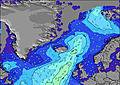 | | 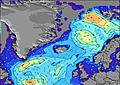 | 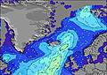 | 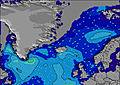 | 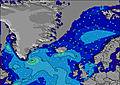 | 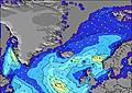 | ||||||||||
Onda Altezza (m) Direzione Periodo (s) | SW 6 | W 6 | W 6 | WSW 7 | W 6 | SW 7 | SSW 6 | SW 7 | SW 7 | WSW 7 | NNW 5 | NNW 5 | NNW 5 | NNW 4 | NNW 4 | NNW 4 | NNW 4 |
Grafico delle onde | |||||||||||||||||
28 | 21 | 20 | 15 | 19 | 13 | 14 | 12 | 7 | 5 | 35 | 26 | 19 | 18 | 16 | 21 | 21 | |
Vento (km/h) | |||||||||||||||||
Stato del vento onshore cross-onshore cross-shore cross-offshore offshore piatto | cross-off | cross-off | cross-off | cross-off | cross-off | cross-off | cross-off | cross-off | cross-off | cross-off | cross-off | cross-off | cross-off | cross-off | cross-off | cross | cross |
Alta Marea | 6:10AM2.68m | 6:29PM3.08m | 6:43AM2.79m | 7:02PM3.16m | |||||||||||||
Basso Marea | 00:10AM0.56m | 12:10PM0.43m | 00:43AM0.42m | 12:44PM0.31m | |||||||||||||
— | — | 4:28 | — | — | — | — | — | — | — | 4:31 | — | — | — | — | — | — | |
10:45 | — | — | — | — | — | — | — | 10:42 | — | — | — | — | — | — | — | 10:38 | |
mm | — | — | — | — | — | — | — | — | — | — | — | — | — | — | — | — | — |
Temp. °C | 12 | 10 | 9 | 8 | 8 | 9 | 10 | 11 | 11 | 10 | 8 | 8 | 9 | 10 | 12 | 13 | 13 |
Gelo °C | 7 | 4 | 2 | 1 | 2 | 2 | 3 | 3 | 3 | 2 | -1 | 1 | 2 | 3 | 5 | 6 | 6 |
Onda 1 Altezza (m) Direzione Periodo (s) | SW 6 | ESE 6 | ESE 6 | SE 6 | W 6 | SW 7 | SSW 6 | SW 7 | SW 7 | WSW 7 | WSW 7 | WSW 6 | SSW 5 | WSW 6 | WSW 6 | WSW 6 | WSW 6 |
28 | 26 | 25 | 19 | 19 | 13 | 14 | 12 | 7 | 5 | 4 | 4 | 3 | 4 | 4 | 4 | 4 | |
Onda 2 Altezza (m) Direzione Periodo (s) | S 7 | W 6 | W 6 | WSW 7 | SE 6 | SE 6 | S 6 | SE 6 | ESE 6 | ESE 6 | SE 6 | S 10 | SSW 9 | SSE 8 | SSE 8 | SSE 8 | SSE 8 |
23 | 21 | 20 | 15 | 9 | 9 | 7 | 6 | 4 | 4 | 1 | 8 | 7 | 6 | 6 | 6 | 6 | |
Onda 3 Altezza (m) Direzione Periodo (s) | WSW 6 | WSW 6 | WSW 6 | SSW 9 | W 7 | E 5 | SE 8 | S 10 | S 9 | S 9 | S 10 | SE 5 | S 9 | SE 7 | S 10 | S 10 | S 10 |
13 | 13 | 13 | 15 | 8 | 2 | 2 | 2 | 2 | 2 | 2 | 1 | 2 | 2 | 2 | 2 | 2 | |
onde vento Altezza (m) Direzione Periodo (s) | — | — | NNE 2 | N 4 | NE 3 | N 5 | NNW 4 | NNW 4 | NNW 4 | NNW 4 | NNW 5 | NNW 5 | NNW 5 | NNW 4 | NNW 4 | NNW 4 | NNW 4 |
— | — | 1 | 7 | 4 | 11 | 7 | 25 | 25 | 25 | 35 | 26 | 19 | 18 | 16 | 21 | 21 | |
Il più vicino Offshore or Glassy | |||||||||||||||||
Distanza (km) | 1134 | 1134 | 1192 | 1257 | 1257 | 1257 | 1183 | 1041 | 1041 | 1041 | 1041 | 1043 | 1116 | 1144 | 1158 | 1269 | 1265 |
Migliori previsioni per le condizioni d'onda in Reykjanes Peninsula | |||||||||||||||||
Migliori previsioni per le condizioni d'onda in Iceland | |||||||||||||||||
Trova Onde Globale | |||||||||||||||||
- Map Icons:
 Break
Break Live Wave Height (m)
 Live Wind Speed (km/h)
 Surf Rating (10 Max)
 Ocean Swells (m)
- Wind Speed (km/h)
Widget Free Surf-Forecast.com per il tuo sito
La relazione di surf / widget meteo è disponibile qui sotto per incorporare su siti esterni a titolo gratuito e fornisce una sintesi delle nostre Sandvik previsione surf. Basta prendere il frammento di codice html da noi fornito e copiarlo nel proprio sito. È possibile scegliere la lingua preferita e unità metriche / imperiali per il feed delle previsioni surf per soddisfare le esigenze degli utenti del vostro sito .... Clicca qui per ottenere il codice.
 Nearest